Amphibian Ecology & Evoloution

with John Boyette

  • About
  • Research
  • Outreach
  • Hikers Log
  • Photography
  • Illustration
  • Contact

Hikers Log - trail date: day 68

May 14, 2021 by Jack Boyette

(Pinefield Hut (mile 898.2) - Bearfence Mountain Hut (mile 919))

Last night I was grateful to be back in the comfort and privacy of my tent. I slept like a rock until early in the morning when a group of owls began hooting at each other in a rather agitated manner. Seemingly as soon as the owls stopped their agitated chorus, the loudest whiporwil I have ever heard began its own assault on my attempt to sleep. In the end, my exhaustion prevailed, and I managed to sleep in until about 6:30am.

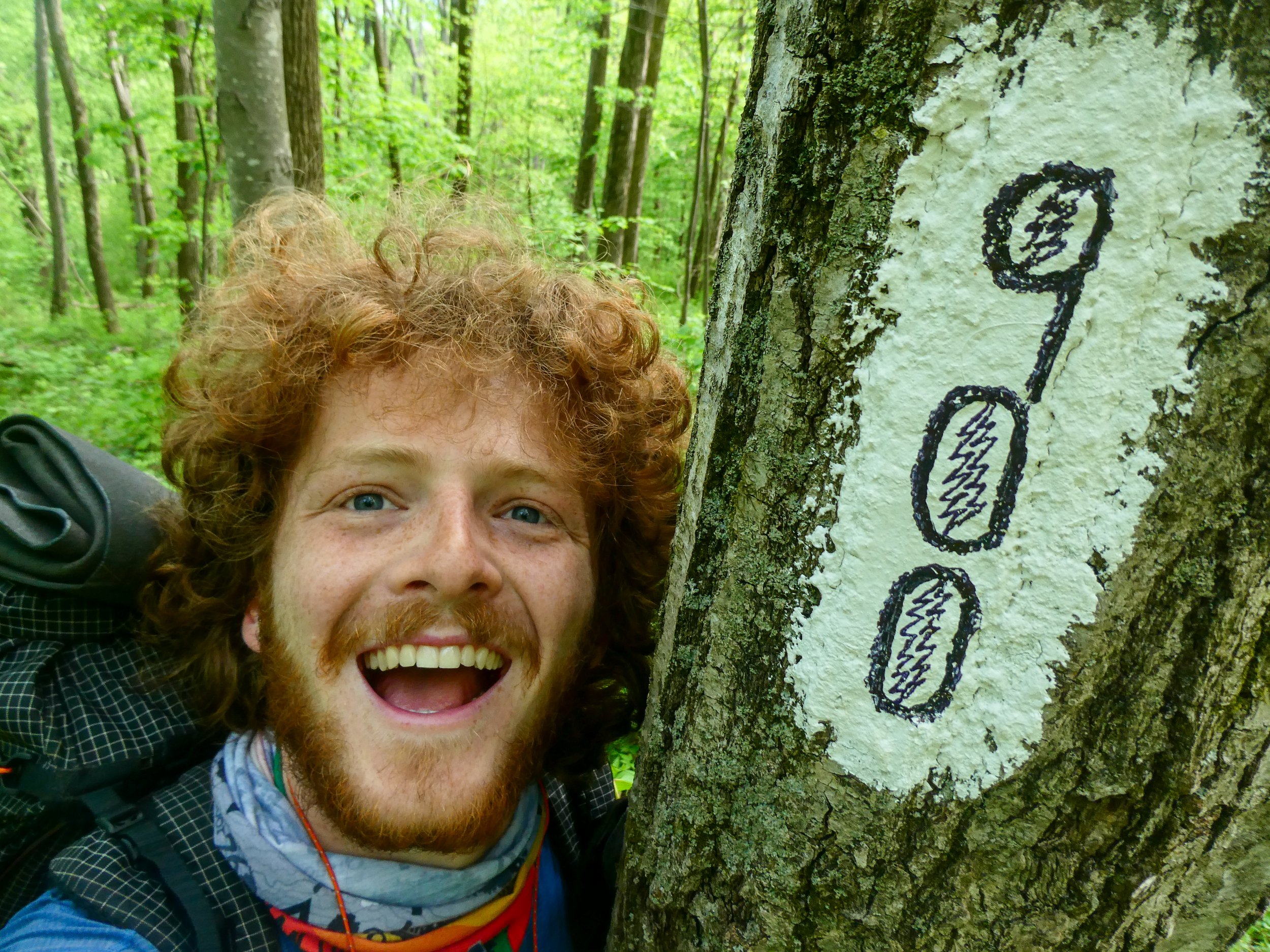
I packed my things, ate a snack, and headed out on trail at around 7:30am. As I was leaving, Clover reminded me to keep an eye out for the 900 mile mark, which was only 1.8 miles away. After about 45 minutes of hiking, I reached the 900 mile mark and stopped for pictures and breakfast. As I was eating, several weekenders who had stayed at the shelter last night passed by. I pointed out the 900 mile marker and they were amazed that I had hiked so far. One woman exclaimed: "You're my hero for the day!" Which made me feel really good😊

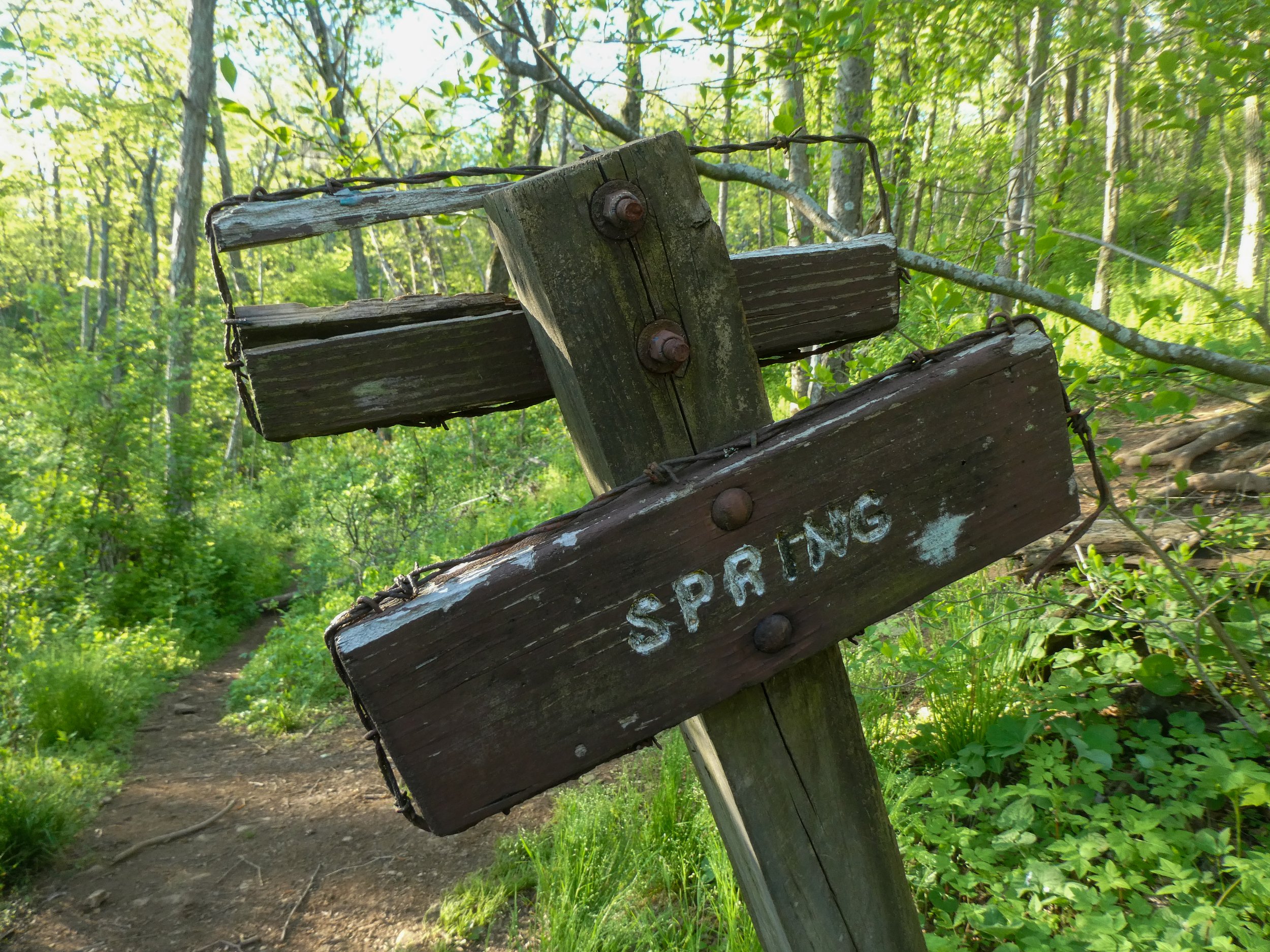
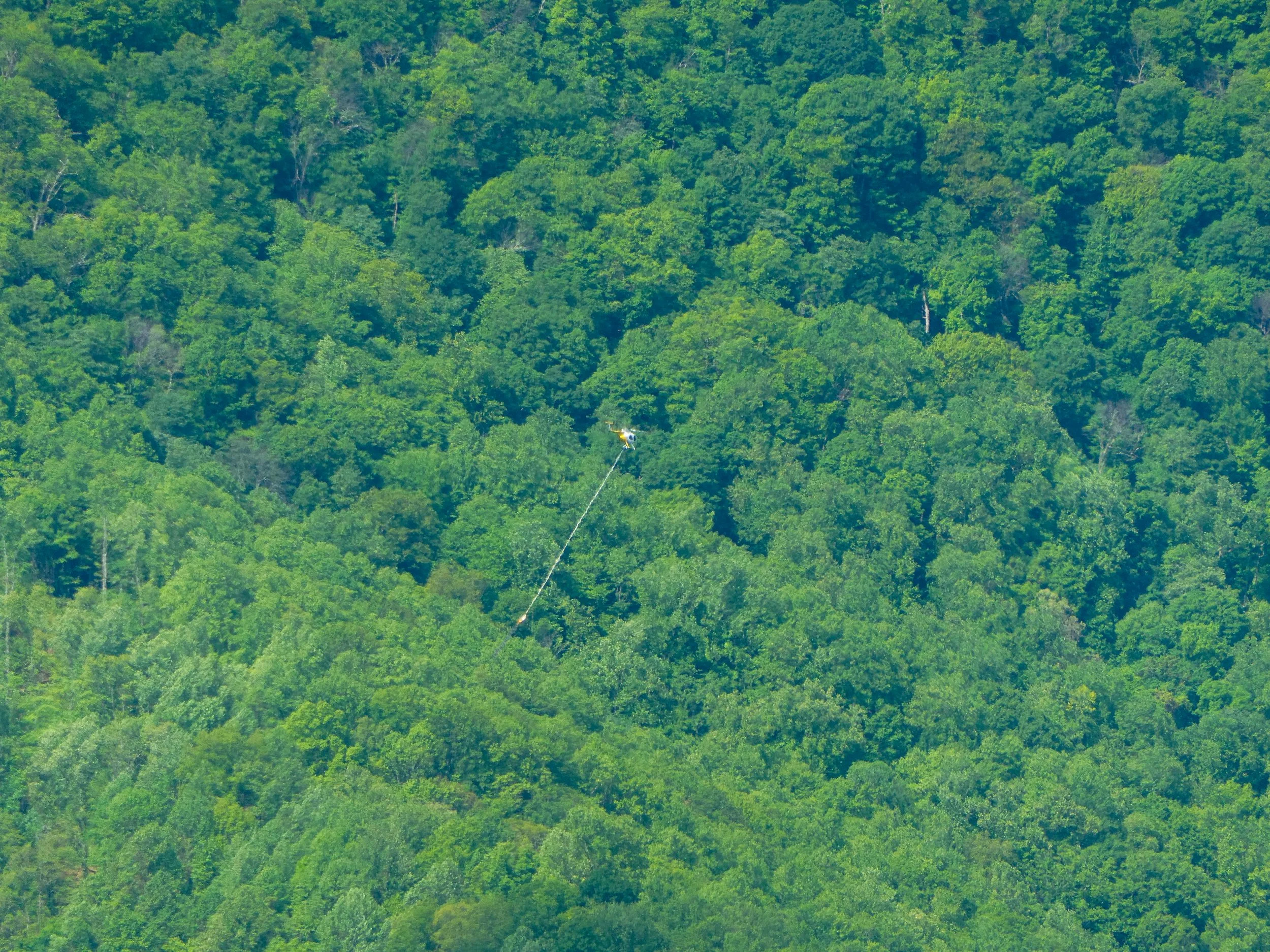
The first marked water source for the day was 0.2 miles off trail at Simmons Gap Ranger Station. However, according to a comment on my navigation app, there was an unmarked source right off trail 0.3 miles past the turnoff for the ranger station. The next on-trail water source would not be for another 7 miles. I took a risk and decided to trust the comment and avoid the 0.4 mile round trip to the ranger station. After 0.3 miles I noticed a rocky area to the right of the trail about 10 yards which looked like a creek bed. After bushwhacking to the rocks, I realized that the creekbed was actually very wide. I could see a bit of water trickling near the edge and thought I could hear a more substantial trickle towards the center. After dropping my pack and making my way over and under many fallen trees, I was able to fill two bottles. I made my way back to the trail, a bit irritated with myself for not just going to the ranger station. To add insult to injury, I hiked for less than a minute before the trail wound closer to the creek and I passed a well worn trail leading to a nice water spot.

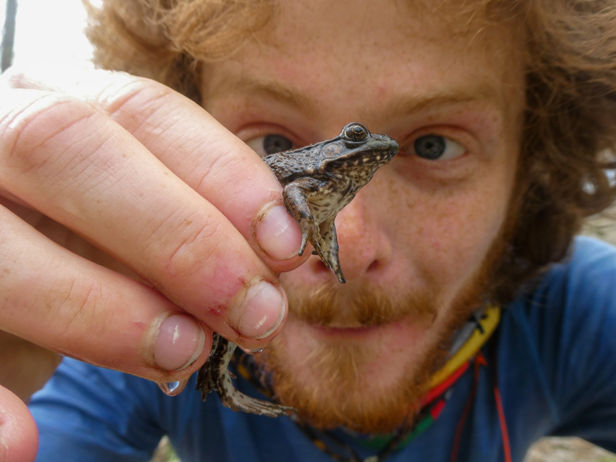
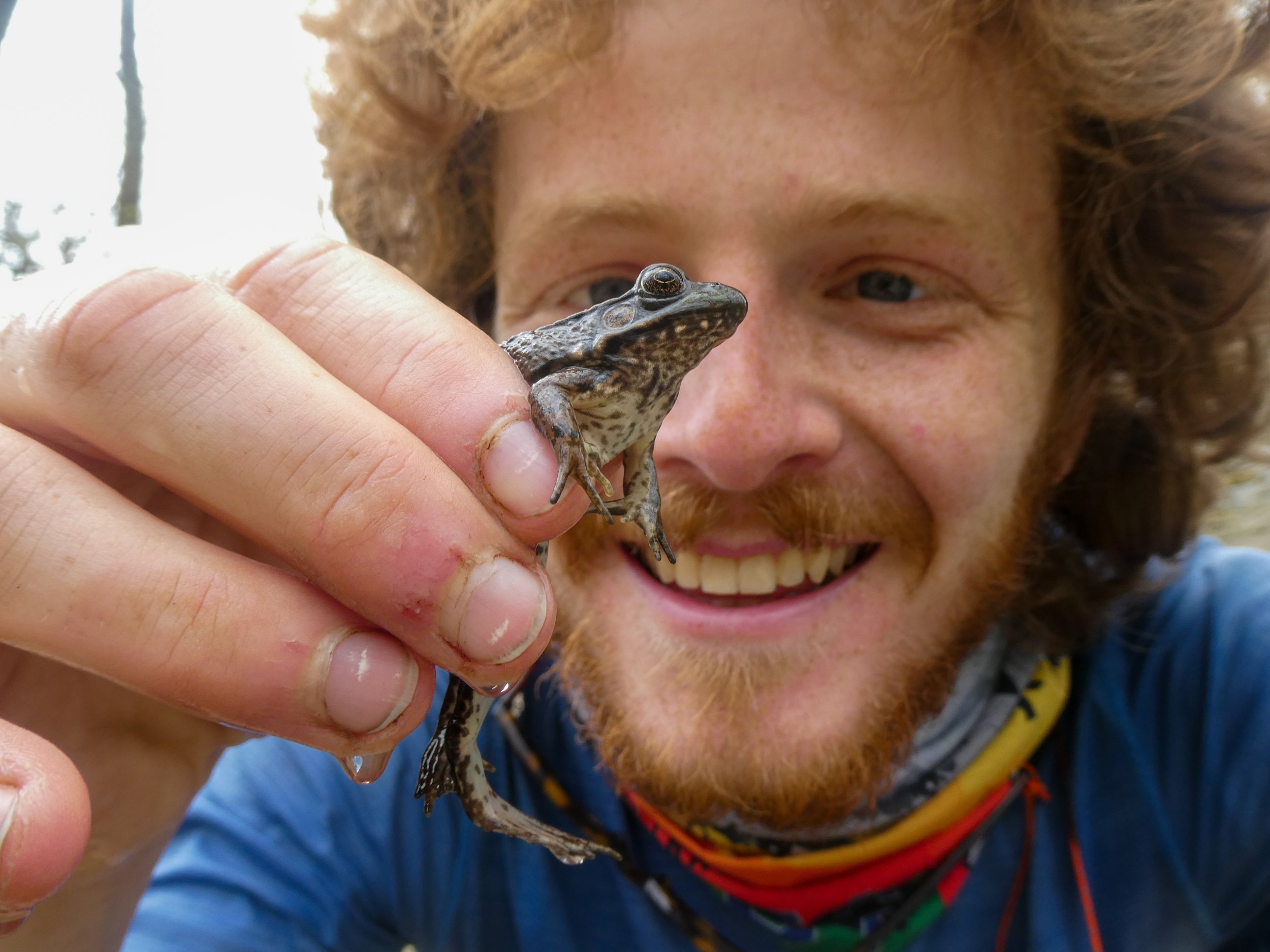
I hiked another 7 miles to a spring just before the summit of Hightop Mountain. While filling my bottles, I noticed a small leopard frog hiding in the main pool of the spring. I very excitedly captured the little frog and took a couple pictures before returning it to the spring.

Just past the summit of Hightop Mountain was a rocky cliff where I stopped for lunch. The views from the cliff were terrific and it soon became apparent that the mountain was a popular destination for day hikers. I had the cliffs to myself for maybe about 15 minutes until a solo hiker arrived followed by a couple with four young kids. While I ate, the flux of day hikers was constant. Many were interested in my thru-hike while others ignored me completely.

After hiking another 3 miles I crossed US Route 33 and ran into a woman who stopped me and pointed out the charm safety-pinned to my bag's shoulder strap. She asked if I had a Greek family member and I explained that yes my grandmother was Greek and the charm had belonged to her. I told her I did not know its significance as my mother had given it to me to take with me with the only explanation being "this was your grandmother's." The woman explained that the charm is called a "phylactery" and that they are often pinned to baby's clothes as blessings of protection and safety. This struck me as pretty amazing. As far as I know, my mother had no idea about the charm’s significance, yet she had given it to me to carry on my hike. Or maybe she knew and hadn’t told me because she thought I would find it silly. I’ll have to ask her.

The next 9 miles to Bearfence Mountain Hut were mostly uneventful. When I arrived at the hut, I found it occupied by a large group of older women who introduced themselves as "The Moms." The Moms are from Pennsylvania and were out for their biannual weekend backpacking trip. They were very friendly and asked Delta and me a lot of questions about our gear and thru-hiking experience. They also offered us box wine (pinot grigio) and marshmallows!

Beneath bending branches

Through forests of golden spring

tattered shoes tread

May 14, 2021 /Jack Boyette
Comment

Hikers Log - trail date: day 67

May 13, 2021 by Jack Boyette

(Calf Mountain Shelter (mile 872) - Pinefield Hut (mile 898.2))

I slept ok in the shelter until Jasmine and Delta woke up and started packing their things at 5am. Delta in particular sounded like he was making noise just for the fun of it. He had slept on one of the upper bunks, and each of his movements reverberated and amplified across the cheap plywood surface of his bunk. What must have been a dropped water bottle startled me like a gunshot. After Jasmine and Delta got moving, I managed to fall back asleep until about 6:30am. I packed my things and was hiking around 7:10am. After a mile, I reached the last water source before a 12 mile carry. I took my time to drink deeply, fill both liters, and get breakfast ready.

After hiking almost 2 miles, I stopped for breakfast at the first Skyline Drive crossing of the day. I sat on the low stone wall of the pull-off for Sawmill Run Overlook, which despite it’s name, was not much of an overlook. After breakfast, I had 10 miles and several Skyline Drive crossings to Blackrock Hut, where I stopped for lunch.

A half mile past the hut, I reached the summit of Blackrock, which was a giant rock pile. A quick boulder scramble provided lovely panoramic views from the top of the pile, where I found Katie, Caroline, and Tyler lounging in a post-lunch daze. I wondered to myself what sort of insane geological phenomenon could produce a rock pile such as this. The rocks looked like they had been crumbled by some ancient giant. For what purpose? Who knows. But I’m sure the indigenous people of this area must have had legends explaining the origins of this place. Those stories would probably be a lot cooler than the geological explanation. Maybe involving an ancient giant?

I continued solo, and after 2 miles, I made it to Jones Run Trailhead where Professor PB&Jazz was waiting with her old Girl Scout troop leader. They were standing by the open tailgate of her SUV in classic trail magic fashion and explained that they were waiting for Katie and the others. Jasmine’s Girl Scout troop leader apparently had bought way more food than she needed and offered me a selection of dried fruit. I happily partook in a bunch of sun dried peaches and prunes before continuing on. As I was rejoining the trail, I ran into Delta, who I alerted to the availability of free food with Jasmine and her troop leader. There may be no better way to make a hiker’s eyes light up than to tell them there is free food. After 0.5 miles, I stopped at Dundo Picnic area to take advantage of its privies and water spigots.

View from Doyle’s River Overlook, a parking area on Skyline Drive

In Shenandoah, the trail seems to always run in close parallel to Skyline drive. This results in very regular road noise, which is not the ideal wilderness experience. After another 4 miles, the trail wrapped around Loft Mountain Campground and continued 3 miles to a set cliff ledges overlooks on Loft Mountain.

I stopped to dig a cathole right before reaching Ivy Creek, where Delta caught up to me. We began a short but steep climb after Ivy Creek and chatted about the Walter Isaacson biography of Leonardo Da Vinci I had been listening too. We both laughed as I described Walter Isaacson’s seeming obsession with speculating that Da Vinci was gay. We reached the summit of the small, unnamed mountain and appreciated the excellent views briefly before continuing on.

Over the next mile, I got ahead of Delta after he stopped for a bathroom break. I soon reached Ivy Creek Overlook, which was a parking area off Skyline Drive offering excellent views to the east. As I crossed the parking area, I noticed a black SUV and a woman rummaging around in the back seat. She seemed totally absorbed in what she was doing, so as I approached to pass, I tried to make my footsteps as noisy as possible to alert her that I was approaching and avoid startling her. As I got closer, she must have heard me, because she looked over her shoulder. Her eyes lit up when she saw me and she asked “Are you thru-hiking?” When I said yes, she started asking me animated questions about my experience. As we chatted, I also started getting bits of her story. Her name was Liza, and I learned that she was converting to Mormonism next week after being raised and living as an Episcopalian her whole life. Apparently she had met a guy (a Mormon guy), fallen in love, and would be soon living a clean life with him under the tenets of the Church of Latter Day Saints. She was in Shenandoah for one last hoorah of drugs and debauchery. Liza explained that she was on a ton of shrooms, some coke, and a little cannabis. It was around this time that Delta caught up, and she offered us a bunch of shrooms. Before we could say anything, she asked us for our thoughts on “all the satanists in media controlling news messaging.” In my shock, I think I managed a response along the lines of “it’s certainly hard to find media outlets to trust” just as Pudin, Clover, and Katie reached the parking lot. Apparently, this was Liza’s cue, because she bid us farewell, hopped in her car and drove away.

Pudin, Clover, and Katie reached us just as Liza was pulling out of the parking lot. I could not help exclaiming “y’all are not going to believe what just happened!” I shared the story of my full interaction with Liza as we covered the last mile to Pinefield Hut. The last mile was super busy with park visitors finishing up their day hikes. When we reached the hut, we found it occupied by a large group of Shenandoah section hikers. I set up my tent behind the hut and then situated myself near the front for dinner. As I was explaining my “Frogman” trail name, I mentioned that I was studying the evolution of frog vision. I think I mentioned the word “opsin,” which was overheard by a LASHer named “Codger” (which apparently means a grumpy old man), who excitedly explained that he is a visual neurologist and knew all about opsins. Before I distracted him, he had been trying to convince another section hiker that her trail name should be “Dorothy” because she was from Kansas. She was clearly unenthused by the prospect, and later that night, out of earshot of Codger, I advised her that there was no reason to embrace a trail name she hated.

I soaked my feet in the creek in front of the shelter as I prepared for bed. As the evening light was fading, just as I was about to crawl into my tent, Jasmine and her Girl Scout troop leader arrived. Their day had obviously been a slow one😂

May 13, 2021 /Jack Boyette
Comment

Hikers Log - trail date: day 66

May 12, 2021 by Jack Boyette

(Paul Wolfe Shelter (mile 859.3) - Calf Mountain Shelter (mile 872))

We started hiking at 8:10am with only 5 miles to go until Rockfish Gap. From there, we planned to catch a ride into Waynesboro, home of the legendary Ming Garden Buffet, an all-you-can-eat Chinese buffet popular with thru-hikers. Waynesboro would also be our resupply stop before entering Shenandoah National Park this afternoon. The most interesting site of the morning was the ruins of an old homestead marked with a sign that read “W. J. Mayo Homeplace.” We joked that maybe mayonnaise was invented here. Later Googling revealed that W. J. Mayo was actually one of the founders of the Mayo Clinic, although Wikipedia states that he was born in Le Sueur, Minnesota and spent most of his life in Rochester, MN. I am not sure what to make of this conflicting information🤷

We made it to Rockfish Gap with six people, so we knew we would need either a big truck or van to shuttle us into town. Fortunately, Paul Wolfe Shelter featured a list of trail angel shuttle drivers who would offer free rides to hikers from Rockfish Gap. We consulted a picture of the list and decided to call a driver named "Yellow Truck,” who said he could pick us up in 15 minutes. The wait was super cold and windy. As we stood near the road, I felt the wind slowly convection-ing away all the heat I had built up during the morning hiking.

After what felt like an eternity of suffering, Yellow Truck surprised us by showing up in a red truck. We asked him what happened to his yellow truck and his gruff reply was “Broke down!” He struck me as a large, surly gentleman. From inside the truck he shouted “Alright! Girls in the front, boys in the back!” I hopped in the back with Katie, Delta, and Puddin.

The drive into Waynesboro was short but super cold and windy. Katie began the drive perched on top of the truck bed’s spare tire. This seemed to really agitate Yellow Truck who started yelling: “tell that boy to sit down back there!!!” A combination of his gruff voice and the wind made communication difficult, and it took him a few yells before Katie understood the command, which seemed to agitate Yellow Truck even more. I somehow managed to hang on to a bit of my body heat by the the time we reached a Sunoco gas station on the outskirts of town. Yellow Truck stopped unexpectedly at the Sunoco and briefly held court with another local vagabond who seemed equally surprised by the red truck. After our foray at Sunoco, Yellow Truck dropped us at Kroger where we resupplied before heading to lunch at Ming Garden Chinese Buffet.

Ming Garden was everything a thru-hiker could want… endless mounds of greasy food. We all ate until our stomachs reached capacity. After lunch, I stayed at Ming Garden to talk to AC while the other Dinos headed to a coffee shop. AC and I discussed our next chance to meet up, and it was decided that she would meet me somewhere in northern Virginia or southern Pennsylvania and we would make a weekend trip up to Philadelphia. I have never been to Philly, so the prospect of spending time with AC in a cool new city was thrilling.

I met up with the other Dinos and we arranged another shuttle with Yellow Truck, who dropped us back at Rockfish Gap. From the gap, the southern entrance of Shenandoah National Park was only 0.3 miles away. We reached the entrance, which was just a sign next to the trail, and Caroline filled out a hiking permit covering our group. She dropped one half of the carbon copy form in the drop box and kept the other half for the northern boundary. We hiked on into the legendary Shenandoah National Park, and I reflected to myself that this was my first time in the park.

After about 4.5 miles of gradual, mostly uphill climbing, we reached Bear Den Mountain, which featured a set of weather radar towers and a handful of tractor seats sprouting from the ground. The tractor seats looked like some sort of playground feature. A commentor on Guthook claimed to have spoken with a trail maintenance crew who explained that the mountain was once an apple orchard and the family that owned the land (who would eventually grant easements for the AT) installed the seats so they could watch the sunset together. I have no idea if that’s true, but it is certainly a nice story.

After another 0.5 miles, we reached Beagle Gap where we met Katie's parents who brought us BBQ, cold drinks, and plenty of junk food for dinner. Despite our heavy lunch, we were all able to put away some BBQ.

After dinner, we only had 2 miles to get to Calf Mountain Shelter. Our last hour of hiking took us over the summit of Little Calf Mountain, which offered fine views of Shenandoah bathed in golden hour light.

We reached the 0.3 mile side trail to Calf Mountain Shelter just as the afternoon light was starting to fade. Considering our stop in Waynesboro and our stop for dinner, we had still managed to knock out about 12.7 miles. I did not feel like setting up my tent and opted to join the others in the shelter. Jasmine was planning to wake up super early so that she could meet her Girl Scout Troop leader, who was planning to join her for a couple days of hiking. Delta said he would also wake up early, but the rest of us felt good about sleeping in.

Looking southwest from Little Calf Mountain, we could see the weather radar towers on Bear Den Mountain

May 12, 2021 /Jack Boyette
Comment

Hikers Log - trail date: day 65

May 11, 2021 by Jack Boyette

(Harper's Creek Shelter (mile 837.3) - Paul Wolfe Shelter (mile 859.3))

The whole crew left the shelter at 8am. We immediately began an uphill climb which would continue over the first 3 miles as we made our way up towards Chimney Rock and Three Peaks. Essentially, this was the NOBO equivalent of the priest climb. Fortunately, the climb offered many spectacular lookouts where we stopped to rest and soke in the views. An open rocky slab at mile 838.8 offered particularly fine views toward The Priest, which sat stately to our southwest.

During the climb, we noticed several small bushy trees beside the trail with white blossoms and nasty 1-2 inch thorns. Some quick googling revealed that these were invasive Bradford pear hybrids, which were likely dispersed here by birds who had eaten the fruit of landscaped trees. According to a University of Arkansas Extension webpage: “Bradford pear trees do not normally have thorns, however their root stock the true Callery pear does have thorns. The birds are eating the small fruits and sowing them freely. The result is that hybrid Callery seedlings are now blanketing our roadsides, and the resulting trees are loaded with thorns and fruits of various sizes.”

During the climb, we also noticed the sound of a helicopter, which sounded nearby. Usually the sound of a helicopter or small plane does not last long, but this one seemed to stick around, getting louder and quieter at random. As we rested at the rocky slab, we watched as the small helicopter revealed itself from the trees near the base of The Priest. The helicopter was lifting something. I zoomed in with my camera and confirmed that it appeared to be something about the size of a person, maybe a small gurney. Whenever I hear a helicopter in the backcountry, I always wonder if someone is being medevac’d, but I’ve never actually seen it happen. We all hoped that the person would be ok.

Pretty blooms and nasty thorns on this Bradford pear hybrid

A small helicopter lifting what appears to be a gurney from near the base of The Priest

Although the Dino’s were hiking loosely together this morning, most of us had headphones in. Personally, I had was trying out an audiobook for the first time. A while back, Lebowski had recommended Libby, a free app that lets anyone checkout audiobooks as long as you have a library card. Since then, Delta and a number of other hikers had recommended audiobooks while hiking. I took our time at Katie’s house as an opportunity to download a few audiobooks. The first one I was excited to listen to was Stephen Hawking’s A Brief History of Time. My thinking was: “what better time than a thru-hike to peel the curtain back on the secrets of our universe.” Instead, I found myself unable to concentrate intently on the theoretical behavior of subatomic particles. It turns out A Brief History of Time is a bit too dense to follow while hiking. I noted this and opted to move on to lighter fare in the future.

The next 5 miles took us over the mostly wooded summits of Chimney Rock and Three Ridges. On the decent from Three ridges, we caught more views from hanging rock overlook, passed antique farm equipment at Reid’s Gap, and then stopped at the Three Peaks Overlook parking area for lunch. Despite it’s name, the parking area, which was situated on the Blue Ridge Parkway, seemed to offer no natural overlook. Instead, the park service had slashed a swathe of trees to the south, creating a pleasant view contaminated by a whole lot of dead trees. We found a nice rock to sit on and tried to ignore the tree massacre. Overall, I’d say it was a nice lunch spot.

For the next 10 miles, we were rewarded with an overlook almost every mile, which made for slow going. Some highlights included Cedar Cliffs at mile 849.5, which was popping with wildflowers and cute little succulent-looking plants. A jagged outcrop at mile 850.9 offered partial views, but I was more intrigued by the rock itself. More specifically, I wondered whether violent or gradual geological forces had spawned such a dramatic rock. Finally, Wintergreen View offered a lovely southern panorama of the budding mountains.

This feisty garter snake tried to bite me as I shoed it off the trail

The jagged outcrop at mile 850.9

Wintergreen view

From Wintergreen View, it was only a mile to the summit of Humpback Mountain, our last climb of the day. From there it was 5 miles of downhill to Paul Wolfe Shelter. The summit of Humpback Mountain failed to deliver any spectacular views, but after about a mile of decent, I encountered a 0.25 mile side trail to Humpback Rocks. As per my personal philosophy, I took the side trail and it was well worth it. The rocks themselves were a behemoth set of jagged cliffs. The views were breathtaking.

Humpback Rocks

Another 4 miles of mostly downhill hiking carried me to Paul Wolfe Shelter. As the afternoon grew late and I neared the shelter, I listened to Cat Stevens - “Tea For The Tillerman.” One of the album’s core themes, seeking meaning in life, felt especially relevant for as I took steps along my admittedly pointless journey from Georgia to Maine. Songs like "Miles from Nowhere" and "On the Road to Find Out" certainly felt appropriate.

I made it to the shelter at 7pm. My feet were very tired and sore after an especially rocky day of hiking. After eating dinner, I soaked feet in the freezing creek for 20 minutes. Delta joined me and we talked about trees. Afterwards, I prepared to retire for the evening. Interestingly, this was the first shelter I had stayed at with bear pole food storage. Basically, there is a giant ~20 foot metal pole erupting from the ground with a handful of hooks near the top. Hikers use a separate handheld pole with a single hook on the end to lift their food bag and hook it onto the main pole. The handheld pole is quite heavy, and it can be a hell of a challenge to actually hook a food bag onto the main pole. Still, it was pretty neat. As I have hiked, it has been fascinating to see how different trail clubs deal with bear safety. From a laissez-faire “figure it out yourself” attitude, to bear boxes, lines, and now; poles. What else might be in store?😂

May 11, 2021 /Jack Boyette
Comment

Hikers Log - trail date: days 63 & 64

May 10, 2021 by Jack Boyette

Day 63: Zero day at Katie's House!

Day 64: (VA Route 56 (mile 834.4) - Harper's Creek Shelter (mile 837.3))

At this point in my hike, my circadian rhythm naturally wakes me up around 6:30-7am when the sun is just over the horizon. This is great on trail, but unfortunately it makes it tough to sleep in on mornings off trail. This morning however, I managed to sleep in until 8:30am which felt pretty incredible.

We were not able to head back out to trail until Katie's mom got back from work. I was told this would be any time from 3-4pm, so we had all morning and a good chunk of the afternoon to continue snacking and relaxing. These are the two main priorities of a thru-hiker when not hiking so I had no complaints.

After a leisurely day of eating far to many leftovers, Katie's mom returned around 4pm and surprised us with a pizza. We ate the pizza and loaded up the two cars around 4:45pm. The drive to the trailhead took about an hour. We all thanked Katie's parents for their incredible hospitality and took a quick picture before finally hitting trail at just about 6pm.

This morning, there had been talk about possibly hiking 9 miles to Maupin Field Shelter, but it quickly became apparent that Harper's Creek Shelter - just 2.9 miles away - was a more realistic destination for the evening. The hike was uneventful, although my body was a bit confused to be starting so late in the day. We made it to the shelter a little after 7pm and I set up my tent before digging into the leftover chicken-chickpea-tomatillo dish I packed out for dinner.

May 10, 2021 /Jack Boyette
Comment

Hikers Log - trail date: day 62

May 08, 2021 by Jack Boyette

(The Priest Shelter (mile 829.7) - VA Route 56 (mile 834.4) *overnight at Katie's house*)

I woke up this morning at 6:15am. After breakfast in the shelter, Puddin, Katie, and I started hiking at about 7:30am. We stopped briefly at a set of rocky cliffs near the priests summit. It was very windy and the views were excellent. Interestingly, there was a guy repelling off the cliff. To where exactly, I’ll never know. We had hoped to catch Delta at the nearby tentsite, but he was nowhere to be found.

In this photo, you can see the repel line and the dark shape of a man obscured by trees

We then began the extended climb down the northeast face of The Priest, which involved a 3,000 foot elevation loss over about 4.5 miles. It would be a murderous climb for anyone hiking SOBO. After about 2 miles, we were treated to a break in the trees along a rocky clearing which offered terrific views into the valley below. After another 1.4 miles, we stopped at Cripple Creek for a few minutes because it was pretty and we had little reason to rush.

Just as we were within site of the parking lot, I spotted my first toad of the AT! The little amphibious friend was hopping right along the trail and we stopped for pics and cuddles. The toad seemed unenthused to be receiving so much attention and expressed its enthusiasm by peeing on Katie. I was shocked that I had made it 62 days without seeing a toad.

Our feet touched the parking lot at 9:55am. Katie's parents, who were supposed to meet us at 10am, had not arrived yet, so we readied ourselves for a short wait. As the minutes dragged on, Katie began to get worried. There was no cell service in the deep gap, so we speculated that they could be lost. Nevertheless, Katie’s parents ended up arriving at just about 11am. They explained that they had indeed been lost, and had to stop at a gas station and then a little country store for directions. Any remnants of concern were washed away when Katie’s dad presented a big bag of fresh bagels and various cream cheeses from their favorite local bagel shop. Delicious🤤

Our first stop was the strawberry patch at Chile’s Peach Orchard and Farm Market. We had big expectations for Chile’s. One of Katie’s childhood friends had apparently been discovered by a professional modeling scout at the strawberry patch. Naturally, we all expected to be discovered for professional modeling gigs😂 Perhaps more realistically, we expected to eat an absurd volume of strawberries. We joked about being asked to leave after our hiker appetites decimated the strawberry fields.

Soon enough our expectations had become reality - at least the eating strawberries part. We each picked and ate strawberries until our stomachs reached capacity. It turned out that not even our combined hiker metabolisms could make a dent in Chile’s strawberry fields. We each filled baskets and then made our way to the farm shop, where Katie insisted we try the apple cider donuts. I had never had one before. Absolutely delicious!

After Chile’s, we made a second stop at Walmart for our second rounds of the COVID vaccine. We arrived a little early and killed time browsing for snacks and other essentials. After we all got poked, we made one last stop at the Whole Foods “in a hole” (as Katie likes to call it) before heading to Katie’s house.

Katie's mom trains horses and their house doubles as a horse farm. After a brief tour, I was shown the guest house, which I would have completely to myself. After washing up, I made my way back to the house where we all pitched in on the creation of a very tasty and veggie-rich dinner. I think AC would be pleased. I certainly was😁

May 08, 2021 /Jack Boyette
Comment

Hikers Log - trail date: day 61

May 07, 2021 by Jack Boyette

(US Route 60 (mile 809.1) - The Priest Shelter (mile 829.7))

I woke up this morning to the sound of a riding lawnmower doing laps outside my tent. Not quite as peaceful as chirping birds, but it was an effective alarm. I quickly packed my things inside my tent. After brushing mower cuttings off my rainfly, I finished packing and made my way to the bathroom pavilion to use the facilities one last time before my shuttle arrived.

Mithril the Guide pulled into the parking lot at 8:10. Again, he unexpectedly agreed to swing through the Hardees drive-thru on the way out of town so I could grab some breakfast. Hardees screwed up my order. I ordered a loaded breakfast burrito, which is on their online menu, but apparently they do not carry them in Buena Vista, so I settled for a bacon egg burrito. Then I ordered for a sausage and egg biscuit, and they gave me a sausage biscuit. Oh well, I thought. It’s calories either way, and it would fuel me up the big climb up from Long Mountain Wayside.

I was dropped off at trailhead, thanked Mithril, and began 3 miles of climbing to the summit of Bald Knob. This will be my shortest day in a while. I’m looking to hike just over 20 miles to The Priest Shelter, which should put me about 6-7 miles from the road where Katie’s mom is going to meet us tomorrow morning. Given that I’d only be out a day and a half before my next resupply opportunity, my pack was full of luxury food items. My lunch plan was half a baguette, cheese, Cheez-its, mango, and avocado. I was very excited🤤

It started sprinkling as I neared the top of Bald Knob. After about five false summits, one of which actually offered a nice view, I finally reached the top. Despite the name, the summit of Bald Knob was completely wooded and I was not rewarded with any more views. I consoled myself with the knowledge that I had just completed about a third of the days climbing.

From the look of things, it seemed that the light rain would hang around for a while. After a steep descent into Cow Camp Gap, I began the much shorter and more gradual climb up Cole Mountain. Along the climb, I was treated to two rocky outcrops with nice views to the west. Cole Mountain itself was a bald ridge with beautiful views of the surrounding mountains. The gray skies set a moody tone.

The skies sprinkled on and off for the next 9 miles as I crossed over the meadow-like ridges of Cole Mountain and Tar Jacket Ridge. The hiking was easy and I was treated to lots of lovely views through this section. I made it to Seeley-Woodworth Shelter, just as the sprinkling stopped and the sun peaked out from behind the clouds. I stopped to enjoy my gourmet lunch and took my time to savored every bite.

After I finished lunch, the rain started up again, this time with a vengeance. I made a rush for the privy just as the hail started. Inside the privy, the hail was deafening. Each piece of ice hit the tin roof with a loud metallic PANG! Fortunately, the hail stopped after a couple minutes and the sun came back out. I started hiking again after spending almost an hour and a half at the shelter. No regrets😁

The weather continued its indecisive swings between sprinkling, hail, and sun for rest of the day. After 2.5 miles, I arrived at the short side trail to Spy Rock, an open, rocky dome with spectacular views in all directions. Spy Rock must be a popular spot because there were ropes reminding curious hikers to stay off the vulnerable vegetation near the rock’s summit. I appreciated the views for a few minutes, but was feeling restless to continue.

I had about 4 miles until The Priest Shelter. I wasn’t sure exactly what “The Priest” was, but I assumed it was a big rock formation or cliff. I kept my eyes open as I entered the Priest Wilderness and began the climb towards the shelter. Every time I saw a biggish rock, I would wonder to myself: “Is that it?” I was never sure. But I was sure I didn’t want to miss The Priest.

Is this “The Priest”???

Despite my 1.5 hour lunch stop, I arrived at the shelter earlier than I have arrived at camp in a while. At the shelter, I met a weekend hiker named Ross, who explained that he was an AT thru-hiking alumni from 1989! He was currently preparing for a Mt. Rainier trip, which sounded very cool. As we were chatting, Clover, Puddin, Jazz, and Retro arrived. Because Katie was from the area, I asked her where the actual Priest was. She looked at me like I was an idiot and explained that we were on the Priest. The Priest was the mountain😅

I had a hell of a time trying to hang a bear bag on a high branch next to the shelter, but I eventually got it. As evening approached, we sat in the shelter eating dinner, we wondered where Delta was. Ross explained that Delta had arrived at the shelter just before I arrived, but he had continued on to a set of ledges about a half mile ahead. He apparently wanted to catch the sunset. Or maybe he thought that’s where we would be camping? Oh well, we’ll catch him tomorrow.

May 07, 2021 /Jack Boyette
Comment

Hikers Log - trail date: day 60

May 06, 2021 by Jack Boyette

(Punch Bowl Shelter (mile 797.8) - US Route 60 (mile 809.1) *overnight in Buena Vista, Virginia*)

I slept well in the shelter and woke up at just about 7am. Fortunately, I was not disturbed by the mother bird that other hikers had warned about on Guthook. I texted a shuttle driver from Guthook named Derek, and arranged for pickup at 2pm 11.4 miles ahead. This will be the first shuttle ride I have paid for, which I feel pretty good from a frugality perspective. I had considered hitching, but I just didn’t want to deal with it today. The upcoming town, Buena Vista, is pretty far off trail. The road is direct, but it had rained every afternoon the past three days. If it was raining when I reached the road crossing, it would be hard to get a hitch. If it had already rained and I was soaking wet, It would be hard to get a hitch. So, my conclusion was: paying for a shuttle just made sense today.

My plan was to shuttle into Buena Vista, resupply, and spend the night at a campsite in town which apparently offers $5 tenting for hikers + free showers. Pretty sweet deal! However, it was unclear if they offered towels. I hoped they offered towels, but I was also thinking that I could probably skip the shower. It has rained every day since my last shower, and I really did not feel particularly dirty or smelly. Also, I’ll be zeroing on Sunday after meeting up with Katie, Jasmine, Clover, and Puddin’ at mile 834.5 on Saturday.

Derek the shuttle driver was based out of Lexington, which is a bit further than Buena Vista. When I first told him I was planning to stay overnight, he suggested Lexington as a bigger, better option. I more or less responded with: “Yeh, but I’d rather spend $5.” From what I could tell, there were also a handful of decent dinner options in Buena Vista. There was a Mexican spot that I was eyeing, a couple pizza places, and there was an ice cream spot near the campground! I’ll ask Derek if he has any recommendations. I had also arranged for Derek to shuttle me back to trail at 8:30 tomorrow morning, and I’ll probably ask him if we can swing through a drive-thru so I can grab some breakfast. After that, I am hoping to get another 21 miles under my belt, which should put me about 6 miles from where I’m planning to meet the tramily (AKA Dinos Assorted).

I started hiking at 8:30am. The morning was chilly, motivating me to hike quickly and work the chill out of my bones. As always, I warmed up quickly and was grateful for the pleasant morning. I soon crossed the Blue Ridge Parkway at Punch Bowl Mountain Overlook, which was not much of an overlook. No views, just a parking lot.

I was in an excellent mood this morning. The weather was beautiful. I was hiking to music and couldn’t help singing out loud. If anyone saw me, they might of thought I was a little crazy. But that would be ok. After a little over 2 miles, I hit 800 mile mark! Someone had painted a really cool retro 80’s style graphic on a tree. Other hikers had assembled an 800 out of pinecones and moss. I soaked in the achievement for a bit, but didn’t linger too long.

After another 2 miles, I reached a large swinging suspension bridge over the Pedlar River. As I crossed, I could not help but take exaggerated steps to shift my body weight and rock the bridge as much as possible. Immature - maybe. Fun as hell - absolutely.

The Pedlar River is dammed to create the Lynchburg Resevoir, whose steep eastern shore the trail wraps around. As I hiked along the resevoir, I passed multiple day-hikers who warned me about big blow downs ahead. After 4 miles, I started hiking along Brown Mountain Creek, which was once home to a small community of freed slaves in the early 1900’s. A sign titled “Memories of the Brown Mountain Creek Community” included an excerpt from an oral interview with a former resident of the community, Mr. Taft Hughes, who remembered his mother’s ash cakes, which were cooked on the hearth, covered with ashes and coals. Apparently “you didn’t taste any ashes on them. But they were much sweeter than if you baked them in a stove, much sweeter.”

I soon passed Brown Mountain Creek Shelter and began to hit the blow downs I had been warned about. For about a mile, the trail was frequently impeded by large swaths of recently wind blown trees. These were big and leafy trees, making for a very challenging puzzle of over/under/around/through.

The last mile before the road featured a gradual 500ft climb to Long Mountain Wayside, a parking and picnic area. I arrived at 1:40, giving me about 20 minutes to sit and relax. The weather was beautiful, and I felt a tinge of regret considering how easy it would be to get a hitch. But oh well. I didn’t have anywhere to be. I lounged in the shade, waited for Derek, and watched as cars passed along US Route 60.

Derek arrived on time and introduced himself as "Mithril the Guide." He was very friendly and explained that he had played college basketball at Washington and Lee University and now lives in Lexington with his wife and kids. Unexpectedly, he agreed to swing me by Food Lion so I could resupply and actually waited outside while I rushed in to grab my provisions. He then dropped me off at Glen Maury Park Campground where, after a brief confusion, I was able to secure the $5 hiker deal for tenting. In the park pavilion, I ate a luxurious lunch of baguette, cheese, golden mangoes, and Cheez-Its.

I spent the rest of the afternoon lounging around the campground, charging my things, and emailing Altra to replace my trail runners. As the evening rolled around, I had just about resigned myself to a 1.5 mile walk to Don Tequilas Mexican restaurant when a young local couple who had been hanging around the park waved me over. They introduced themselves as Chris and Mary and offered me half of their Dominos pizza. I gladfully accepted with many thanks. I guess trail magic doesn’t have to happen on trail and trail angels can take many forms. Oh how the trail provides😁

May 06, 2021 /Jack Boyette
Comment

Hikers Log - trail date: day 59

May 05, 2021 by Jack Boyette

(Thunder Hill Shelter (mile 772.5) - Punch Bowl Shelter (mile 797.8))

Last night I had a near-death experience. In the middle of the night I woke up to an unusual sound and noticed a dark shape hovering above my face. For context, my tent is designed so that when I sleep, the top of my head is almost touching the mesh door which acts as the entrance. This black shape seemed to be clinging to the mesh, maybe a foot above my face. In my partially awake stupor, I couldn’t tell if it was on the inside or the outside of the mesh. I opted to just stay still. Then the shape started moving at me. Fast. My brain realized it was a rat! Running down the mesh at my face. I threw my hand up to hit it, still unsure which side of the mesh it was on. Fortunately, it was on the outside, and my blow sent it flying off into the night. With my adrenaline pumping, I rolled over and tried to get back to sleep.

I woke up for real around 7:15am. I needed water for breakfast, but I was determined to avoid backtracking 0.2 miles again. I decided to check out the apparently “stagnant” spring which served as the shelter’s only water source. Guthook made it sound sketchier than it actually was. It wasn’t flowing, but the water was crystal clear, and as I approached, I saw a frog hop into the spring. If it was good enough for the frog, it was good enough for me. 

I got hiking at roughly 8:30am. The sky looked cloudy, but there was no apparent storm front rolling in. With 33 miles until my next planned resupply in Buena Vista, I wasn’t sure how far I needed to hike. As far as camping options were concerned, there was a shelter 16 miles away and another one almost 26 miles away. According to Guthook, there was no water and no campsites between the two. This presented a bit of a dilemma. I wanted to hike more than 16 miles, but after a long day yesterday, I didn’t want to do over 25 miles. I thought I’d prefer to stealth camp between the shelters, but with no water, that seemed unlikely. Part of me wanted to push for the farther shelter. If I make it there, I might finally catch up with Katie, Jasmine, Puddin, and Clover, which would be nice because were planning to get our second round of COVID vaccinations together in Charlottesville. I thought I might catch them at the shelter last night, but no such luck.  

After 1.5 miles, I reached the Blue Ridge Parkway and soon found myself at the Thunder Ridge Lookout, which featured an impressive stone observation platform. After another 3.5 miles, I crossed a gravel road at Petites Gap and met a trail club crew repairing a sign which had been damaged in a wind storm. I stopped to chat for a bit and one of the older gentleman explained that he personally maintains Thunder Hill Shelter. When I told him my trail name, he asked if I had seen the frog in the spring. With a bit of surprise, I told him I had and he explained: "Yeh… he's taken up residence there. It's his home now."

Stopped at Marble Springs

The next 8 miles involved a quick climb over the wooded summit of Hitchcock Knob, followed by about 2.5 miles of rolling ridge hiking, and then another 2.5 miles of downhill towards Matt's Creek Shelter and the James River. Just before the shelter, I caught up to Push and I soon spotted my first corn snake of the trail! The little guy was just to the right of the trail, with its tail stretched out into the footpath. Push commented that whenever he hikes with me, he sees more wildlife!

Push and I made our way to Matt’s Creek shelter for lunch. Delta joined us soon after. Over lunch, we chatted about Push’s experience competing in triathlons and ultra marathons. Afterwards, I left Push and Delta and hiked along Matt's Creek for about a mile until it merged with the James River. As the trail met the river, I was impressed by the imposing cliffs which the river must have carved over millions of years. With the river to my left, and the cliffs to my right, the trail followed a somewhat narrow wooded shoreline which offered a scenic pass between the river and rock. Camping was forbidden in this area, presumably due to the risk of flashfloods, but it was really pretty and - understandably - there were multiple established campsites. As I made my way along the river, the sky opened up, seemingly as if someone had turned a faucet on. The torrential downpour was brief, vanishing as quickly as it had appeared. But it was enough to leave me sopping wet.

I crossed the James River Bridge, which is the longest footbridge on the AT. The bridge was impressive and seemed to be constructed using the supports of an old rail bridge. When I reached the other side of the bridge, I was greeted by an older gentleman who introduced himself as a volunteer with the US Forest Service. He asked if I’d be willing to complete a survey about my use of the National Forest Lands. I figured “why not” I might as well try to be helpful. I quickly realized I had made a mistake. The survey was ridiculously long and it was definitely not designed with thru-hikers in mind. Questions like “how long do you plan to use the national forest lands?” are hard to answer when you’re constantly weaving in and out of USFS land over the course of a multi-month thru-hike. I think the older volunteer could sense my mild annoyance and I felt a little bad, but we made it through all the questions and he thanked me and apologized for the crazy questions.

After another 2 miles, I took a short side trail to John's Hollow Shelter where I filled 2 liters of water, prepped dinner, and used the privy before tackling the next 8.8 miles to Punchbowl Shelter. There would be three big climbs (totaling ~3,120 feet) between here and there, and no water. Sure enough, the climbing started immediately. Over the course of 2 miles, fierce switchbacks climbed over 1,400 feet to the summit of Little Rocky Row, offering nice views of the James River from the summit as well as the Fullers Rocks just below. After a brief stop to catch my breath, I continued on to the next climb. Another mile of switchbacks elevated me another 700 feet to the summit of Big Rocky Row. As I was nearing the summit, I heard the unmistakable sound of a rattle. It was my first timber rattlesnake of the trail! It was a sizeable specimen, although I might not have spotted it if it hadn’t started rattling. I whipped my camera out to take a video as it slowly slithered further from the trail and disappeared into the undergrowth. Just beyond the summit, I found a lovely grassy campsite beside a cliff offering spectacular view to the south. If I had enough water, I would have been tempted to spend the night there.

View from Little Rocky Row

Cliffs near the summit of Big Rocky Row

As I prepared for the final climb over Bluff Mountain, I queued up a playlist of angsty middle school classics. I’m talking Shinedown, Disturbed, Atreyu, Slipknot, and Stone Sour - among others. The next 4 miles mostly involved rolling ridge hiking until the final ascent to the summit of Bluff Mountain. When I finally reached the peak, I was exhausted. Bluff Mountain had once been home to an old fire tower, but now all that was left were a couple large concrete blocks that must have once supported the legs. I opted to take a break, plopped down on one of the blocks with a dramatic sigh, and admired the wonderful view to the northwest. The previous three climbs were tough, and I soaked in the view as my reward.

With a little under 2 miles to go, I began the final push to Punchbowl Shelter. Fortunately, the trail was more-or-less entirely downhill, and I arrived at 6:45pm. To my surprise, I was the only hiker at the shelter, so I decided to set up in the shelter. The shelter was set in a large clearing beside a swampy pond. Guthook described the pond as providing “some ambiance, but also some black flies during the summer.” Maybe the threat of black flies scared everyone else away. Fortunately for me, although there were some gnats buzzing around me, nothing seemed to be biting. Someone in the Guthook comments had also warned about a birds nest in the shelter, but I checked and it was empty.

Push arrived about 30 minutes after me and opted to set up his tent. He explained that he enjoyed the extra privacy. I usually agree, but I was more than happy to spend the night in a shelter all to myself. After eating dinner, I made my way down to the spring in front of the shelter. As I was filling my bottles, I noticed a moderately sized leopard frog sitting beside the flow. I caught it and noticed that its hind leg was limp and appeared to be injured. Poor guy. I took a few pictures, showed Push, and released it back at the spring. Godspeed my froggy companion!🫡

May 05, 2021 /Jack Boyette
Comment

Hikers Log - trail date: day 58

May 04, 2021 by Jack Boyette

(Bobblet's Gap Shelter (mile 748.9) - Thunder Hill Shelter (mile 772.5))

I got hiking at about 8:00am. I wasn’t sure of my destination for the evening. North of Bobblet’s Gap, there was a shelter at 18.5 miles, and another at 23.5 miles, so I’d probably end up at one of those. I crossed Blue Ridge Parkway three times over the first 3 miles. Most of the crossings seem to coincide with parkway overlooks, and I was treated to views from the Peaks of Otter Viewpont and Mills Gap. On one hand, although there aren’t too many cars, I wish the trail wasn’t so close to the road. However, the ridge is beautiful and the overlooks along the parkway are spectacular.

The trail broke away from the Blue Ridge Parkway after 3 miles, following the ridge as it rose over the small hump of Cove Mountain. After another 3 miles, I reached Cove Mountain Shelter where I stopped for a snack and privy break. Just 0.1 miles beyond the shelter, the trail passes Buchanan View, a rock outcrop overlooking the town of Buchanan to the northwest.

As I hiked on, the trail began its gradual descent towards VA Route 614 and Jennings Creek. As I hiked, I soon caught up with Carly, who explained that she had earned herself a trail name: “Bonanza Jellybean,” which is a reference to the book Even Cowgirls Get the Blues, which I had never heard of. We reached the road and crossed over Jennings Creek on a concrete bridge. Below the bridge was a large swimming hole apparently popular with locals. Carly hiked on, but I opted to stop at the swimming hole for lunch and a quick swim to cool off. Being a Tuesday morning, I had the swimming hole to myself. The water was brisk and refreshing. As I ate my lunch on a rock, Delta reached the swimming hole and also stopped for lunch. The day was quickly getting hot and the water offered a lovely reprieve. Lebowski hiked by and we encouraged him to join us. He explained that today was his 30th birthday and he wanted to do 30 miles. “30 for 30!” he explained with infectious enthusiasm. We wished him happy birthday and he continued along.

After lunch, I continued on and the trail immediately began a steep, hot ascent over an unnamed mountain. As I reached the top of the mountain, I noticed a large fence lizard basking on a tree trunk. I stopped to take pictures, and was surprised by how close my new reptilian friend allowed me to get with my camera. She just sat there watching me with caution and maybe a dash of contempt. After a short but steep descent, the trail crossed a number of small streams and I found myself at the massive Bryant Ridge Shelter, apparently one of the largest shelters on the trail. It was a double-decker with a wrap-around porch and enough room to easily sleep 20 hikers. I decided to stop, stretch, and cool off for a bit. As I was doing my stretches, I could hear thunder in distance. Nice.

From Bryant Ridge Shelter, I had 10 miles to Thunder Hill Shelter where I was hoping to camp. Those 10 miles included two major mountain climbs, for a total ascent of approximately 4,255 feet and a total descent of approximately 1,598 feet. About 5 miles away, in a gap between the two mountains was Cornelius Creek Shelter. So if the weather got crazy, that would be my chance to bail. I got hiking as thunder came closer. After maybe 30 minutes of climbing Floyd Mountain, the skies opened up. It had been a hot day, so frankly I welcomed the rain and did not even put my rain jacket on. As I summited Floyd Mountain, the rain and wind really picked up. Visibility was low as I hiked into a wall of wind and rain. This had to be the hardest rain I've seen on trail.

Up ahead I spotted Delta’s orange OR rain jacket and Gossamer Gear umbrella. He was sitting to the left of the trail, huddled in a little ball underneath his umbrella. As I approached, I yelled “Beautiful day, isn’t it!” The huddled form lifted the umbrella and I was startled to realize it wasn’t Delta. It was some man I’d never seen before. “Fuck off!” he responded, clearly annoyed at my cheeky comment. Oh well.

I made it to Cornelius Creek Shelter just as the rain was starting to ease up. I prepped my dinner in the shelter as the rain stopped. Carly AKA Bonanza Jellybean joined me and we talked about all the weird dreams we’ve had on trail. I bid farewell to Carly and continued hiking. I soon caught up to Delta, and I told him about my amusing encounter with his body double in the rain. We briefly stopped to admire the Black Rock Overlook and then hiked together for the last climb over Apple Orchard Mountain. As we climbed, we encountered a few spotted newts, who must have been lured from their homes under leaves, rocks, and logs by the torrent of rain. I also stopped to forage some ramps which would feature nicely in my ramen bomb.

As we reached the summit of Apple Orchard Mountain, the trail routed along side a crazy-looking tower, which Guthook described as an FAA long range radar.

0.3 miles past the summit, we reached “The Guillotine,” a famous AT landmark involving a large rock wedged in a crevice. The trail passes through the crevice and under the rock, which seems as if it could fall and smush a hiker at any moment. I passed through, followed by Delta. Fortunately, neither of us got smushed.

We made it to the shelter and set up our tents. Unfortunately, I had to backtrack 0.2 miles for water, which felt way longer than 0.2 miles. The water source wasn’t even that great, and I had to bushwhack a bit to find it. There’s a stagnant pooling spring at the shelter. I’ll take my chances with that in the morning. Fortunately, my spirits were lifted by the inclusion of ramps with my ramen bomb. Fresh veggies on trail really is a game changer.

May 04, 2021 /Jack Boyette
Comment
  • Newer
  • Older

© 2023 John Boyette