Amphibian Ecology & Evoloution

with John Boyette

  • About
  • Research
  • Outreach
  • Hikers Log
  • Photography
  • Illustration
  • Contact

Hikers Log - trail date: day 98

June 13, 2021 by Jack Boyette

(South Mountain Pass Road (mile 1409.1)) - Dennytown Road Campsite (mile 1421.2))

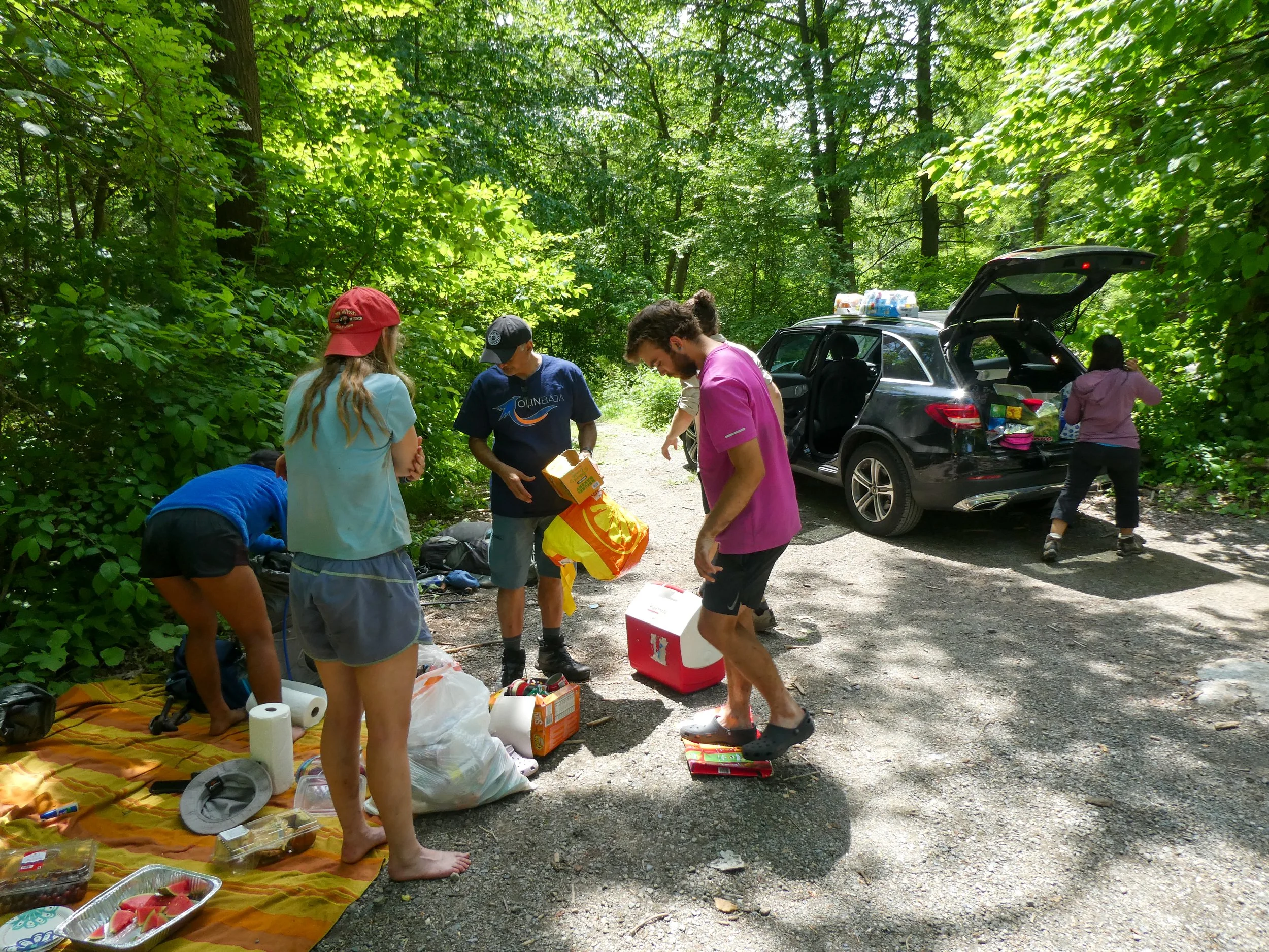
Over the course of our time on Long Island, I think that Jasmine’s dad, Acky, never stopped cutting up and serving us fruit. Mango and watermelon were clear favorites, but there was also no shortage of grapes, blueberries, little trail mix packets, and various Indian snack foods. Acky and Jasmine’s mom, Samina, were incredibly gracious and gregarious people. Before we left, Acky managed to wash the stink out of all of our socks, which I suspect would qualify as a miracle in the eyes of the Catholic church. The secret was an overnight water and detergent soak, followed by vigorous wringing before the washing machine.

As we were packing, Jasmine made the call that she would stay behind to rest her knee for a few days. Her left knee has been giving her serious trouble, and though she suspected it was only tendonitis, I think we were also spooked by Clover’s injury. Out of an abundance of caution, Jasmine planned to rest, visit the doctor, and also book some time with a family friend who is a gifted masseuse.

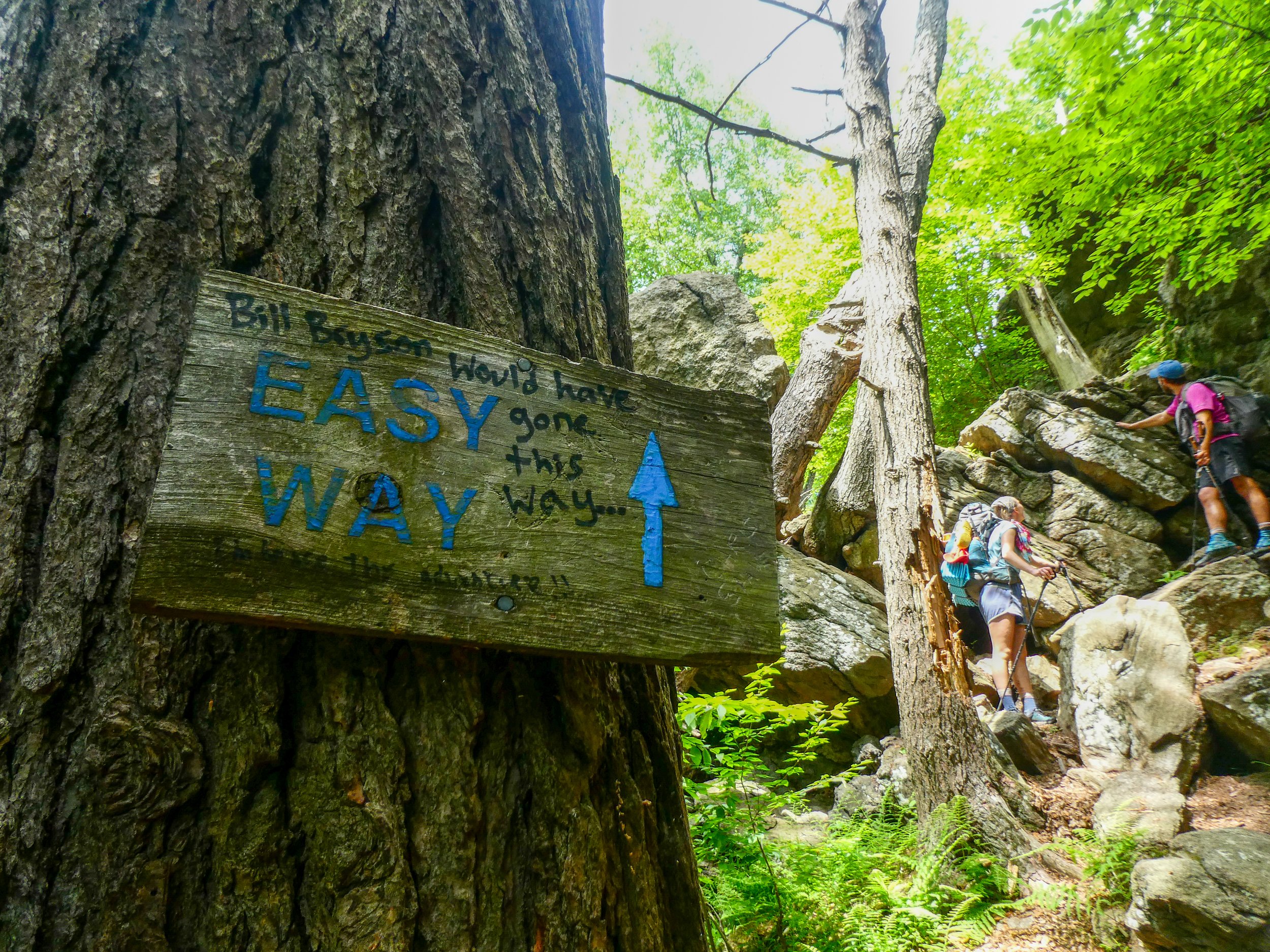
Samina drove us back to trail and Jasmine accompanied. Things seemed pretty normal, all jokes and silliness, until we reached the trailhead and it became apparent that it would be tough for Katie to hike on without Jasmine. The two had started the trail together and rarely hiked apart for long. I saw them as inseparable and I think they did too. We all hoped this would be a brief “see ya later” kind of split, but after Caroline’s leg, I think we all feared the worst. As we walked into the woods and started up a hill, Caroline’s emotions really started welling up, and Puddin’ stayed to comfort her while Delta and I hiked on.

After about 6 miles, we reached the Appalachian Deli - Grill - Pizza at the Route 9 intersection directly on trail. The deli was a large 24/7 convenience store attached to a Shell gas station, and sold hiker staples as well as subs, pizza, and all manner of junk. We stopped briefly because everyone wanted a snack. In my eternal frugality, I opted to eat the lunch I had packed out from Long Island.

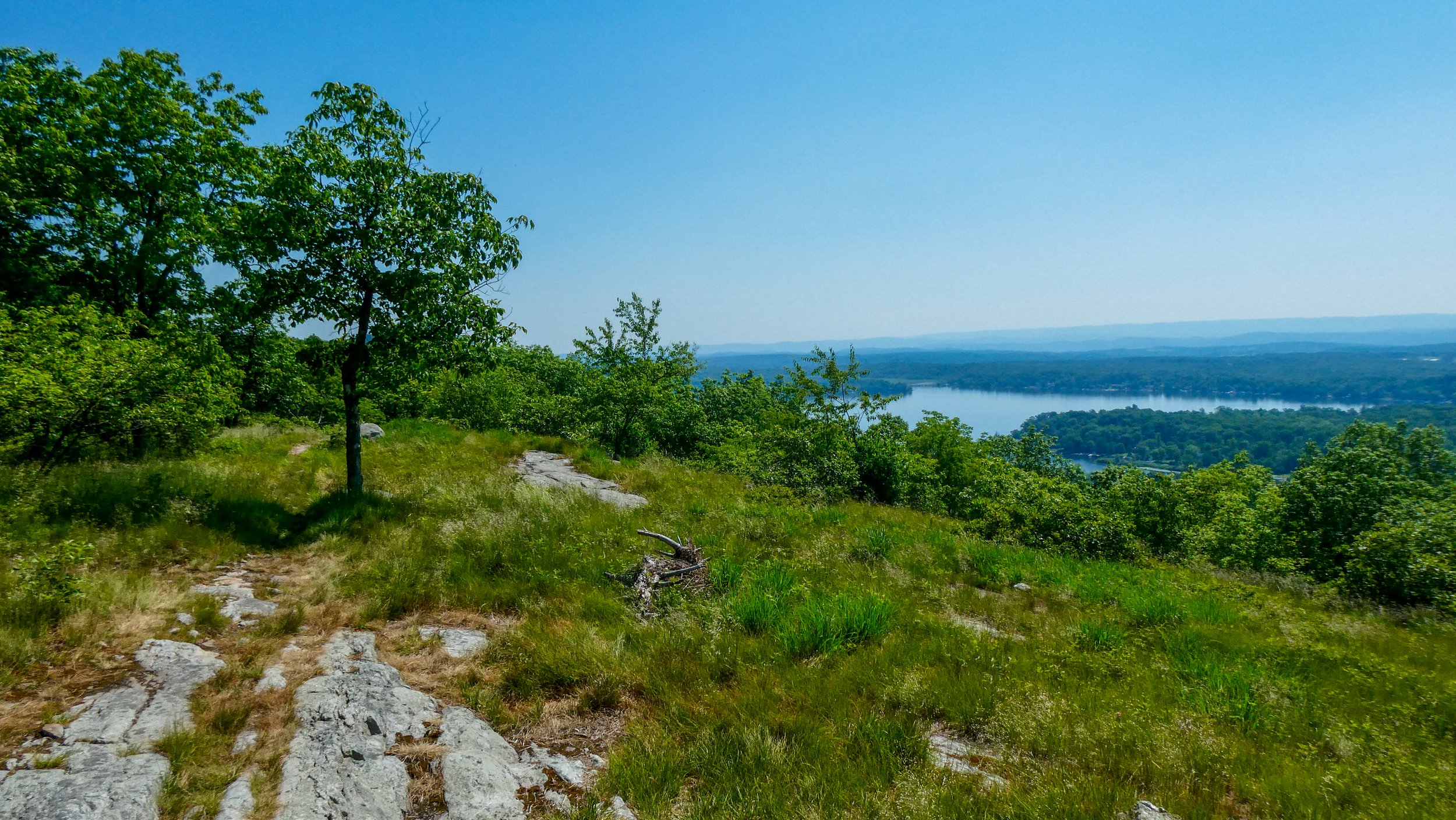
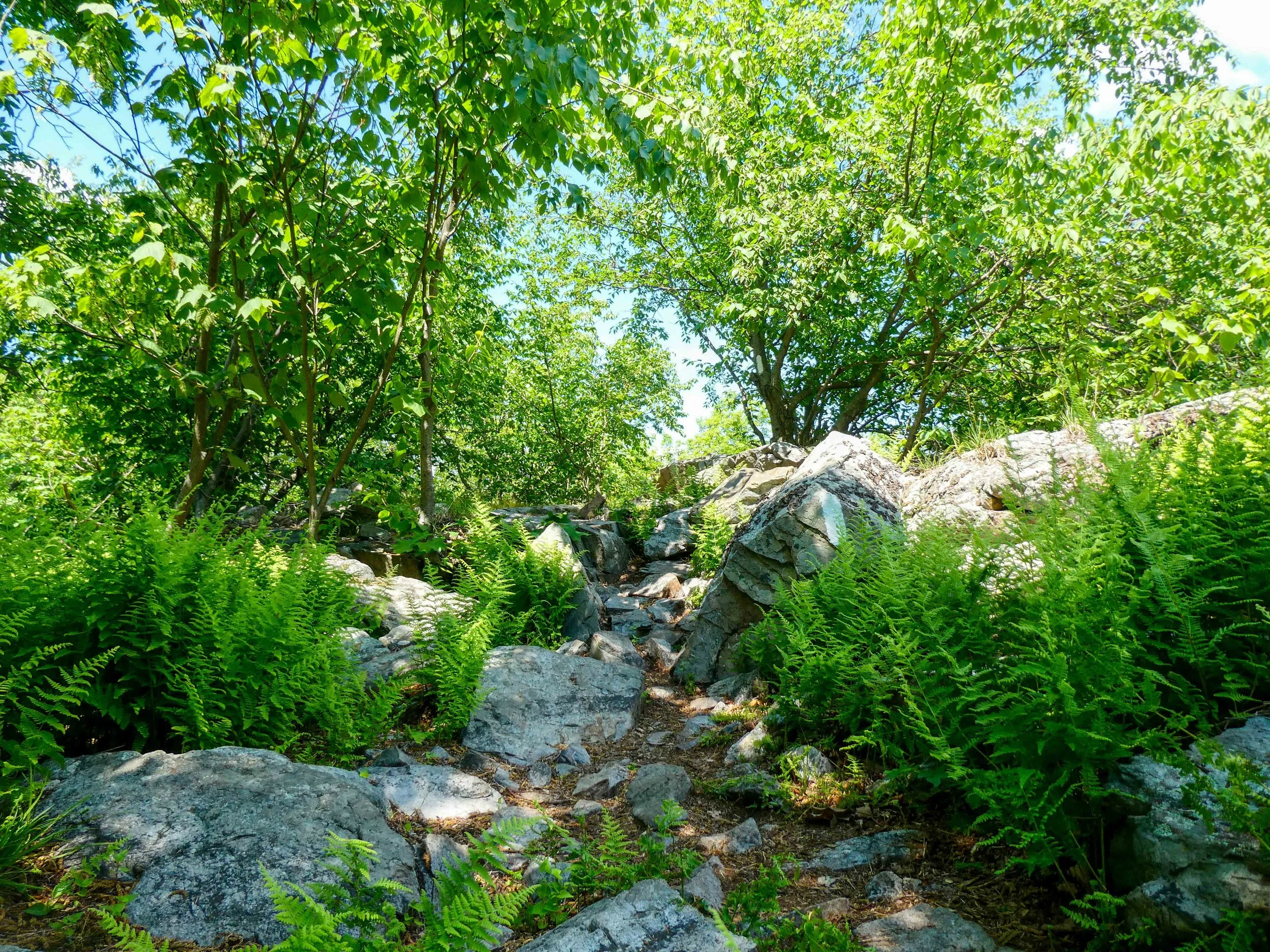
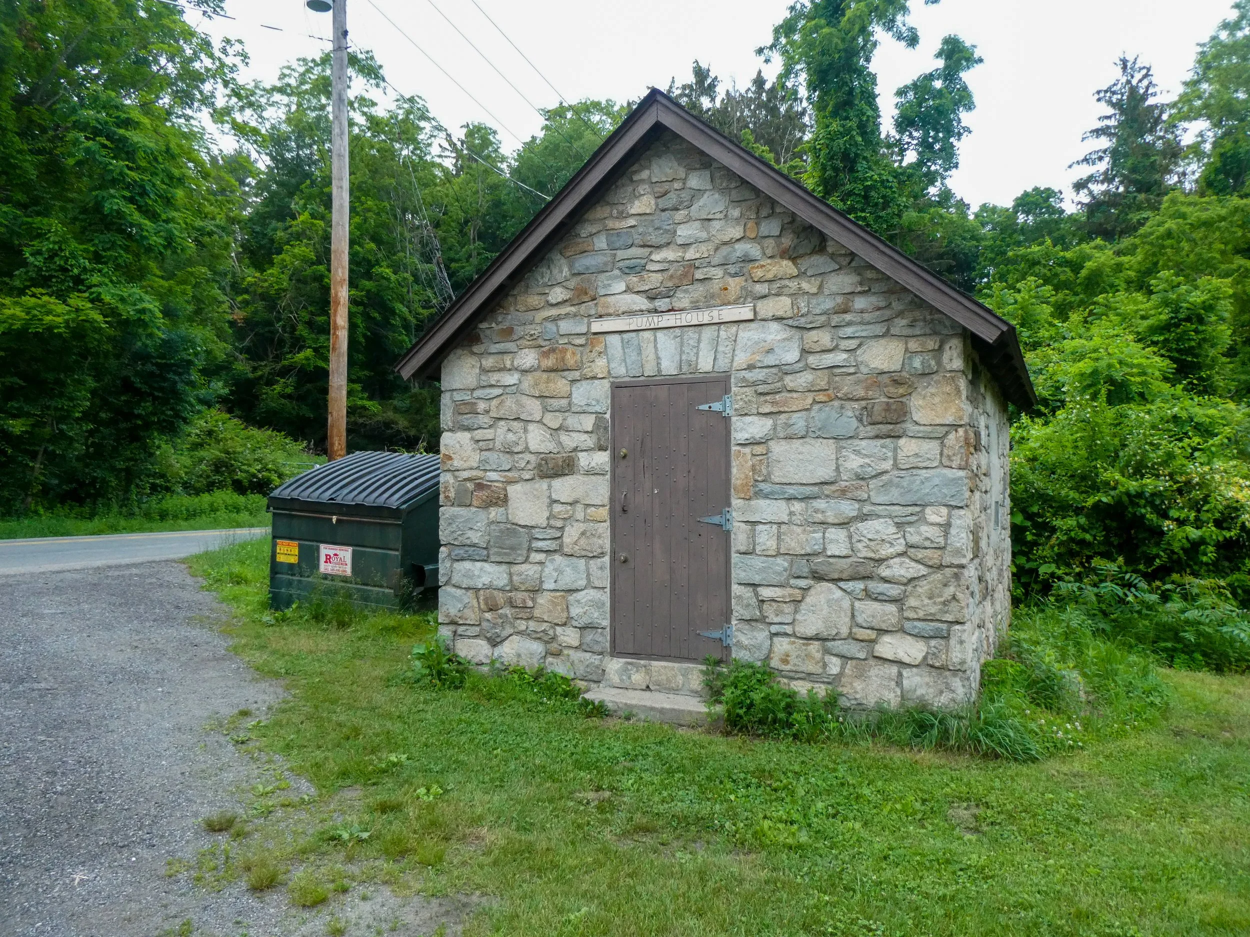
The next 8.7 miles offered relatively uneventful group hiking. Spirits were higher after our deli stop and we made good time to Dennytown Road, where there was a sizeable group tenting site maintained by Fahnestock State Park. At the road crossing, we found a pumphouse with a running spigot. The campsite was just up and off the road to the west. It was a flat, open field, with fire pits, grills, port-a-potties, and tons of mosquitos.

We set up camp, and I joined Katie, Delta, and Puddin’ around the picnic table for dinner. I was a bit startled when Delta and Puddin’ each busted out bags of homemade Indian flatbreads that they called theplas. Despite enjoying Indian food, I had never heard of theplas. They looked more like tortillas than fluffy naan. They also seemed to be well-seasoned with bits of pepper embedded in the bread. Delta and Puddin’ had ordered their sacks of thepla from Jasmine’s family friend. I must have not been in the room when these orders were placed, because I would have loved to get a sack of my own 😭

June 13, 2021 /Jack Boyette
Comment

Hikers Log - trail date: day 97

June 12, 2021 by Jack Boyette

Zero day at Jasmine's house! A day full of H Mart, watermelon, mango, music videos, and homemade ice cream. Caroline also joined us!

June 12, 2021 /Jack Boyette
Comment

Hikers Log - trail date: day 96

June 11, 2021 by Jack Boyette

(West Mountain Shelter (mile 1400.1) - South Mountain Pass Road (mile 1409.1))

At about midnight a whiporwil flew into the shelter and commenced to sing with the vigor of a fire alarm. The bird continued its auditory assault at regular one hour intervals, allowing me enough time to fall back into a deep sleep before rudely reawakening me.

We woke up around 6am and packed while appreciating the glow of the rising sun over the landscape. I began hiking a little after 7am leaving the shelter after Jasmine and a little before the rest of the crew. We weren’t in any particular sort of rush this morning. It was about 7 miles to the Trailside Zoo, which opens at 10:30AM, and then another 2.7 miles to the Anthony’s Nose Trailhead on South Mountain Pass Road, where we were planning to meet Jasmine’s parents at noon.

On the blue blaze back to the trail, I collected water from a gross stagnant frog pond. I still had a half bottle of fresh water, so the pond water was more of a “just in case” backup since the next and only marked water source for the next 8 miles was unreliable. After filling water, I realized that I had lost my 2 day old earbuds, which was annoying, but I would certainly have a chance to pick up some new earbuds in NYC.

After a little less than 5 miles, I reached Bear Mountain State Park. The trail up the mountain was partially paved, with ancient-looking stonework that seemed to be (unnecessarily?) supporting the rocky cliff to the left of trail. As I got closer to the peak, I could hear Katie, Puddin’, and Delta on the switchbacks below, so I opted to wait on a bench overlooking the Hudson from a rocky slab. We were doing well on time, so we moseyed along to the Bear Mountain summit, featuring trailside vending machines, fancy ladies walking tiny fancy dogs, a closed observation tower, and more views of NYC in the hazy distance.

We made our way down from the summit and into the Bear Mountain Recreation Area, which was nestled between in a field between Hessian Lake and the Hudson River. We were briefly entertained by the park’s “demonstration trail,” a tiny little loop which highlighted the different strategies and features of trail building and maintenance. I learned some new terminology, including “coping stones,” which are rocks placed at the edge of trails on the downhill side to help hikers avoid erosion and nasty falls.

We made our way to the Trailside Zoo a little after they opened at 10:30am. It was a bit surreal and undeniably cool to be following AT blazes though a zoo. After reading a few signs, I realized that the zoo was focused on native animals and specifically housed animals that had been rescued from injury or confiscated from illegal private captivity. Some of the highlights included the reptile house, a bobcat, a fox, and a black bear (who looked brown… the sign described it as a cinnamon color phase). Amusingly, the zoo bear was my first bear spotted on trail😅

We left the zoo and immediately found ourselves at the Bear Mountain Bridge, a massive suspension bridge over the Hudson River. The bridge offered excellent, if not a bit dizzying, views over the Hudson, with Bear Mountain behind us to the west and Anthony’s Nose in front of us to the East. Past the bridge, the trail followed along the road for about 0.3 miles, before re-entering the woods and climbing up the backside of Anthony’s Nose. We hiked for about 2 miles before reaching the Anthony’s Nose Trailhead on South Mountain Pass Road where Jasmine was waiting with her parents.

Jasmine’s parents, Acky and Samina, had apparently been super pumped to do trail magic, and had pulled out all the stops. They set a big beach towel on the ground and laid out a spread of fresh fruit (so much watermelon!), cookies, personal pringles cans, chips, and several Indian snack foods. As we were gorging ourselves, we were joined by a thru-hiking couple I had heard of but had not met yet: Pickles and Firedaddy. Pickles is a white girl with dreads, hexagonal glasses, and a gregarious personality. Firedaddy is her very tall husband. They were both charismatic, talkative, and funny.

After we had all eaten our fill, Pickles and Firedaddy hiked on and we packed things up for the hour and a half drive into Manhatten, where we stopped at Jasmine’s favorite pizza spot: Joe’s Pizza. We grabbed our to-go pizza and walked across the street to the tiny, triangular, Father Demo Square. We sat on a bench in the crowded square and dug into the pizza. The area seemed very familiar. As in I knew I had been there before on a previous New York trip. As I looked around, I realized we were across the street from Berber Street Food and Village Revival Records was just around the corner. I felt like a local recognizing all his favorite spots.

On our way out to Long Island, we drove along the southern perimeter of Manhattan. I spotted some new landmarks for the first time such as the Vessel and the Little Island. Once we got past Brooklyn, all the Long Island sites were new to me., and I watched as the city slowly transitioned into a sea of seemingly endless suburbs.

June 11, 2021 /Jack Boyette
Comment

Hikers Log - trail date: day 95

June 10, 2021 by Jack Boyette

(Fitzgerald Falls (mile 1378.6) - West Mountain Shelter (mile 1400.1)

I got hiking this morning at about 7:30am. Immediately, the trail scrambled up the rocks to the right of the waterfall. This set a precedent for most of the morning, which was filled with rocky, technical climbs. Like yesterday, these were climbs requiring me to abandon my trekking poles, in favor of a hand-over-hand approach up the mountainsides. Yesterday, the climbs really started to grind on me, but this morning, I was in a good mood. The terrain was really cool and really pretty. It was a great temperature too.

I stopped for breakfast on a rock and checked Guthook. While scoping the day’s landmarks, I learned that there was a terrific swimming hole coming up in about 10 miles. Guthook comments claimed that it is the best swimming hole on the AT so far, so I was excited to investigate.

After 5.5 miles, the trail routed me past Little Dam Lake. As I hiked along, I felt that without a doubt, this was the place on the AT that has most reminded me of canoe country. The slender lake, rocky shores, and lily pad-covered waters were strikingly similar to some remote lakes in the Crownlands and Quetico. I stopped to get some pictures and noticed a series of what appeared to be paths cut through the lily pads on the water’s surface. I followed one of these paths with my eyes and spotted a beaver dam near where I was standing along the shore. I walked towards it and a group of beavers (I think I counted five) plopped into the water. The beavers started swimming around and every so often, one of the bolder beavers would swim up close to the shore, in what I perceived as a transparent effort to check me out. I saw a lot of beavers in Ontario and Minnesota, but they would always slap their tales and dive under when the canoes got anywhere near. but these beavers almost seemed curious to investigate my presence. I think this was the closest I have ever been to a beaver, and I managed to get some pretty good pics. In short, Little Dam Lake was awesome.

About 2.5 miles past Little Dam Lake, I crossed NY Route 17 and met a trail angel named Fred, who had Gatorades, brownies, banana bread and apple sauce cake in his trunk. I had a brownie and red Gatorade and sat on a cooler to chat with Fred. Soon after, Delta showed up and Fred told us a lot about the history of the region and also demonstrated his fluency in Winston Churchill quotes, which seems to be a theme for old guy trail angels. Maybe it’s just part of the aging process for men?

Delta and I hiked on, immediately crossed above Interstate 87, and continued the next ~1.6 miles to Island Pond, the much anticipated swimming hole. A small dirt road broke crossed the trail and led to the pond, ending in a boat ramp. Along the shore where lots of good rocks for lounging, so Delta and I took the opportunity to hang out, rinse off, and eat lunch.

The north end of Island Pond looking south. This would be a hell of a campsite

After Delta and I finished our lunch, we started making our way back to the trail and could hear Katie, Jasmine, and Puddin’s voices carrying through the trees. Sure enough, we joined up with them right as we made it back to the trail. We continued on for less than a half mile before making it to the “Lemon Squeezer,” which is a sort of crevasse between massive boulders that’s just a little too narrow to fit through easily with a pack. We squeezed through as a group with many a silly word of reamer-related, juice-themed encouragement.

THE LEMON SQUEEZER

Just past the Lemon Squeezer was a short cliff requiring a moment of free climbing. Nothing too dangerous, but definitely challenging with a full pack. There was a detour around the cliff marked “EASY WAY ↑”, which in classic thru hiker fashion, had been tagged “Bill Bryson would have gone this way…” We did not go the easy way.

We did not go the easy way…

…definitely not the easy way

After our cliff climb, I had to stop to dig a cat hole, so the Dinos hiked on without me and I ended up hiking solo for the rest of the day. This was fine with me, as I was halfway through the audiobook for “How to Change Your Mind” by Michael Pollan. The subtitle offers a fitting synopsis: “What the New Science of Psychedelics Teaches Us About Consciousness, Dying, Addiction, Depression, and Transcendence.” The book is superb, taking what I feel is a balanced approach to reassessing our societal biases towards psychedelics in the midst of a renaissance in scientific research. These new studies, led by researchers at Johns Hopkins and NYU, are producing a flood of evidence suggesting that classical psychedelic drugs can be used responsibly for medicine and recreation. Today, the chapter that stood out most described the use of psilocybin, the psychoactive compound in magic mushrooms, in anxiety treatment for people in end-of-life-care for advanced chronic disease. Essentially, mystical experiences facilitated by psilocybin helped patients come to terms with their mortality. The anecdotes were beautiful, and I’ll admit I cried as Michael Pollan described an older woman with terminal cancer who found peace with her diagnosis after a trip. My heart strings really got tugged as her husband recounted her amazing calm and cheer in her final days of life. I must have looked a bit odd, walking down a beautiful section of trail, on a sunny day, headphones in, crying with a big smile on my face. But no one was around to notice.

I passed William Brien Memorial Shelter, which was right on the trail, set in a clearing at the bottom of a rocky hill. The shelter itself had a unique stone lean-to construction with wide stone columns that seemed to emerge from the hillside. I thought it would be a cool place to stop if I had not agreed to meet the Dinos at West Mountain Shelter, which offers a view of the NYC skyline, right from the shelter.

The afternoon offered beautiful ridge hiking with regular views of the Hudson River to the east. In the late afternoon, I ran into Painless and Detox who were hanging out at a tentsite next to the ridge. They both commented something to the effect of “we thought you were way ahead of us,” which I am never sure how to respond to. I barely recognized Painless because he shaved and cut his hair, but it was nice to catch up with two characters I had not seen in a while.

About 2 miles before the shelter, the trail crossed Palisades Interstate Parkway. The parkway features two two-lane highways separated by a wooded median. Hikers have to cross on foot, without any sort of pedestrian bridge or walkway. I have had to cross bigger roads on the AT, but it felt like the traffic was moving exceptionally fast on this one. I waited a bit, got a feel for the speed of traffic, and was able to cross without too much stress.

After the parkway, the trail climbed back up on the ridge, and I almost tripped over a large timber rattlesnake trying to catch the last rays of the setting sun. The snake did not seem too bothered by me and slowly slid off the trail. It only rattled when I got closer for a picture. Just beyond the snake was a 1400 mile marker that someone had arranged with small rocks. I briefly celebrated, snapped some photos, then walked on to discover a second marker constructed from sticks. Finally, at the side trail junction for West Mountain Shelter, I found one last marker painted on the 4x4 post marking the blue blaze.

As I took the 0.5 mile blue blaze to West Mountain Shelter, I felt a satisfying mix of happiness and exhaustion. Today was wonderful. The hiking offered more or less the same terrain as yesterday, but it wasn’t as hot, and this time I was expecting all the rock scrambles. Less heat and proper expectations made everything easier. There was also a lot to look forward to. Tomorrow, we will see the Trailside Zoo and meet up with Jasmine’s parents for a zero day on Long Island!

I made it to the shelter, which was perched on a rock overlooking the Hudson River. I joined the other Dinos and set my stuff up in the shelter. At first I could not spot the NYC skyline, but Katie and Jasmine pointed out a tiny, fuzzy blur on the horizon far to the southeast. I zoomed in with my camera and was actually able make out some of the more iconic buildings. After dinner, I tried to dig a cathole and had a hell of a time trying to find a spot. It seemed like the ground was either rock or somebody’s tentsite. On my way back to the shelter, I found a quiet rock to sit on and record a message for AC before returning to the shelter.

The NYC skyline, seen from the AT

June 10, 2021 /Jack Boyette
Comment

Hikers Log - trail date: day 94

June 09, 2021 by Jack Boyette

(NJ Route 94 (mile 1359.6) - Fitzgerald Falls (mile 1378.6))

Delta, Puddin, Katie, Jasmine, and I hitched a ride back to trail in the morning. Five people is an awkward number to try and hitch a ride with, but sure enough, a guy named John picked us up in a standard size sedan. The others piled in the back and I hopped in the passenger seat. John dropped us off at what my USGS map overlay ominously referred to as the “Stairway to Heaven.” Sure enough, it was a hell of a climb right out the gate, and we were all drenched in sweat by the time we reached the top.

Beyond the Stairway to Heaven, it was a little less than 7 miles to the New Jersey / New York border. These miles were filled with beaver ponds, streams, and dense forest canopy. Once we crossed into New York (after a brief celebration), it was like a switch got flipped. Suddenly, the trail was a hot, exposed rocky ridge. This was not a flat Pennsylvania ridge either, forcing us to regularly scramble up rocks on all fours. This became the theme for the day: heat, rocks, and constant up and down on exposed ridges.

New Jersey had spoiled us with its profusion of board walks, offering flat, easy hiking. In northern VA, WV, MD, PA, NJ, we could pretty reliably count on a solid pace of 2.5 miles/hr, but today was barely 1.5 miles/hr (like back in GA, TN, NC). I think I was also hot and dehydrated all day, so that did not help. Not to mention it seemed like all the water was brown.

Despite all my complaining, today was a fun day of communal hiking. It was my first time hiking with the Dinos since before Pennsylvania. In normal fashion, Katie and Jasmine were pumped about an upcoming side quest: The Belvalle Farms Creamery, located off a short blue blaze past mile 1,373. Their enthusiasm was infectious, although to be fair, I don’t need any convincing to visit an ice cream spot. On the side trail, I spotted a young milk snake with a striking white coloration with red saddles outlined in black. The tiny colubrid was determined to demonstrate its snappy ferociousness. I thought it was cute.

We made it to the creamery and discovered a sizeable crowd, as one would expect for a hot summer afternoon. I took the opportunity to plug in a couple electronics and fill my water at the spigot before ordering a banana split with Belvalle Bog ice cream (a chocolate base with brownie bits and fudge), maple pecans, caramel, and Oreo bits.

As we were eating, everyone’s phone started buzzing with a severe thunderstorm warning and we could see ominous clouds forming to the north.

We were still planning to hike almost 5 miles to Fitzgerald Falls for camp. As much as I enjoyed the communal hiking earlier, at this point in the day, I was in a sort of headspace where I just needed to hike solo for a bit. I ended up heading out a little before the rest of the crew and listened to Kendrick Lamar’s To Pimp A Butterfly while busting out the miles. The trail was mostly forested, but would occasionally pop up on rocks above the tree line, offering me a view of the rain storm in the near distance. These moments were ominously beautiful. The clouds were dark, the wind was powerful, and the rain was falling heavily just a short distance away as Kendrick Lamar’s jazzy epic boomed in my ears.

Despite its threatening proximity, the storm avoided me, and I did not experience any rain until I reached Fitzgerald Falls. I set up my tent on a bed of pine needles in the midst of a gentle sprinkling near the creek at the base of the falls. The Dinos must have stopped at the shelter two miles earlier because they never made it to the waterfall. No one else was around either. I stood in the stand of pine as the rain eased. Pine needles thickly carpeted the ground, the air smelled like rain, and the mossy rocks flushed with the saturated glow of rain.

June 09, 2021 /Jack Boyette
Comment

Hikers Log - trail date: day 93

June 08, 2021 by Jack Boyette

(High Point Observation Tower (mile 1,340.1) - NJ Route 94 (mile 1359.6) *overnight at Warwick Drive-In*)

I slept well on the observation platform. Although the platform views were nice, I opted to eat breakfast a half mile away at the NJ High Point Monument, which as you might expect, offered even nicer views of the surrounding hills. As had been my M.O. for a while, I had no real idea where I wanted to end up tonight.

The morning hiking was all gradual downhill from the high point, with the trail routing me through a couple pastures and past a couple small ponds. The coolest landmark of the morning was the “Secret Shelter,” which is an unofficial shelter about 0.2 miles north of the AT. The shelter is situated on private land owned by a former thru-hiker and features a medium sized, barn-like shelter, two spigots, a pit privy, another small locked building, and a mini barn shelter about the size of a play house, which I believe is home to the Secret Shelter’s only native resident: Jake the donkey.

When I arrived, Jake didn’t seem too keen on letting me getting close, so I investigated the spigots and found that one was not working and the other offered only a slow trickle. I filled my water bottles and noticed that there was a bucket of nasty water below the spigot, presumably for Jake. I dumped the bucket and left the spigot running to fill it while I checked out the shelter. Inside, I found a power strip and a box fan, but I did not stay inside long as the shelter was beginning to feel like a sauna in the late morning sun. When I returned to the spigot, I noticed an old wire hair brush on the ground. When I picked it up Jake seemed to perk up. I guess his desire to be brushed outweighed his distrust of strangers because he let me brush him. I was happy to make a new friend.

After eating lunch at the Secret Shelter, I bid farewell to Jake the donkey and continued northward. The trail was easy going, but the afternoon had really heated up. After 1.5 miles, I stopped at the Lott Road bridge over a damned stream. Guthook did not have the spot marked as a water source, but I stopped to refill my bottles and take a bird bath to cool off. Hopefully there is not some really good reason the stream is not marked as a water source. Like a nuclear waste dumping facility just upstream. The water tasted fine, but I might be glowing tonight 😬

After another 1.5 miles, I began a short road walk, crossed over the Wallkill River, and routed into the Wallkill River National Wildlife Refuge. The Refuge was made up of a network of ponds and marshes in a large field, offering a habitat for migratory birds. The trail skirted around the edge of this field for about two miles. As I completed the partially rectangular circuit around the refuge, the skies began to darken. Light rain started as the trail routed away from the big field and over a board walk through a semi-forested marsh. I crossed another small road and stopped at an abandoned house for water. Guthook explained that the house is on property owned by the National Park Service and is managed by the NJ State Parks system. The park rangers leave water running to a spigot on the outside of the house so hikers can fill water, which is useful in this section of trail with no alternative (marked) water sources.

Despite the sign’s promise, I didn’t see any turtles

After filling water at the abandoned house, I began the first short climb of the day towards Pochuck Mountain Shelter, where I sheltered briefly from the rain. I checked my phone for any messages and discovered a cryptic text from Katie: “WARWICK DRIVE IN TONIGHT!!!” This seemed vaguely familiar, so I checked Guthook, and sure enough there is a drive in movie theater outside Warwick NY that lets thru hikers tent camp for free. I think Katie had mentioned the Warwick Drive In a few days back, but I didn’t realize it was coming up so soon. The road into Warwick was only 6.6 miles away.

When the rain eased up a bit, I continued on. After a little over 4 miles, I crossed County Road 517 and reached the Pochuck Boardwalk, a roughly mile-long raised path through a wetland that is one of the few wheelchair accessible AT sections. As I made my way along the boardwalk, the rain slowed and eventually stopped, but everything (myself included) was already soaked. This left the wetland particularly vibrant, with grasses that seemed to glow as they soaked in the excess moisture.

About 2 miles after the Pochuck Boardwalk ended, I crossed a railroad track and found myself in a field full of cows. One of them even seemed mildly curious. The cow field ended at NJ Route 94, which was the road into Warwick. I was able to quickly hitch a ride into town, where I got dropped off at the ShopRite just in front of the drive in. I did a partial resupply, grabbed some snacks for the movie tonight, then made my way to the drive in.

Adam Heart Mother

When I got to the drive in, I discovered that Delta, Puddin, Katie, and Jasmine were already there, along with a few other thru hikers I vaguely knew like the cousins Camel and Kibbles. The drive in staff had us set up our tents on a grassy hill at the back of the lot. From there, we had our pick of three screens, each of were showing a double feature. Screen one was A Quiet Place: Part II plus Spiral: From the Book of Saw, screen two was Cruella plus Tom & Jerry, and screen 3 was Spirit Untamed and Scoob!. Viewing the screens from our hill would be free, but if we wanted sound, we would need to pay $5 to rent a handheld radio, which we then had to tune to the proper channel corresponding with the screen we were watching. I had seen the first Quiet Place and thought it was pretty good, so I opted for screen one.

This was my first time at a drive in movie theater, so I was pretty excited, but my excitement soon turned to disappointment as I struggled to hear anything from the crappy radio. As you might expect, A Quiet Place: Part II has a lot of very quiet scenes and whispered dialog. So I would crank the volume to try and hear, then a monster would appear and the movie would suddenly get very loud and the speaker would distort terribly. The experience made me really appreciate the importance of good sound in a film viewing experience. Having a big image is obviously important, but I think good sound is underappreciated. I gave up watching the movie in my frustration, which was fine, because no one seemed all that invested in the movies. Katie and Jasmine even surprised me with a birthday cake!

Jake was a pony

although he was very shy

we became good friends

June 08, 2021 /Jack Boyette
Comment

Hikers Log - trail date: day 92

June 07, 2021 by Jack Boyette

(Crater Lake (mile 1,316) - High Point Observation Tower (mile 1,340.1))

Today is my birthday! I woke up as the others were leaving. They left early in hopes of catching up with Jasmine at the next shelter. When I left camp, I was unsure where I wanted to end up. Part of me wanted to hike 23 miles for my 23rd birthday, which was doable. But I also knew there were a lot of cool sites coming up, and I wanted to take my time. I might just stop a lot. I left camp a little after 7am planning to hike a couple miles to an overlook for breakfast.

After almost 3 miles, I stopped on Rattlesnake Mountain for breakfast. As I sat down for my granola jar, I received a long, lovely message from AC wishing me a happy birthday. I had service, so I gave her a call and we were able to talk for 20 minutes before she had to go to a meeting. As I packed my stuff away, I noticed that the rock I had been sitting on was crawling with ticks. An evening tick check was certainly in order.

After about 6 miles of beautiful ridge hiking, I started the climb down into Culvers Gap - home of Branchville, New Jersey. On the way down I encountered a baby bird sitting in the middle of the trail. The thing was little more than a ball of fluffy feathers, adorable in a pathetically helpless kind of way. I moved it off the trail, conscious that it would almost certainly become a meal for some lucky snake or raptor, but at least it wouldn’t get stepped on by some unaware hiker.

In Culvers Gap, I stopped at the Sandwich Lobby to eat lunch. The tiny shop is just off the trail and run by a friendly (Caribbean?) family who let hikers fill water, use the restroom, and charge electronics. I already had lunch, so I was not planning to buy anything, but the owner was still kind and welcoming. At the shop, I met a thru hiker couple named “The Hun,” a woman from Hungary, and “Wanderer,” an older man from the States. As we made small talk, The Hun offered me half of her sandwich because she could not finish the whole thing. They also told me they started their thru hike from Georgia last year in June. I did not mention this to them, but I am fairly confident that I briefly met them on an overnight trip I did last year north of Hiawasee. I passed them at Bly Gap and they told me they were thru hiking. I remember thinking they were getting a very late start. A short time later, as I was hiking down from White House Rock, I ran into them going the opposite direction as they were doing the incredibly steep climb up from Bly Gap. I made a comment along the lines of “I heard Katahdhin calling your name up near the top!” If I run into them again, I’ll try to verify this. I am pretty confident it was them, but really, what are the odds??

As I was leaving the Sandwich Lobby, I thanked the owners for their hospitality and they kindly offered me a drink from their fridge. I grabbed a Snapple tea/lemonade, which I had never had before, but it was really good. Free sandwich and free drink. Good vibes all around at the Sandwich Lobby. As I crossed the road and made my way back to trail I encountered a port-a-potty in the parking lot in Culvers Gap and immediately felt the urge to poop. After taking care of business, I made my way back to trail and almost stepped on the tail of a baby garter snake, which quickly slithered away through the leaves.

After an easy two mile climb, I made it to Culver Fire Tower. I didn’t stay long, and after another 3.5 miles, I made it to the summit of Sunrise Mountain, which featured a large, rugged stone pavilion built by the Civilian Conservation Core. Inside the pavilion I discovered a birthday present from the other Dinos, featuring a Little Debbie birthday cake, a wint-o-green Lifesaver, a bottle of wild flowers, an AWOL guide page with “FROG MAN happy birthday!!” written on it, and a bunch of small rocks carefully arranged to spell out “HBD FROGMAN!” The little display made me smile. I decided to take an afternoon break, kicking my shoes off, elevating my feet, and enjoying my birthday cake and Lifesaver while calling family to update them on my birthday whereabouts.

After making a few phone calls, I decided to make my own monument to the 1,300 mile mark, which I had technically passed yesterday. I rearranged the rocks from my HBD message to spell out 1,300, improvising the completion of one of the zeros with a stick. Thus, I celebrated a major milestone about 30 miles late, but better late than never!

9 miles later, it was almost 7pm as I approached the High Point State Park headquarters. I was getting tired, so my plan was to seek out a stealth spot somewhere near the headquarters to set up camp. Technically, I think this is a section of trail where hikers are supposed to camp only at shelters, but the state park headquarters was on a little state highway, and anywhere there is a road there is usually unofficial campsites. It had been a good day, but I was tired and did not want to push myself to the point of misery on my birthday. My plan was to use the restrooms and fill up water at the headquarters, then camp nearby.

When I reached the state park headquarters, I was disappointed to find the restrooms locked. Fortunately, the spigot was flowing. Then, I noticed a fenced off construction area on one side of the headquarters. I could see a port-a-potty peeking over the fence, so I gave the gate a push, and sure enough, it swung right open. After my pit stop, I felt like trying to make it to the shelter 1.5 miles away. It was 7:30pm, so I would probably make it to the shelter before dark, but I would need to skip the side trail to the NJ high point.

I ended up making it 1 mile, opting to stop at the high point observation platform, a raised wooden viewing deck offering a panorama of the high point monument and the surrounding New Jersey Mountains. I set my sleeping gear up on the platform, cowboy style. In the back of my mind, I worried that I might get cold sleeping on a raised platform, but the weather was fair, and my sleeping pad should provide sufficient insulation. The view was lovely (certainly much better than the shelter), and I felt content to sit and watch the sunset rather than push ahead another half mile. Plus, I’ll be able to visit the high point monument first thing tomorrow morning. I couldn’t help thinking that this was a good way to end my birthday as the sunset turned the clouds a vibrant ruby red.

After many hot miles

an afternoon siesta

on Sunrise Mountain

June 07, 2021 /Jack Boyette
Comment

Hikers Log - trail date: day 91

June 06, 2021 by Jack Boyette

(Delaware Water Gap (mile 1296.1) - Crater Lake (mile 1316))

AC and I left our Airbnb in Kutztown, Pennsylvania around 9am. After making a quick resupply, we stopped at a Waffle House on the way back to Delaware Water Gap. I have been craving Waffle House for the last 3 months and was surprised to find one above the Mason Dixon Line! I happily ordered an All Star Special and felt nostalgic for all the times my dad and I used to get Waffle House before scout trips.

We made it back to Delaware Water Gap at 11am and stopped by the apple pie bakery to get AC a cup of coffee. After that we found a gazebo in front of Church of the Mountain where we ate watermelon and I organized my resupply. I was about to hike into New Jersey, so we both knew this was probably the last time AC would be able to meet me on trail. I was simply getting too far from Chapel Hill. After I was packed it took a while to muster the strength for a “see you later.” Our zero day in Kutztown had been lovely. We had an early birthday celebration, making a cookie ice cream sandwich cake and visiting a record store where I picked up a copy of Future Islands’ “As Long As You Are,” which has been an absolute trail anthem for me. For my birthday, AC got me a very fancy Excalibur food dehydrator, which I’m super excited to use. Eventually, we shared a final embrace and wishes of happy trails. I was off and hiking at just about noon.

I made my way down the main street, past all the cute houses, past the Deer Head Inn, and past the fire station onto the giant Interstate 80 bridge over the Delaware River. Halfway over the bridge, I reached the New Jersey border. Goodbye, Pennsylvania!!!🥳🥳🥳 There shouldn’t be anymore rocks from here on out🚫🪨🚫

Beyond the bridge, the trail left Interstate 80 and joined a small road which followed the river and passed by the Kittany Point Visitors Center for the Delaware Water Gap National Recreation Area. The visitors center was closed, but a whiteboard outside featured a daily weather forecast which, in rather dramatic fashion, warned the heat index would max out at 112°F. Apparently the actual temperature was 92°F, with 71% humidity. I was amused. It felt hot, but the heat index estimate seemed absurd. I think I’d be dead if it felt like 112°F.

The trail continued alongside the river, and I passed the first ATC ridge runner I have seen since Shenandoah just before Big Meadows Lodge. She told me the first shelter after Delaware Water Gap was 25 miles out, but there are plenty of campsites. She just warned me to hang a bear bag because the bears in New Jersey are “crazy.” I have heard this sentiment repeated by a lot of folks. Fingers crossed I’ll see a bear. before passing under Interstate 80 and reaching a small trailhead parking lot. The area was clearly popular with day hikers, and I quickly discovered why. The trail was beautiful, following alongside the large, cascading Dunnfield Creek.

After a half mile, the AT split off from the Dunnfield Creek Trail and started slowly climbing the ridge. The trail was wide and the grade was easy-going, but the heat had me sweating. A lot. After about 3.5 miles, I reached Sunfish Pond, a small 41-acre glacial pond which a plaque declared as a registered National Natural Landmark. Another hand-painted sign explained that the pond is one of the seven natural wonders of New Jersey. Apparently the pond is naturally very acidic, and only a few hardy species can survive like pumpkinseed sunfish and yellow perch.

The pond was beautiful. As I approached, I could hear many frogs singing along the shore. I spotted many frogs as I walked along the shore. Each time I stopped to admire the few, I found a bullfrog crouched among the shore brush. Apparently, bullfrogs are one of the hardy species who don’t mind the pond’s acidic water. I am not surprised. Bullfrogs are tanks.

Near the far end of the pond, I ran into JPEG and "Aquadog" who were drying off after a swim in the pond. We chatted for a bit, collaboratively praised the day, and I hiked on. I was in a great mood and wanted to drink in as much of the day as I could.

The trail left the pond and climbed up onto Raccoon Ridge of Kittatinny Mountain, offering many views of the Delaware River and Pocono Mountains to the north and the Yards Creek reservoirs to the south. After another 2.7 miles, I stopped at a small footbridge over Yards Creek, taking the opportunity to "camel up" on water and eat a snack. I continued to climb up to Kittatinny Ridge, enjoying many spectacular views, and a vulture who decided to show off for my camera. A little over 2 miles after Yards Creek, I reached the Catfish Fire Tour. The lookout box was closed to the public, but I was able to climb up the stairs and appreciate a lovely panorama.

After another 1.4 miles, I reached a pond formed by a large beaver dam. To my surprise and amusement, the trail routed hikers over the dam itself. The footing was a bit precarious, but I enjoyed the novelty and thrill of possibly slipping and ending up in dirty giardia water. If it weren’t for all the full-bloom mountain laurel dominating the underbrush, I might have thought I was back in Ontario.

The next 5.5 miles offered pleasant ridge hiking at steady elevation, and I was treated to frequent views of the surrounding lakes and ponds. Late in the afternoon, as the shadows were growing long, a large porcupine waddled across the trail in front of me. It stopped at the base of a sizeable oak tree and bristled its quills to appear larger than it really was. After a moment’s pause, I was surprised to watch the porcupine slowly crawl straight up the tree trunk, where it perched itself about 10 feet up. I watched for a bit and then moved along, content with my first porcupine encounter.

It was 7:30pm, peak golden hour, and I was less than a mile from a campsite at Crater Lake. I would be getting in a bit late, but I felt satisfied to have made it nearly 20 miles through hot weather after a noon start. Plus, I don’t have to make dinner tonight thanks to the leftover Brussels sprout pizza I hauled out from Kutztown. I was pumped to eat pizza at a lakefront campsite furnished with privies. I thought it might even feel like Ontario.

As I approached the short blue blaze down to Crater Lake, I saw a Zpacks Duplex tent with an Arc Haul pack peaking out from the rain fly. As I approached the tent, my suspicions were confirmed when I spotted a dinosaur hand sanitizer holster attached to the pack strap. “What’s up Delta? Long time no see.” Delta poked his head out the tent and exclaimed “Frogman! Puddin and Katie are just down the trail at the campsite.” Sure enough, I found Puddin and Katie at a sad little tentsite where the Crater Lake blue blaze split with the AT. The last time I saw my trail family was the day before I hiked into Pennsylvania. Now here they were, the day I hiked out of Pennsylvannia. They had already set up their stuff, so I found a relatively flat spot and set up my tent. I broke a tent stake and then we all caught up as I ate my leftover pizza. No one was sure where Jasmine was, but Katie seemed to think she had likely made it to the next shelter, which had been their original plan as a group, but Delta had a migraine so these three stopped early.

When I asked about Caroline, I was shocked to learn that she had to get off trail permanently. Her knee pains in Shenandoah got so bad that she left trail to get an x-ray. The doctors did not see anything so she assumed it was tendonitis and got back on trail after a short rest. She ended up hiking another 60 miles until the pain became unbearable. She got off trail again and got another x-ray and an MRI. Her femur was broken. Apparent she had a small stress fracture in her femur that the doctor missed the first time. After another 60 miles, it developed into a full-blown fracture. She literally hiked until her femur broke. Plus there is something wrong with her meniscus. Clover will not be able to continue her hike this year.

As the evening light faded, I made my way down to lake to use the privy and fill up water. No one was around. I waded out into the placid lake as the last wisps of sunlight vanished into the night. I breathed deeply, feeling happy as minnows nibbled on my feet. Beautiful. Peaceful. Calm.

Symphony of frogs

from the banks of Sunfish Pond

music to my ears

June 06, 2021 /Jack Boyette
Comment

Hikers Log - trail date: day 90

June 05, 2021 by Jack Boyette

Zero day with AC in Kutztown!!!

June 05, 2021 /Jack Boyette
Comment

Hikers Log - trail date: day 89

June 04, 2021 by Jack Boyette

(Kirkridge Shelter (mile 1289.7) - Delaware Water Gap (mile 1296.1))

I woke up to deeply overcast skies. Although the rain appeared to be holding out, the clouds hung low and heavy. Chooch left the shelter early, but I took a little extra time, knowing I only had 6 miles to hike before noon. The hiking was pleasant, with lots of downhill towards Delaware Water Gap. I passed a couple overlooks, but the clouds obstructed any views, imparting the illusion that I was at a much higher elevation, perched among the clouds. As I descended from the ridge towards town, the trail offered several views of the Delaware River and Interstate 80 on the opposite shore (which was also New Jersey).

As I neared town, the trail leveled out a bit and routed me past the east shore of Lake Lenape, which was really more of a pond. I could hear many frogs calling from the shore, and several leapt in as I walked alongside the water.

Just beyond the pond, the trail joined a road into town. On the edge of town, the trail turned right, but I turned left to make my way further into the small community of Delaware Water Gap. I passed the Deer Head Inn, which is the longest continually operating jazz club in the country. Just beyond the Inn was Church of the Mountain, a Presbyterian church which operates a donations-based hostel in its basement. It was a little past 10am, so my plan was to take a quick shower and then head down the road to a Fairmount Inn near the interstate with coin laundry.

After my shower, I made my way along the town’s main street, past the single intersection, and towards the Fairmont Inn. Along the way, I passed a ton of quaint but character-rich old houses, a pie shop (which had rave reviews on Guthook), and (shockingly) a sake brewery. Although I did not have time to explore, I was utterly charmed by the town, and knew I would need to return some day. I then ran into Dallas as I approached the Fairmont Inn. She was staying at the Deer Head Inn and told me Lighthouse had her room the night before she arrived and left her a bunch of beers in the fridge. I was excited to learn Lighthouse was still in my bubble of hikers.

The laundry room was a creepy, windowless box situated towards the rear of the hotel at the end of a maze of hallways. I put my laundry in the washer and then made my way to the lobby to do my virtual Zoom tour with the Landmark Apartments in Tuscaloosa. The tour was just about everything I expected. The apartment was small, the floors were gray, and I was altogether underwhelmed. The agent was nice enough, and I asked a couple questions almost as a formality, but overall I kept things brief. I already knew I wanted to live in the old house in downtown Tuscaloosa.

After my tour, I dried my clothes and headed back to Church of the Mountain, where I had a phone call with Stephen Dempsey of Dempsey Realty. I got great vibes from Stephen, although I was disappointed to learn that the $850/month apartment I was most interested in had already been leased. That left unit #2 and unit #8. Although unit #2 was only $800/month, it was a bit too small. On the other hand, unit #8 was one of two carriage house units over the garage, offering more space and privacy. Unfortunately, at $900/month, unit #8 seemed out of my price range. I asked Steven if he could offer a reduced rate for a grad student, and excitingly he said yes, offering me $850/month for unit #8. I thanked him for his time and submitted a rental application as soon as I got off the phone.

Anna Claire picked me up shortly afterwards and we made our way to an Airbnb in Kutztown, PA.

June 04, 2021 /Jack Boyette
Comment
  • Newer
  • Older

© 2023 John Boyette