Amphibian Ecology & Evoloution

with John Boyette

  • About
  • Research
  • Outreach
  • Hikers Log
  • Photography
  • Illustration
  • Contact

Hikers Log - trail date: day 88

June 03, 2021 by Jack Boyette

(Leroy Smith Shelter (mile 1276.1) - Kirkridge Shelter (mile 1289.7))

I took my time in camp this morning, not leaving until 10:45am. I was not feeling rushed because I did not have far to go. I spent the night 20 miles outside Delaware Water Gap, where I will be meeting AC tomorrow afternoon. So, between today and tomorrow, I only need to go 20 miles. There is a shelter today at about 13.5 miles, but my plan was to go a little further than that. I thought maybe 16 miles or so would be good so I only have ~4 miles into town tomorrow.

Another consideration is that I have a virtual tour with an apartment complex tomorrow at noon, so I need to make sure I have plenty of time to get into town. The tour is with Landmark Apartments, which are the newer apartments I am interested in. The rent is $820/month, but the space is really tiny and it’s not very close to campus. I figure I will do the virtual tour, but I do not have high hopes for Landmark Apartments.

This morning I found the website for the company managing the big historic house, Dempsey Rentals, and sent an email before I left camp. According to the company’s website, it seems like all of the apartments will be available starting August 1st. Because the house was converted into apartments, each one is unique, and rent ranges from $800-900/month. The one I am most interested in is Apartment #5. They all look cool though, and I am especially interested in the $800-850/month apartments (not sure I can swing the $900/month). I am really excited about these apartments. They seem to have everything I want and I really hope that they are still available. On the listing, it says “perfect for faculty or grad students,” so it even seems like I might be the target rental demographic.

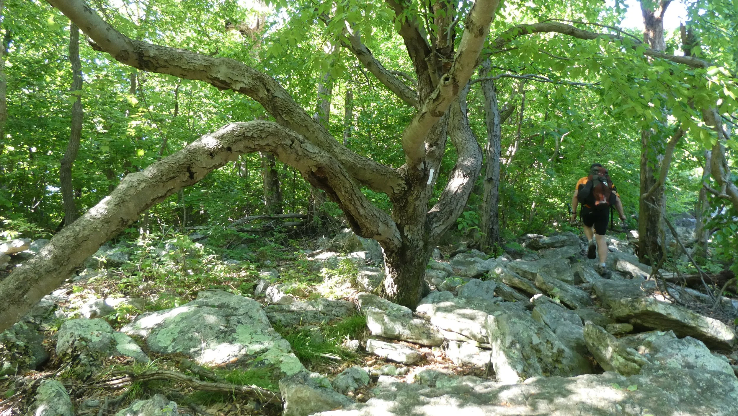
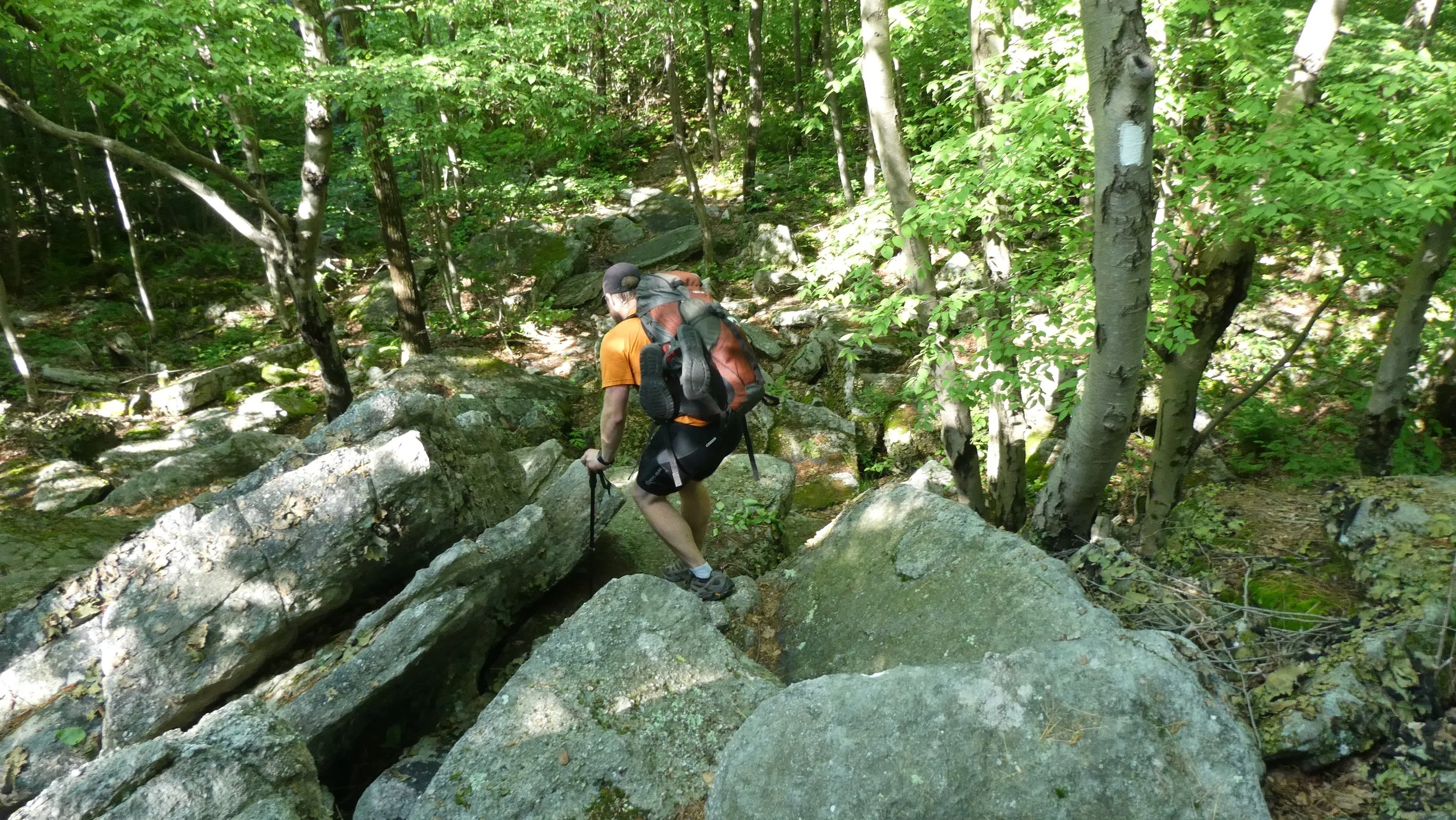
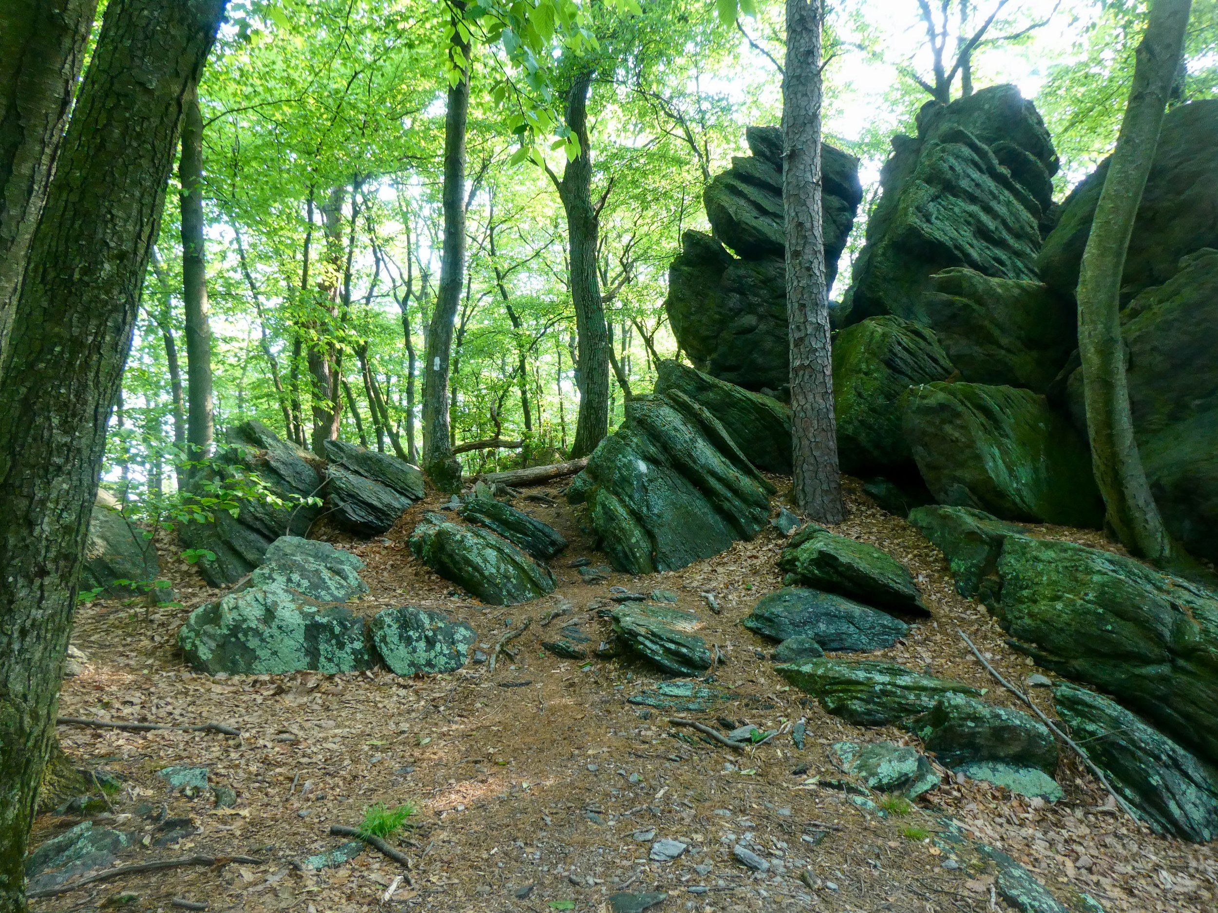
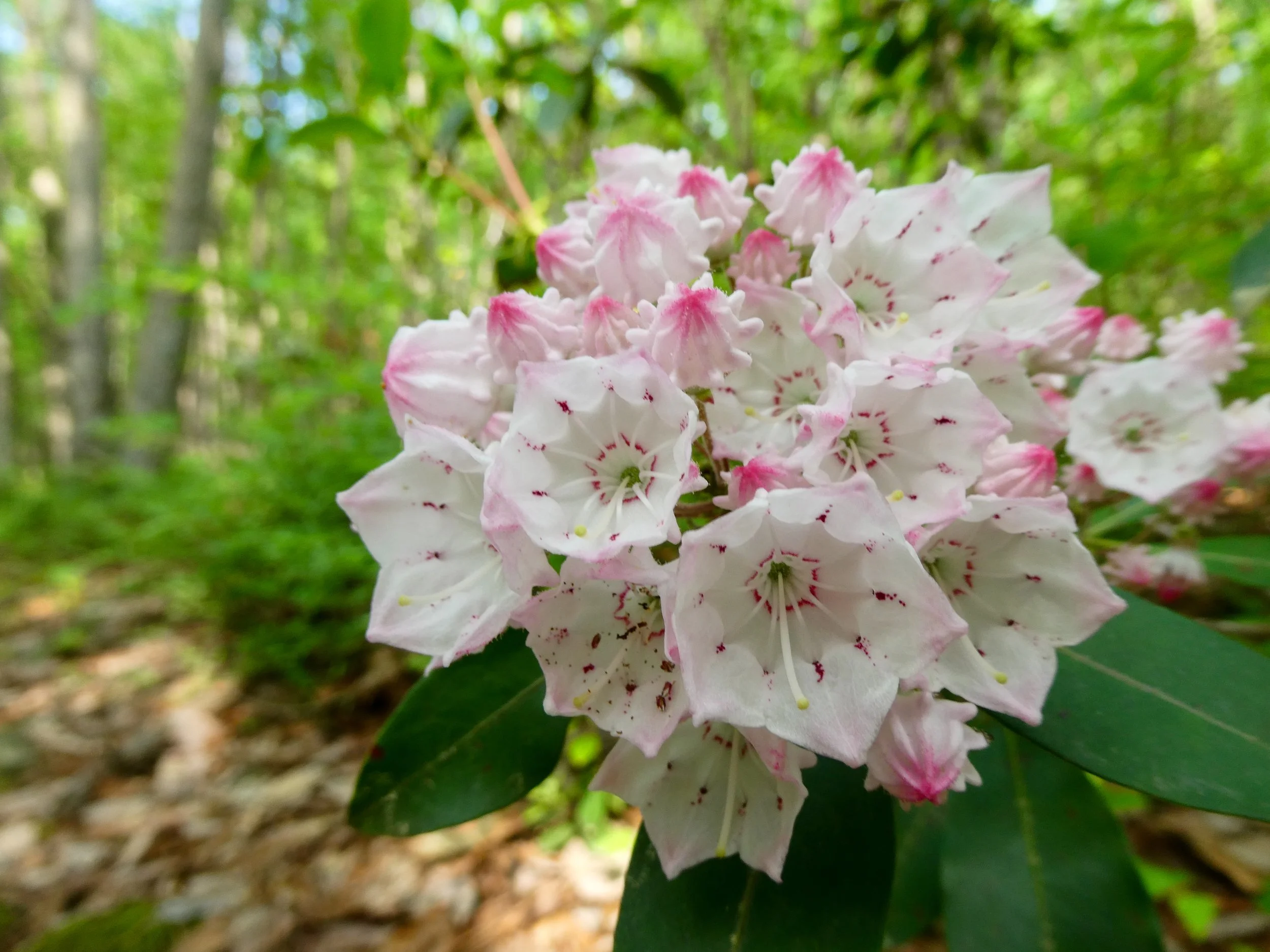
The morning started out foggy and stayed overcast, threatening rain but never quite delivering. The hiking was uneventful, with the trail cruising along the sometimes very rocky ridge. The only major climb of the day came at mile 1,281 following the steep descent into Wind Gap. During my lunch break, I checked my email and discovered a response from Dempsey Rentals. I requested a phone call to discuss the available apartments tomorrow afternoon. After lunch, the clouds finally started to drizzle.

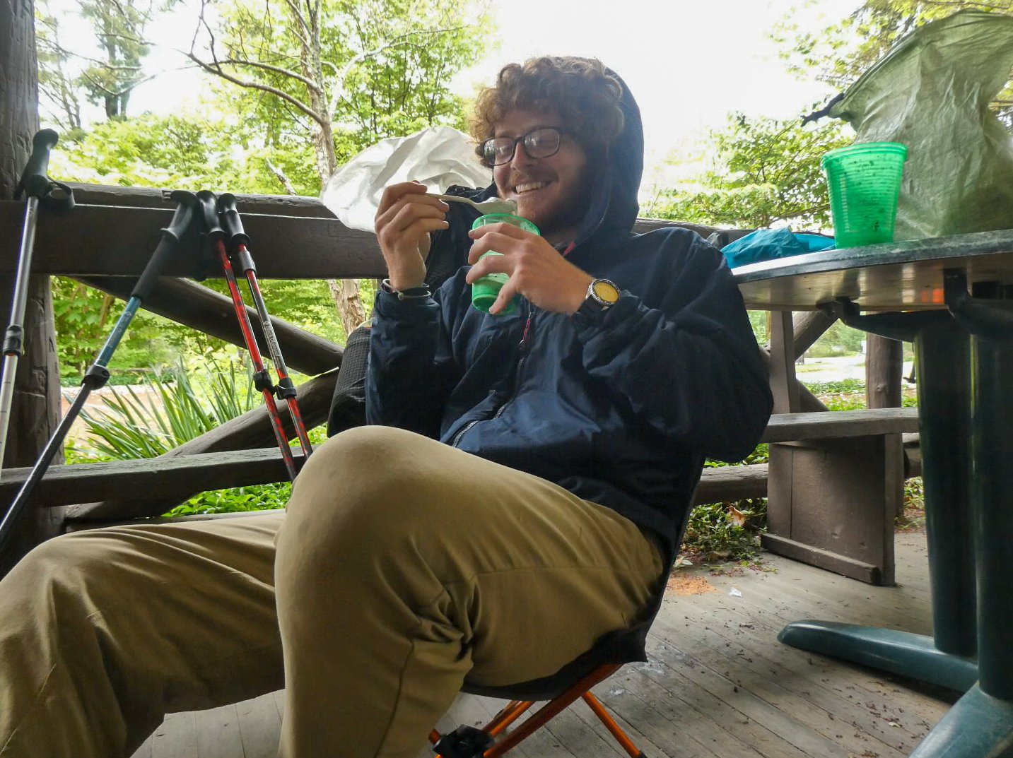
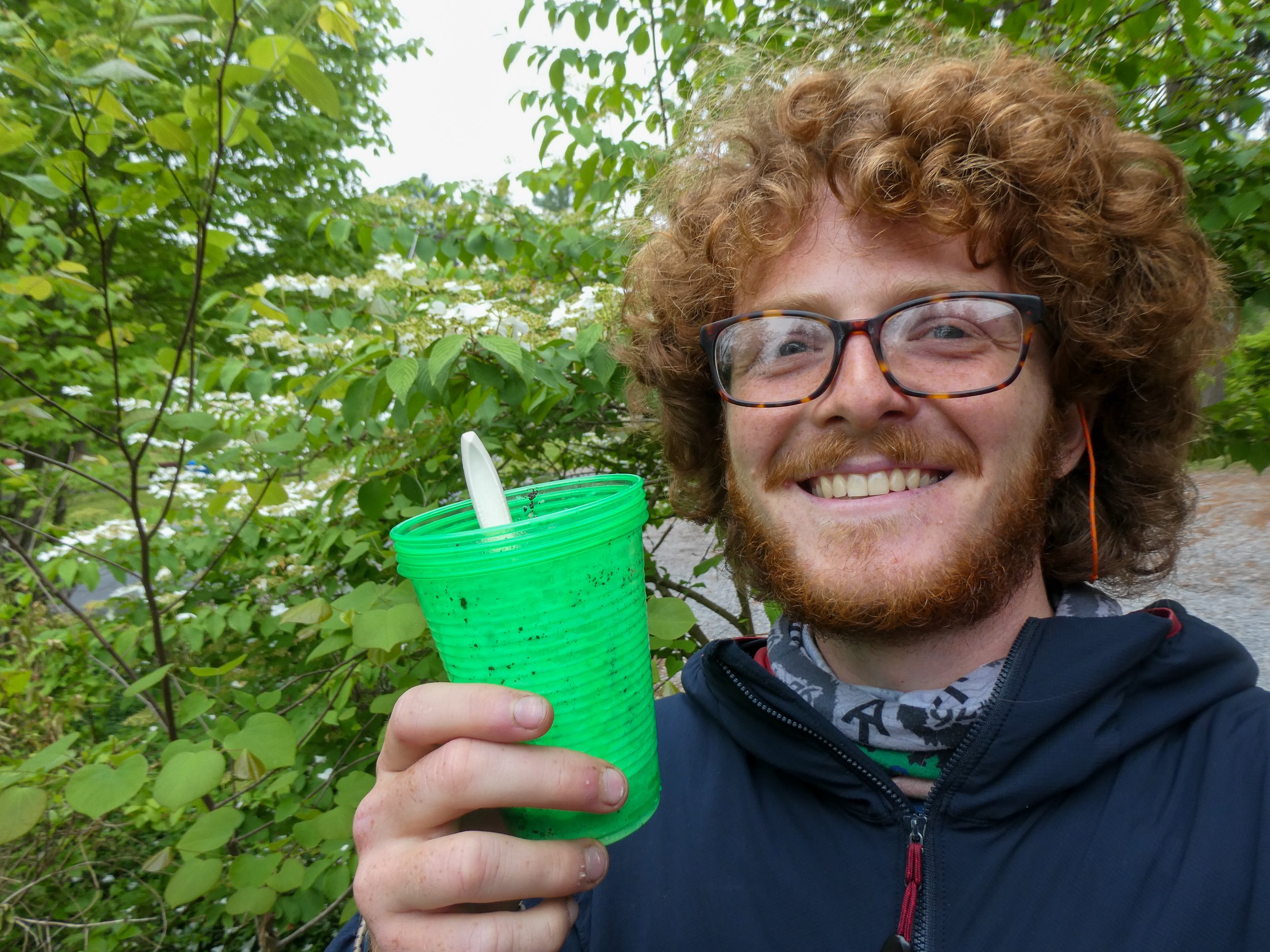
I reached Kirkridge Shelter around 4:30pm just as the rain was starting to pick up. The shelter was empty, so I set my stuff up inside and prepped my dinner. The shelter was wide and deep, with an awning that jutted out far past the raised floor which served as the sleeping platform. From where I set up my stuff, I sat and stared out at the rain. I felt like an early human, huddled in the relative safety of my cave, staring out at the elements.

The illusion was broken only when another hiker appeared, accompanied by a white and gray pitbull who quickly ducked into the shelter and shook off the rain. I had never met this hiker before, but I realized I recently ate lunch near him a week or so back. I was perched on a rock while he and the dog sat below. As I recall, he had been watching a show on his phone and never looked up to notice me. This time, he introduced himself as “Chooch” which I later learned was a polymerization of “cheap” and “mooch.” Chooch had apparently earned his trail name on a previous regional thru-hike which he had done with very little money, managing to scrape by through a combination of extreme frugality and the generosity of others. This time though, Chooch had a more modest budget and actually offered to share some goodies with me.

June 03, 2021 /Jack Boyette
Comment

Hikers Log - trail date: day 87

June 02, 2021 by Jack Boyette

(PA Route 248 (mile 1260.1) - Leroy Smith Shelter (mile 1276.1))

I woke up this morning a little before 8am. My goal for the morning was to spend time contacting apartments and rental agencies in Tuscaloosa. To do this, I wanted to find a space where I could charge my devices, browse online apartment listings, and make phone calls. Fortunately, there was a Dunkin Doughnuts across the street from Squeak's house so I made my way over with Side Hustle and Sketchbook. To my disappointment, the seating area was roped off, so I ordered a half dozen doughnuts and returned to Squeak's.

Side Hustle and Sketchbook made their way back to the trail while I did a small resupply. I then did apartment research in Squeak's backyard, contacting a couple promising rental places. After feeling satisfied with the morning's productivity, I asked Squeak when she could take me back to the trail. She told me that she was in a meeting but that we would leave as soon as she was done.

About an hour and a half later, Squeak emerged into the backyard and announced that we were ready to go. I grabbed my pack and we headed towards her tan Lincoln. When we reached her car, we were dismayed to discover that she had a VERY flat tire. She asked if I knew how to change a tire and I told her I did, but when we opened the trunk to fetch the spare, we found that it had severely dry rotted and was unusable. Squeak said her husband should be home in 30 minutes or so. In the meantime, she would contact some of her friends to see if they could drive me to the trail.

While I was waiting for Squeak to find me a ride, I discovered a very promising lead on Apartments.com. Most of the apartments in Tuscaloosa seem to fall into two bins. Either decrepit dumps with gross carpet or soulless new developments with grey linoleum floors. This one was different. The listing was for a number of apartments in a big, old house in historic Tuscaloosa. The house had been converted to eight independent one bedroom apartments, ranging from $800-900/month. The location was awesome. It was a 20-minute walk from the biology building and only a couple blocks from a grocery store and the main commercial strip downtown.

After maybe 15 minutes - and before I could respond to the listing - Squeak announced that she had found me a ride. Soon, an older woman arrived in a black SUV with handicap tags. She introduced herself as "Laura" and I thanked her for volunteering to take me to the trail. Laura dropped me off at ABC Heating and Cooling on PA Route 248, across the bridge from where I got picked up. This was fine with me because it meant I did not have to complete the nearly half mile road walk.

The time was about 1pm and I was hoping to hike 16 miles to the first shelter out of town. I knew this stretch of trail was going to be tough. The climb out of town was supposedly at times a hand over hand rock scramble. Once I made it onto the ridge, I would be hiking along a designated "Superfund Site." This area was so polluted by zinc smelting that it has been completely fenced off for over a decade to allow for revegitation. There also happens to be no on-trail water sources - that are not polluted with insane levels of heavy metals - for 20 miles. So as I began the climb from Palmerton, I was carrying about 6 pounds of water, which I hoped would be enough to get me 16 miles to the shelter where I could access a spring down a steep side trail.

As I began hiking out of town, I composed a response to the listing for the cool old apartment. The climb was indeed steep and rocky. Fortunately, I was able to send the message before the trail got too crazy. soon though, I found myself climbing up steeply graded rock walls on all fours. To date, this is the most technical climbing I have done on trail and I would certainly hesitate to call it "hiking" - more like "bouldering." 😅 Despite the challenge, the climb was a lot of fun and the views were spectacular.

Eventually, I made it to the ridge and found myself overlooking Palmerton. Before I left town, Squeak had given me an assignment which she called the "Squeak Challenge." I was supposed to try and find her house from the ridge and send her a picture. It took me a while, but I eventually located the nearby Dollar General and finally found Squeak's house. I sent her a picture and she responded that I had earned eternal glory.

After 4 miles I reached a set of powerlines where I missed a sharp turn in the trail and continued along a gravel road for a few minutes. I pretty quickly realized that something was wrong and doubled back to find the trail. I think this is the first time I lost the trail and I was briefly very annoyed with myself. Fortunately, I corrected the mistake quickly and only lost a bit of time.

For the next 12 miles I hiked along the same ridge, encountering a timber rattlesnake and a large rat snake. Otherwise, the afternoon was pretty uneventful. The rocks seemed to stay at a fairly consistent level of "mildly annoying" so I spent much of the day staring at my feet. I reached the shelter a little before 8pm. My feet were sore and I was surprised at how tired I felt despite only having hiked 16 miles. I set up my tent and ate dinner while chatting with Aspen, Strap-on, and Trivia.

Tomorrow I am planning for another short day. From where I am camped, I have 20 miles to Delaware Water Gap, where I'm meeting AC in two days. So I'm thinking I'll probably hike another 16 miles or so and try to find a nice tentsite tomorrow night.

Pennsylvania rocks

20 mile water carry

zinc polluted ridge

June 02, 2021 /Jack Boyette
Comment

Hikers Log - trail date: day 86

June 01, 2021 by Jack Boyette

(Allentown Hiking Club Shelter (mile 1242.4) - PA Route 873 (mile 1259.7) *overnight in Palmerton*)

I started hiking today at about 8:50am. Moving northbound, the Allentown Hiking Club Shelter is positioned at the beginning of a short blue blaze which leads to a water source and then reconnects with the AT. I needed water, so I opted to take the blue blaze and skip the short ~0.25 section of AT. The blue blaze was roughly the same distance and probably a bit more scenic since the AT in this section was an old logging road. Besides… I’ve learned I’m not a purist.

When I reached the spring, I filled up both water bottles and my cold soak jar. The next water source was about 10 miles away at Bake Oven Knob Shelter where I figured I’d probably stop for lunch. My plan for the day was to hike about 18 miles to George W. Outerbridge Shelter, just outside Palmerton, PA. The hope was that I could hitch a ride into Palmerton early tomorrow morning and then spend the morning in town charging my devices. I realized last night that I’m actually quite low on power. I didn’t get a chance to charge things in Port Clinton, but I hadn’t been too worried because my power bank was displaying two (of four) blue dots, so I thought it was still half full. However, last night when I plugged in my phone, the power bank showed a single red blinking light. It was an unpleasant surprise, but as long as I can get into Palmerton tomorrow morning, I should be fine on charge.

The morning’s hiking was very rocky and included several scrambles along knife’s edge ridges with lovely views. After about 9 miles, I reached the trailhead parking lot for Bake Oven Knob where I found Sketchbook and sideHUSTLE who were stopping for lunch. Bake Oven Knob was just a short 0.4 mile climb away, so I opted to eat lunch with a view. The climb was indeed VERY steep, at times approaching an all-fours rock scramble. The views were absolutely worth it though, and I was grateful that I hadn’t stopped for lunch in the dusty gravel parking lot below. The rocks along the knob were heavily painted with graffiti, which I viewed with mild curiosity as I shoveled Fritos in my mouth. I also noticed a few strings of Tibetan prayer flags, some of which were strung between trees at the perimeter of the rocky outcrop, but many of which were broken and scattered on the ground.

As I was enjoying the views, food, and juvenile tags, a shaggy-looking hippie dude approached the cliffs. He was obviously disgruntled and began muttering angrily. I realized he must have been the one who hung up the prayer flags as he began collecting them from the ground. I tried to ignore him and enjoy the view, but his muttering grew louder and he eventually decided to air his grievances with me. He cursed the “IDIOTS” who vandalized the rocks and his prayer flags, explaining that he likes to come to Bake Oven Knob to meditate. His energy struck me as way off, and I found myself totally unmoved by the perceived injustices he was lamenting.

The vitriol he was directing at the people (probably kids) who vandalized his precious prayer flags seemed unfitting for someone presenting themselves as a meditative hippie type. I also saw parallels between his hanging of prayer flags and kids writing graffiti on the rocks. Both actions were attempts to leave a mark on the knob, and although they probably differed somewhat in their permanence, both actions violated Leave No Trace principals and spoiled the illusion of wilderness for other hikers. Furthermore, the act of writing graffiti or hanging flags displayed a selfish sense of ownership over the knob. This man clearly viewed the knob as his personal meditation palace. If he wanted to hang prayer flags, that was ok because the knob existed only as a space to host his hodgepodge appropriation of south Asian culture. He seemed disgusted by the idea that other folks might see the knob differently.

I kept my thoughts to myself, finished my lunch, and wished him well before hiking on.

Shortly after the knob, I stopped at Bake Oven Knob Shelter to use the privy. After about 2.5 miles, I ran into Sticks, Ranger, Gadget, and Whistler taking a break at a tentsite next to the trail. I joined them, positioning myself on a rock chair, and busting open a Nature Valley protein bar. The group was good company, and I opted to hike with them for a while. I learned that they were getting picked up by a friend who would be giving them a ride to Bethlehem PA, where they had hotel reservations. I also learned that Whistler was a retired teacher and Gadget was an air traffic controller.

After five miles, we made it to George W. Outerbridge Shelter, which is situated on the ridge right before the road into Palmerton. At the shelter, we met Camel and Kibbles, two young blonde cousins hiking together. I was about to unpack my stuff when Gadget asked me if I had seen a comment on Guthook’s Palmerton icon. The comment was from a trail angel named “Squeak” who allows hikers to tent in her yard for free. She also offers access to her shower and free laundry. Seeing as we were only 0.5 miles from the road, I texted Squeak to ask if I could crash in her yard. She texted back almost immediately and confirmed that I could spend the night - she even offered to shuttle me to and from the trail. As I was texting Squeak, Sketchbook and sideHUSTLE reached the shelter and asked if they could get in on the free tenting at Squeak’s. She said “sure,” so Sketchbook, sideHUSTLE, Sticks, Ranger, Gadget, Whistler, and I hiked the short but steep 0.5 miles to PA Route 873.

Squeak arrived promptly in an old, boat-sized Lincoln sedan. Sketchbook, sideHUSTLE, and I hopped in the car, and exchanged introductions with Squeak on the way into town. She explained that she is a dean at a nearby small liberal arts college and hosts hikers all the time. Apparently, the only reason her place isn’t an official hostel is because such a designation would require legal hurdles and insurance. Squeak also warned us that she doesn’t cook or clean, so her house is a mess.

We got to her house and it quickly became apparent that yes, she does not clean. The yard was a mess and the inside was a mess, but I was so grateful that I didn’t care. Squeak had her own tent set up in the yard, which she said I could use if I didn’t want to set up my own tent. I took her up on the offer and set up my gear in her single-man Big Agnes tent.

She had two sons who are about to finish high school. She explained that one of them is autistic, so we shouldn’t be offended if he didn’t talk to us. Squeak had a huge pile of wood in her backyard, and she urged us to start a fire and burn “as much of it as you can.” After we got our stuff set up, sideHUSTLE started a fire and we started slowly feeding bits of the pile into the pit. The wood was all sorts of shapes and sizes. She explained that some of it was from the Gibson guitar factory and some of it was from an old fort. There were also 2x4s and other random dimensional lumber. Pretty soon we had a small bonfire going in her residential backyard. Then her sons started adding things. Then another neighborhood kid (who was also autistic and apparently hangs out in their backyard all the time) appeared and also started throwing things into the fire. At this point, the fire was huge. Far too big for the tiny fire pit in squeaks narrow residential backyard. sideHUSTLE and I eyed each other nervously, and started scooting our chairs back from the pit. The fire was big, and sparks would fly each time one of the kids added another piece of wood. Then the piece would catch, and the fire would flare and grow… *TOSS *BOOM *WHOOSH… Then another one… *TOSS *BOOM *WHOOSH!

In the midst of this chaos, Squeak’s neighbor appeared at the fence. He was a middle aged man of Latin American descent. At first I expected him to complain about the obvious fire hazard just feet from his house. Instead, he cracked a big smile when he saw Squeak, and she greeted him warmly. She introduced him as “Amigo” and explained that he was part of a backpacking club she organizes for folks with little camping experience. Amigo is his trail name - apparently because he’s Mexican. He left the fence and returned shortly holding a baby doll. He removed a lit cigarette from his mouth and placed it in the doll’s mouth, proudly presenting it to all of us and declaring “LOOK, the baby is SMOKING!” and cackling hysterically.

I couldn’t help but laugh at the bizarre imagery of it all. Squeak briefly went inside the house, and things got even weirder when she returned with a set of bagpipes. She explained that she was learning the pipes before bursting into play. At this point, I was convinced that reality was peeling at the seems. A couple hours ago I was walking down the trail. Now, I was sitting in a stranger’s backyard. In front of me, Squeak’s kids were still feeding the inferno… *TOSS *BOOM *WHOOSH… To my right, Amigo had propped up his smoking baby on the fence, a tendril of smoke rising from the doll’s smoldering cigarette. On my left, Squeak’s bagpipes were erupting in song. It was all too surreal. I was clearly dreaming. Squeak’s place was chaotic in the best possible way.

Eventually, the gathering dispersed and I set out with Sketchbook and sideHUSTLE in search of dinner. We ended up walking to One Ten Tavern, a bar near the edge of town. It was trivia night inside, but we opted to sit outside on the porch. I ordered a cheese quesadilla and potato and cheese pierogis. I also ordered a porter from a somewhat local PA brewery. Everything was palatable, but the conversation with Sketchbook and sideHUSTLE really helped elevate the evening. Sketchbook is an elementary school art teacher. She carries a small Moleskine sketchbook, which explains her trail name. sideHUSTLE is a Honda mechanic by trade, but on the side, he resells clothes, which paid for their thru-hike and earned him his trail name. We enjoyed dinner and conversation, eventually making our way back to Squeak’s as the sun was starting to set.

Before bed, I called Anna Claire and walked to the town square as we caught up on life. The small town at night, illuminated by streetlamps, was rather charming. I paced around a large gazebo and along the park creek until I found a nice bench to sit and talk. After an hour and some change, AC and I wished each other goodnight, and I made my way back to Squeak’s. I stay up a while sitting by the fire with sideHUSTLE, before finally turning in for bed. A lovely way to end a lovely day.

Bonfires and bagpipes

cigarette smoking babies

Squeak's house of chaos

June 01, 2021 /Jack Boyette
Comment

Hikers Log - trail date: day 85

May 31, 2021 by Jack Boyette

(Port Clinton Pavilion (off mile 1220) - Allentown Hiking Club Shelter (mile 1242.4))

A little after midnight I awoke to the sound of yelling coming from the direction of the house party. I heard what sounded like “GET THE F— OFF MY PROPERTY!!!” followed by the sound of tires screeching and multiple gunshots. The car (or cars) sped down the road away from the pavilion and must have merged onto the road behind the pavilion because about a minute later I heard another burst of gunfire from the road on top of the hill behind the pavilion. The car(s) then sped off and everything was quiet. Savage, Trainer, and I all shared in a bit of muttered confusion before shrugging it off and falling back into sleep.

I managed to make it through the night without getting pooped on my a bird. In fact, I slept very well and woke up to find mostly blue skies. I took the morning slow and wasn’t hiking until about 9:30am. The air wasn’t warm yet, but mote importantly it wasn’t cold and the sky promised a reprieve after three days of miserably cold rain.

The first part of my morning involved a road walk through Port Clinton. The most notable sight was a sign posted on a front yard shed that read: “HIKERS ARE NOT WELCOME.” This was odd because all the people I’ve met in trail towns have been extremely welcoming. Maybe this particular person had a bad experience with a hiker in the past and is now prejudiced towards the whole community. Or maybe they just have a serious “STAY OFF MY LAWN” kind of mentality. I’d wager the second speculation is more likely. I believe the hiker community at large is a pretty respectful group of folks. Amusingly, they had hung a metal butterfly next to the sign in what might of been an attempt to soften its aggressiveness.

As I was making my way back through Port Clinton, I also took the opportunity to retire one of my Smartwater bottles. This particular bottle had sprung a pinhole leak after 1,220 miles of trail. RIP. Thank you for your service🫡

My plan for the day was to hike about 19-20 miles, but if I wanted to camp at a shelter, my options were to go 15 or 22 miles. According to Guthook, there aren’t any good campsites between the shelters, so I knew I’d probably end up hiking 22 miles.

The trail took me down along the Schuylkill River for about a half mile before crossing under PA Highway 61. On the other side of the bridge, I reached a road crossing and small parking lot. Just as I was rejoining the trail I noticed a pair of hikers - a young man and woman I hadn’t seen before - getting dropped off. They were colorfully dressed and looked like cool folks, but I didn’t stop to chat. I figured I’d run into them eventually.

The climb out of town was steep and lasted about 1.5 miles before I reached the rocky ridge. After another 5 miles of ridge hiking, I reached Pulpit Rock. The overlook was crowded with day hikers. Among them I spotted Stew, who I started chatting with. As we were chatting, the colorful couple I had seen earlier reached the rock. Stew already knew them and greeted them warmly. The man was sideHUSTLE and the woman was Sketchbook. They asked if we were planning to eat lunch yet, and we all ended up sitting down to grub. There were so many day hikers crowding the overlook that we couldn’t even position ourselves with a nice view while we ate. Instead, we just ate together off to the side. Regardless, I was excited about my lunch. It was half of a DIY sub which I had packed out from town, including a Walmart French wheat loaf, salami, honey ham, and pepper jack cheese (the first half had been my dinner yesterday).

I didn’t learn much about Sketchbook or sideHUSTLE since Stew, in his gregarious manner, did most of the talking. He told us that he’s recently been hiking in a pair of bike shorts meant for cyclists. They have extra padding in the crotch/groin area designed to grant extra comfort to cyclists perched on hard and narrow bike seats for long rides. Stew hoped they would help with chaffing, but they’ve had the opposite effect. Apparently, the padding is like a sweat sponge, which causes irritation as it rubs against his thighs all day. Sounds unpleasant.

About 2 miles after Pulpit Rock, I reached the Pinnacle, who’s side trail was marked with a behemoth ~15 foot pile of rocks that I imagine have accumulated over many, many years of day hikers’ contributions. I made my way down the short side trail, which was congested with day hikers, and discovered a huge cliff offering spectacular views to the east overlooking the farms below. As I approached the rocks, Stew motioned me over to the north end of the cliff. A small crowd of day hikers had gathered near him, and with a big smile on his face, he declared “There’s a rattlesnake over here!” and pointed to the ground in front of him. Sure enough, there was a medium sized timber rattlesnake, coiled up on a ledge below. The snake appeared to be almost ready to shed, and seemed uninterested in the crowd forming above.

After admiring the view for a bit, I hiked on and found that the trail became a beautifully graded two track road. The next few miles offered easy hiking, with tons of water sources and tentsites. I caught a big crawfish at one water source and then at the next one I caught up with Stew. We ended up hiking together for most of the afternoon, and I learned a lot about Stew’s life over the past few years. While in undergrad, he had studied abroad in New Zealand where he met a French girl with whom he started a relationship. After graduating with a geology degree, he went to France to spend time with the girl. Things fell apart after two weeks, so Stew ended up bumming around France and Europe. He managed to pick up a good bit of French, but then COVID hit and Stew was forced to scramble for something to do. He ended up finding a Workaway position on a farm out west with a francophone woman who offered to help him practice his French. After that, he started a geology masters program in Philadelphia but hated it. Now he’s on the AT. When he finishes, he’s planning to teach English in France. It all sounded like a chaotic but fun few years.

I ended up making it about 22 miles and stopping at the Allentown Hiking Club Shelter while Stew hiked on. At the shelter, I found the trail family I met the night before Port Clinton, including Sticks, Ranger, Gadget, and Whistler.

After days of rain

the sunny sky emerges

casting me in warmth

May 31, 2021 /Jack Boyette
Comment

Hikers Log - trail date: day 84

May 30, 2021 by Jack Boyette

(Eagle's Nest Shelter (mile 1211.2) - Port Clinton Pavilion (off mile 1220) *overnight in Port Clinton*)

The morning hiking was gray and chilly. The rain held mostly held out, although everything was still saturated from the last two days. The wetness brought out an intensity of life in the forest, with every bit of foliage - from ferns to rhododendron - radiating a proud, vigorous green.

The trail stayed mostly flat over the first 8 or so miles, but took an absolute nosedive just before reaching town. Fortunately, I avoided slipping and my butt remained un-busted. Once I reached town-level, the trail crossed over four railroad tracks at a railroad station just outside of town. I crossed a bridge over the Schuylkill River and reached Broad Street, one of the (3?) main roads in Port Clinton. Almost as soon as I stepped foot onto Broad Street and before I even started attempting to hitch, a truck pulled up next to me and the driver asked where I was headed. I told him I was trying to get to the Walmart just down the road in Hamburg, the next town over. He told me to hop in and introduced himself as Freddy.

Freddy dropped me off at Walmart, I did my resupply, and ran into Numbers eating lunch at the Subway near the front of the store. Numbers asked if I was hiking on today and I told him that I was planning to spend the night at the Port Clinton Pavilion. I’m planning to meet AC in a few days, so I’m not in any real rush. He told me he was hiking on and I bid him happy hiking, thinking I’d probably be going too slow to run into him again. I then wound my way through a maze of parking lots to Five Guys, where I had a very tasty lunch.

After Five Guys, I made my way back to the busy turnoff into the Walmart parking lot. I saw a couple hikers trying to hitch from the same spot when Freddy dropped me off. It seemed like a perfect spot. Tons of cars, stopping at the light before either turning right or left (the direction I wanted to go). However, it took me an unexpectedly long time to land a ride. Eventually, I was offered a ride from Laurie, who worked at the Walmart vision center. I told Laurie I was spending the night at the Port Clinton pavilion, but I was first trying to get to the barber shop, where hikers were apparently welcome to hang out and charge things.

Laurie dropped me off at the barber shop, which I quickly discovered was closed for memorial day. Fortunately, Laurie hadn’t drove off yet, so I quickly ran back to her car. I think I startled her a bit, but after I explained that the barber shop was closed, she agreed to take me down the road to the pavilion.

According to Guthook, the Port Clinton pavilion is owned by a local church, which allows hikers to use it for free. When I arrived, I discovered many dozens of birds flitting about in the rafters. The pavilion was huge and could probably sleep 100 hikers laid out like sardines across the floor, however I struggled to find a spot I deemed unlikely to be pooped on by birds. I eventually settled on a section of floor without much bird poop that also wasn’t under any nests. Next, I tried to find an outlet to charge my things but I quickly realized there was no power in the pavilion. Fortunately, I should make it to Palmerton in about two days, so I don’t think I’ll be at risk of losing charge. I was eventually joined by Savage and Trainer, who also struggled to find spots with low bird poop risk. We chatted until the sun set and it was time for bed.

As I fell asleep last night, I was vaguely aware of a house party and front yard bonfire happening just down the street from the pavilion. From the sound of music and occasional hollering, it seemed like folks were having a good time.

May 30, 2021 /Jack Boyette
Comment

Hikers Log - trail date: day 83

May 29, 2021 by Jack Boyette

(Tentsite (mile 1184) - Eagle's Nest Shelter (mile 1211.2))

Numbers and I woke up to more cold rain, which continued on and off all day. The morning hiking wasn’t too eventful - mostly just cold and rainy - although, I did get to witness Numbers navigate the Pennsylvania rocks in his trash bag poncho (which, to his credit, he handled gracefully). The rocks made themselves known today, with a few stretches of trail that were little more than boulder fields. Despite the rain, the rocks weren’t too slippery. However, they weren’t always stable, and I relied on my well-conditioned rock feet and trail legs to manage the minefield of unpredictably-shifty boulders.

With the cold and rain, I had my sights set on a shelter for the evening. The 501 shelter was about 16 miles into the day, just a bit before the 1200 mile mark. I knew I wanted to go farther than 16 miles, and I also wanted to break 1200 miles, so the next shelter, Eagle’s Nest, became my destination. That meant I needed to bust out a 27.2 mile day.

Numbers, decked out in his trash bag poncho

Just before 4pm, the rain let up as Numbers and I reached the 1200 mile mark! Numbers reminded me that he didn’t start at Springer, so it wasn’t mile 1200 for him (at least not this year).

As the afternoon wore on, the rain mostly held out. I hiked on without Numbers for the last few miles after he stopped for a biology break. I continued listening to my true crime serial killer audiobook and passed a small group of hikers about a mile before the shelter. I reached Eagles Nest and was shocked to find it empty. As I was eating dinner the small group I had passed reached the shelter. They turned out to be a small trail family of thru hikers. There was a couple named “Sticks” (the lady) and “Ranger” (the guy). There was also a gentleman in his (50s?) named “Whistler” who kind of looked like Fred Armisen. Also Gadget

May 29, 2021 /Jack Boyette
Comment

Hikers Log - trail date: day 82

May 28, 2021 by Jack Boyette

(Peters Mountain Shelter (mile 1,160.6) - Tentsite (mile 1184))

I woke up this morning at 6:30am and shook off the urge to sleep in. Numbers and I had agreed to hike together today and had decided to try to leave by 7:30am. I quickly broke down my tent before visiting the privy and retrieving my food bag from the bear box. I had just finished packing my things when Numbers approached to check if I was ready. I confirmed that I was and we left camp at just after 7:30am.

Numbers allowed me to take the lead and after about 2.5 miles, we stopped at Kinter View to eat breakfast. While we ate, Numbers commented on how fast I hiked. It was surprising and flattering to hear a triple crowner say I hiked fast, although to be fair, Numbers had just gotten back on trail in Harpers Ferry.

We hiked another 8 miles, mostly discussing grad school, science, and the promise of CRISPR gene therapies. We then stopped at a stream for a snack break. While there, the sky grew considerably darker, threatening rain. We started hiking again and pulled on our rain jackets in anticipation.

After 7 miles we reached Rausch Gap Shelter at 2:15pm. The rain had still not started yet and we decided to eat a late lunch in the shelter before moving on.

A mile past the shelter we reached Stony Creek, which has been flooded for a many years due to a large beaver dam. Numbers had crossed through before and explained that it was a pretty cool and unique bit of trail. The dam itself was worn down from years of hiker activity. We took our time, carefully choosing our foot placement on only the sturdiest branches and logs. With the help of our trekking poles for balance, we were both able to make it through without losing a foot to the disgusting slurry of beaver pond water.

After we made it passed the beaver pond, the skies finally opened up. We received a steady drenching as we hiked the next 4 miles, eventually reaching Swatara State Park. The rain started to leach our hiking spirit, so we decided to call it after reaching a tentsite just past the park. I set up my tent while Numbers set up his tarp. He admitted that these most often shelter camps these days, so he was curious to see how his rusty tarp pitching skills would hold up against the rain. I have had a lot of curiosity about tarp camping, but watching Numbers set up his tiny tarp over the wet ground made me grateful for my Tarptent. We were able to chat for a while from our respective shelters before exhaustion eventually claimed us both.

May 28, 2021 /Jack Boyette
Comment

Hikers Log - trail date: day 81

May 27, 2021 by Jack Boyette

(Darlington Shelter (mile 1,138.3) - Peters Mountain Shelter (mile 1,160.6))

I started hiking this morning around 8:30am. I hiked about 2 miles and reached PA Route 850 where a pregnant lady was setting up trail magic. She introduced herself as "Naps" and asked if I wanted a cheesesteak pretzel. She explained she was meeting a 61 year old lady thru-hiker named "Dallas" whom she had hiked the PCT with last year. Dallas arrived and they exchanged affectionate greetings. I hung out for a bit while Naps and Dallas were catching up. Dallas seemed shocked to see her friend pregnant, while Naps shared amusing post thru-hike insights. For instance, she shared that she sometimes longs for trail life, but other times, especially when the weather is terrible, she’s grateful to have a roof over her head. As I was preparing to leave Naps asked if I was heading to Duncanon and offered to slack-pack me, which I gladly accepted. Trainer showed up and he also accepted the offer to be slack-packed. We then all agreed to meet Naps in Duncanon in 3 hours and set off down trail feeling as if we were floating.

Trainer is one of the Little Hotties who I’m less familiar with. As we hiked, I learned that he is from New York and has been working construction for a couple years. His big goal after trail is to join an electricians union. Dallas on the other hand is most recently from… get this… Dallas. She earned her (very creative) trail name last year during a PCT thru-hike after retiring from a career as the VP of logistics for Toyota.

After a mile and a half of field hiking, we climbed back up on the ridge and encountered a long stretch of Pennsylvania's infamous rocks. The ridge was mostly flat for 5 miles until we reached Hawk Rock, a fine overlook with lovely views over Duncannon. The overlook was crowded with day hikers so I didn’t stay long. Afterwards, the trail began a steep decline towards town. At this point, I was hiking solo. To entertain myself, I was listening to an audio book called “American Predator,” a true crime book about the serial killer Israel Keyes. True crime has never been my thing, but the audio book was available on Libby and I have to admit that so far it’s been riveting.

After a brief road walk, I made it to Duncanon around 12:30pm. Naps was parked outside the outfitter with a doughnut on her car. She explained that she had gotten a flat tire just a couple miles outside of town. I took a shower at the outfitter, whose name, “Kind of Outdoorsy,” made me chuckle. After my shower, Naps shuttled us to a grocery store for resupply. I then hung out in the rear hostile portion of Kind of Outdoorsy while my laundry was getting done (I split a load with Trainer and Savage).

Naps, Dallas, Trainer, and Savage were planning to go out for dinner, but I opted to move along, leaving Kind of Outdoorsy at 4:15pm. The walk through town was pleasant. I got the vibe that Duncannon is a small but colorful community. Just outside of town, the trail crossed two large bridges over the Juniata and Susquehanna Rivers. After crossing the Susquehanna, I crossed a set of railroad tracks before beginning a steep climb up to a very rocky ridge. The notorious Pennsylvania rocks were on full display as I zoomed along the ridge.

After about 2.5 miles, I stopped at Clark's Ferry Shelter for water. My goal for the evening was to make it to Peters Mountain Shelter, which was almost 7 miles away, and it was 6pm. It was clearly going to be a late night.

The ridge offered many fine views. The overlooks themselves were mostly power line swaths, but as I hiked later into the afternoon, the golden hour light imbued a lovely saturation on nearby ridges. I was moving quickly and ended up spooking a raccoon up a tree. The creature seemed to eye me with equal parts suspicion and curiosity as it climbed its way up into a maple tree, where it perched and stared. I stared back for a while, snapped some photos, and moved along.

I reached the shelter around 8:30pm and found Numbers and a number of friendly weekenders. I sat around the campfire for a while, happily accepting a bit of trail magic from a local couple. Before retiring for the evening, numbers and I agreed to hike together tomorrow and planned to roll out of camp around 7:30am.

May 27, 2021 /Jack Boyette
Comment

Hikers Log - trail date: day 80

May 26, 2021 by Jack Boyette

(Tentsite (mile 1,116) - Darlington Shelter (mile 1,138.3)

I began hiking this morning at about 8am and soon stopped for breakfast on a large rock next to the trail. While I was eating I noticed the cicadas singing for the first time. As I slowly looked around I noticed cicada nymph shells everywhere. They seemed to be on every branch on every tree and shrub. From where I was sitting I counted 30 shells before I gave up counting. I even spotted a couple metamorphosed cicadas from where I was sitting. Brood X had arrived in force!

After about 2 miles of climbing, I reached a ridge covered in giant rocks. The trail wove between and sometimes over the giant boulders, creating a sort of rock maze in which the trail could easily be lost. It quickly became apparent that the trail builders seemed more concerned with making this section interesting rather than easy - and I was all about it!

As I climbed down off the ridge, I caught up to Mr. Darcy. We hiked together for a bit and I asked him about the english literature program he was pursuing at the University of Glasgow. He explained that it was a one year program in which he would be focusing on nature writing, which includes everything from Thoreau to Bill Bryson. By adopting a lense of "eco criticism," he hoped to critique the basic narrative of most nature writing, which tends to focus on white men "conquering" the wilderness. He also explained that his trail name is indeed a reference to Pride and Prejudice because he "is the most eligible bachelor on trail."

I hiked on and soon realized that while engaged in my conversation with Mr. Darcy, I had missed the last water source before town. This meant I had about a third of a liter to last me 2.8 miles into Boiling Springs - and it was hot! Soon the trail left the woods and led me through wheat pastures which provided no shade or relief from the sun. These pastures continued for about a mile and led me right to the edge of Boiling Springs, Pennsylvania.

The walk into town was rather scenic as the trail routed me through a lakeside park. The lake was filled with swans, ducks, and geese and although it was midday on a Wednesday, many people were fishing along the pond. As I was taking pictures of the geese, Mr. Darcy and three other thru-hikers (Aspen, Strap-on, and Trivia) hiked past and invited me to join them for lunch at a cafe right off trail.

We were seated on an outdoor patio and were joined by Numbers. I ordered a salad topped with a mountain of roasted vegetables including zucchini, bell pepper, squash, onion, and portobello mushroom. I also ordered a side of chips and salsa. Apparently, the upcoming 13 miles were totally dry, so I practically chugged water hoping to establish a strong baseline of hydration. The upcoming terrain was flat and I worried that it would be more field hiking with no relief from the afternoon sun.

After eating lunch I completed a small resupply at a gas station and hung out for a bit on the Appalachian Trail Conservancy's regional office porch. At a little before 2pm I began hiking again and soon found myself walking in a narrow wooded corridor between pastures. On either side of me were fields and farms, but fortunately the trail was well shaded and I made good time over the relatively flat terrain.

After a little over an hour I emerged from the wooded corridor into a field and watched as a large group of ominous clouds approached rapidly. Strong wind gust blew and I watched branches fly from the tops of trees. In anticipation for some really rough weather, I stowed my phone and camera away in ziploc bags. Fortunately, the worst of the storm passed just north of me and I was subjected only to brief rain and wind.

I continued hiking and was thrilled to encounter a female box turtle in the middle of the trail. She was surprisingly tolerant of me taking pictures and turned out to be rather photogenic!

I crossed over Interstate 76 and then over US Route 11 followed by Interstate 81. Afterwards, I passed through more fields and crossed over Conodoguinet Creek (which is actually a major river) before beginning the short climb to Darlington Shelter.

I reached the shelter a little after 6pm and a man who introduced himself as "Mango" asked if I wanted a trail magic hoagie. I accepted this offer without hesitation and Mango explained that he had thru-hiked the trail in 2020. He was now out for a short overnight with his two great danes, both well over 150 pounds and sweet as can be. I ate my hoagie and then set up my tent before eating my actual dinner. After dinner, I visited the privy and retired to my tent just as it was starting to rain.

Tomorrow my plan is to hike 11 miles into Duncannon where I hope resupply, shower, and do laundry. After that I can either hike to the shelter 5 miles outside of town, or I can hike to the shelter 11.5 miles outside of town.

Hiking through hot fields

hoping for a shady tree

dreaming of water

May 26, 2021 /Jack Boyette
Comment

Hikers Log - trail date: day 79

May 25, 2021 by Jack Boyette

(Tentsite (mile 1,097.8) - Tentsite (mile 1,116))

I woke up this morning a little after 7am and was disappointed to discover that it was still cold and wet. It did not seem to be actively raining, but each slight breeze shed rain from the trees above and a heavy fog hung in the air. This was not exactly ideal weather for unreasonable levels of icecream consumption, but I figured there was still time for the sun to heat things up and dry things out.

After hiking a little over 2 miles, I reached the 1,100 mile marker. I am not sure what the exact mileage of the halfway point is, but in my mind it has always been at 1,100 miles. Technically, the halfway point changes every year along with the total length of the trail, which fluctuates as small reroutes are incorporated. I just know that this year's official total mileage, when added to the length of the approach trail, equals just about 2,200 miles. So as I stood gazing at the 1,100 mile marker, my only thought was: "Wow... I've really hiked half of the Appalachian Trail!"

After hiking another 1.5 miles, I reached a dramatic sign marking the halfway point of the 2011 Appalachian Trail. The sign seemed like a more fitting monument to the trail's halfway point than the small "1,100 miles" painted on a tree. I stopped for pictures and took a moment to reflect on what I had accomplished. I also considered how much still lay ahead.

In 3.5 miles I reached Pine Grove Furnace State Park whose general store was home to the infamous "half-gallon challenge." The store was open when I arrived, but they only had two tubs of icecream left. The flavors were butter pecan and coffee crunch - neither of which I wanted to eat a half-gallon of. The lady behind the counter explained that the icecream selection had been devastated by a hoard of voracious thru-hikers over the weekend. She consoled me by explaining that the icecream delivery truck should arrive in the next two hours. I decided to wait and used the time to dry out my tent and charge my electronics.

After about a half hour, what looked like a delivery van pulled up next to the store and I went inside to see if the icecream was being delivered. Inside I found a woman who seemed to be the manager or maybe the owner. I asked her about the icecream delivery and she said she was unsure when the truck would arrive. She then suggested that I just get four pints served from the icecream bar. That way I could get four different flavors for the challenge.

The first flavor I got was cookies and cream. I then took a seat on the store porch and began the half-gallon challenge. My first pint disappeared quickly and I returned to the store for my second. This time I got banana caramel. At this point in the day, the sun had still not emerged and although I was wearing my insulated hoodie, I began to shiver as I ate my second pint of icecream. The bananas and caramel went down much slower than the cookies and cream, but it too disappeared. Mint chocolate chip was my flavor of choice for the third pint. At this point, my consumption was slowing and I was feeling rather chilled. Fortunately, I had good company to cheer me on including Painless and Mr. Darcy. With their encouragement I finished my third pint and returned to the store for my final, determined to conquer the half-gallon challenge. I brought things full circle and selected cookies and cream as my final flavor. The last pint was a slog. As I neared the final spoonfuls, I decided I should find a restroom in case I got sick. I finished the last spoonfuls as I made it to the restroom, where I sat for a while. I was victorious.

I spent the next two and a half hours at Ironmasters Mansion Hostel, an old historic building which had been converted into a hiker hostel nextdoor to the general store. While there I charged things, checked my email, and generally avoided moving much. Pine Grove Furnace State Park is also home to the Appalachian Trail Museum, but unfortunately the museum is only open on weekends. At around 2:30pm I packed my things and made my way back to the general store. There I found Numbers - the tripple crowner I met a while back hiking with his mother. We chatted for a bit and he explained that his mother finished her section hike and he had gotten back on at Harpers Ferry.

At about 3pm I started hiking again, planning to do about 11 miles to a tentsite and stream. The afternoon hiking was pleasant and uneventful. I finished my audiobook for "The Immortal Life of Henrietta Lacks," which I greatly enjoyed. At about 7pm I rolled into an empty tentsite and took my time setting up. I ate my dinner in peaceful solitude and retired to my tent just after 8pm.

Tomorrow, I'll hike into Boiling Springs, Pennsylvania after 8 miles for a small resupply. Then I hope to hike another 14 miles to Darlington Shelter. Apparently, the weather forecast calls for scattered thunderstorms tomorrow afternoon, so hopefully that will not be too unpleasant.

Half gallon challenge

May 25, 2021 /Jack Boyette
Comment
  • Newer
  • Older

© 2023 John Boyette