Amphibian Ecology & Evoloution

with John Boyette

  • About
  • Research
  • Outreach
  • Hikers Log
  • Photography
  • Illustration
  • Contact

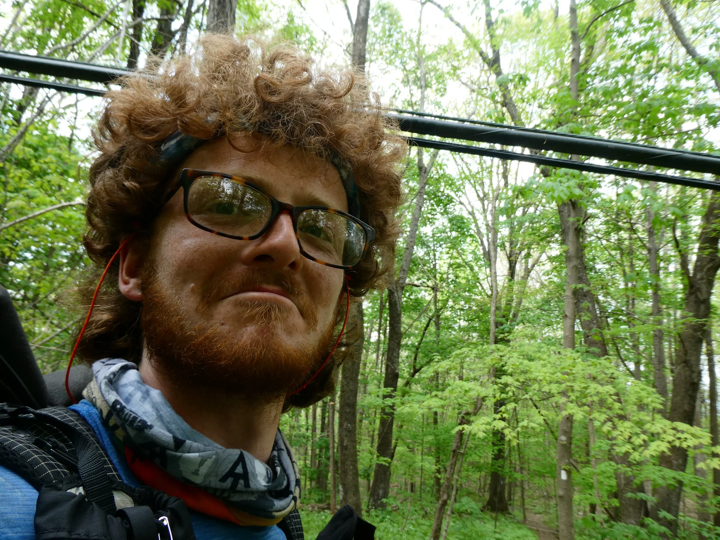
Hikers Log - trail date: day 57

May 03, 2021 by Jack Boyette

(Daleville, Virginia (mile 730.3) - Bobblet's Gap Shelter (mile 748.9))

This town is not pedestrian friendly :(

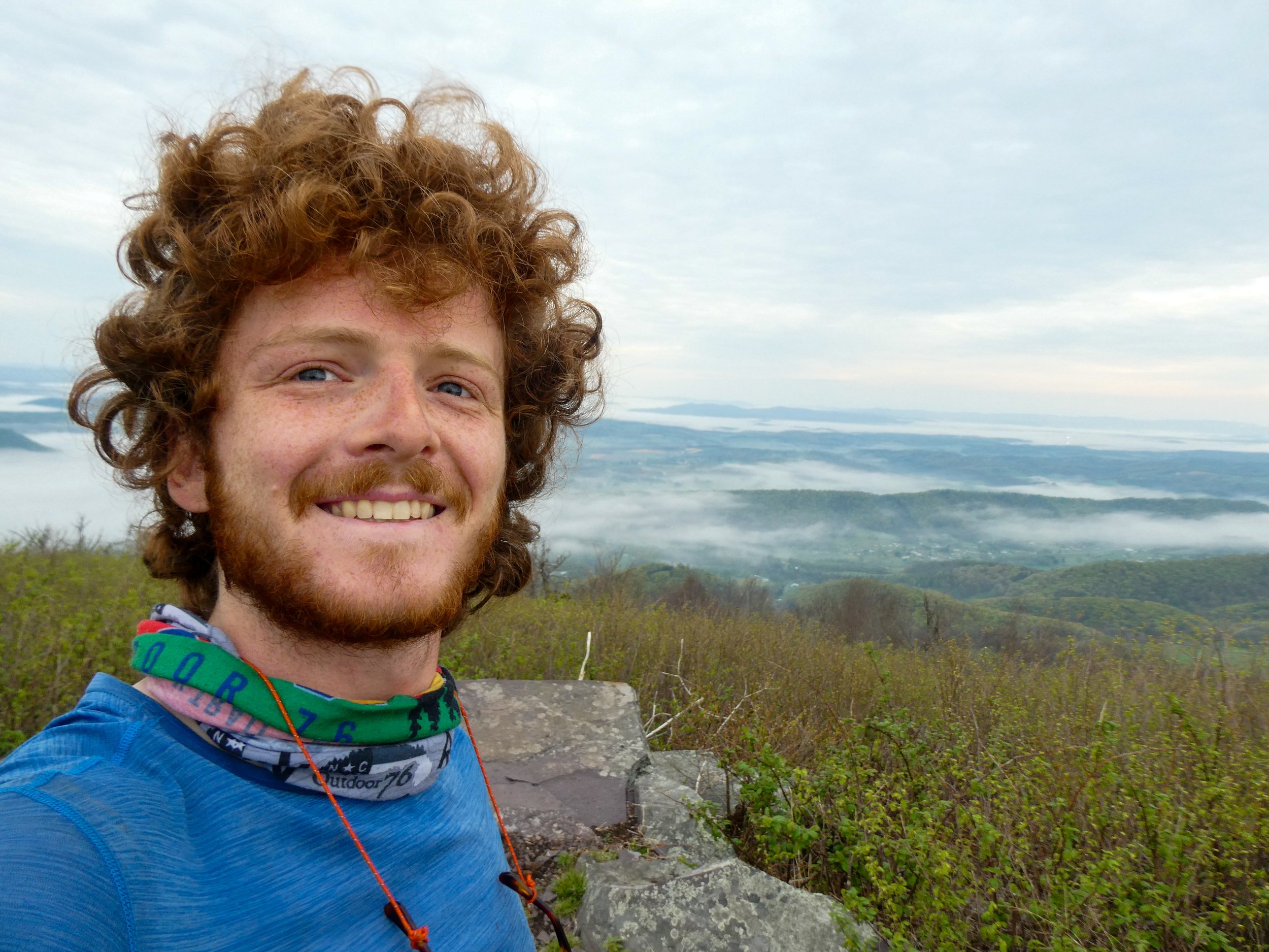
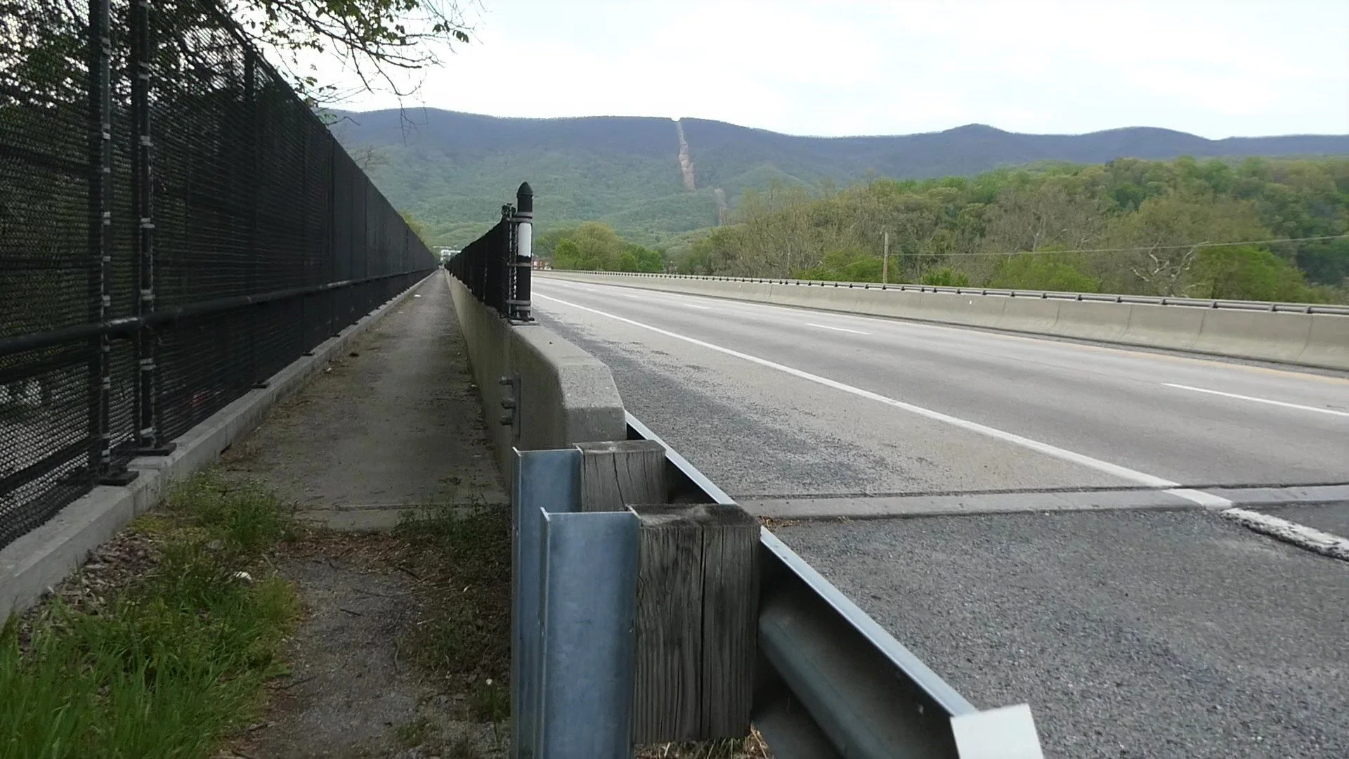
Delta and I had agreed to meet at the trailhead at noon, so I took my time and had a chill morning. After eating lunch at a McDonald’s next to the Motel 6, I made my way under the interstate one last time. Fortunately, I wasn’t hit by a car as I scampered across the exit ramp, under the overpass with virtually no shoulder, and across the on ramp. I made it to the trailhead and found Delta already waiting for me. There were thunderstorms predicted in the afternoon and the sky was certainly foreboding.

As we began hiking, we both agreed that it officially felt like spring. The trees had exploded with leaves seemingly overnight. The trail was really starting to feel more and more like a “green tunnel.” We made it 5 miles to Fullhardt Knob Shelter just as it started dumping rain. We opted to wait it out. Delta had packed out carrots and guacamole, so we sat in the shelter and munched while the rain did its thing.  

The rain eventually eased up and we continued hiking. I had to ditch my rain jacket pretty quickly because the heat and humidity was so intense. A light mist hung around the trail and all the plants were vividly colorful in their recently hydrated state. As usual, Delta and I talked a lot about cars. I learned that his realistic dream car is an early 90’s Corvette with the “polo green” paint job. He also explained his philosophical distaste for modifying vehicles, both aesthetically and mechanically. After a couple miles, the rain had mostly stopped and the trail began crossing over a number of streams and creeks.

A little before Curry Creek, I spotted my first eastern newt (AKA red-spotted newt, or Notophthalmus viridescens) of the trail! These guys are a super iconic and charismatic Appalachian amphibian. As juveniles, they live their lives in the terrestrial “red eft” stage, which can last two to three years. After this time, the efts find permanent bodies of water and metamorphose into their fully-aquatic adult stage. Around this time of year, efts become very active, so now that I had seen one, I knew to be on the lookout for more!

As expected, Delta and I spent the rest of the day basically tripping over little red efts, which seemed to love congregating along the trail. We both grew super paranoid, and were absolutely terrified that we would step on one. Fortunately, their bright orange coloration makes them rather conspicuous, and I think we were able to avoid smushing any newts.

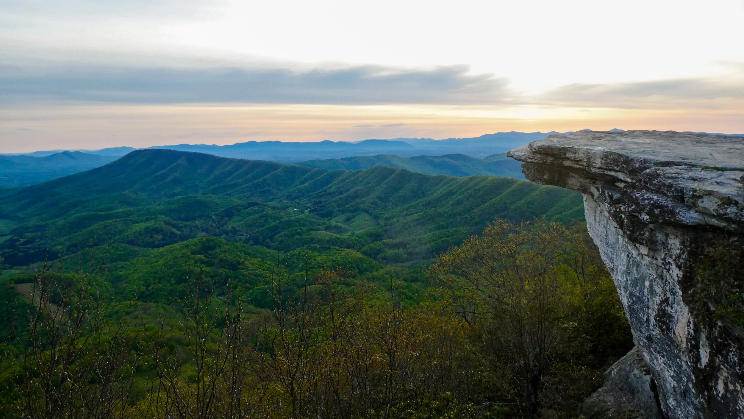
After hiking a little over 11 miles for the day, we reached Wilson Creek Shelter. We were both feeling good, so we decided to push to the next shelter a little over 7 miles away. After 2 miles, the trail routed alongside the Blue Ridge Parkway.  Over the next 5 miles, the trail crossed the Blue Ridge Parkway twice. Once at Taylor Mountain Overlook and again at Harvey’s Knob Overlook. Both overlooks provided scenic panoramas of the southern Virginia mountains.

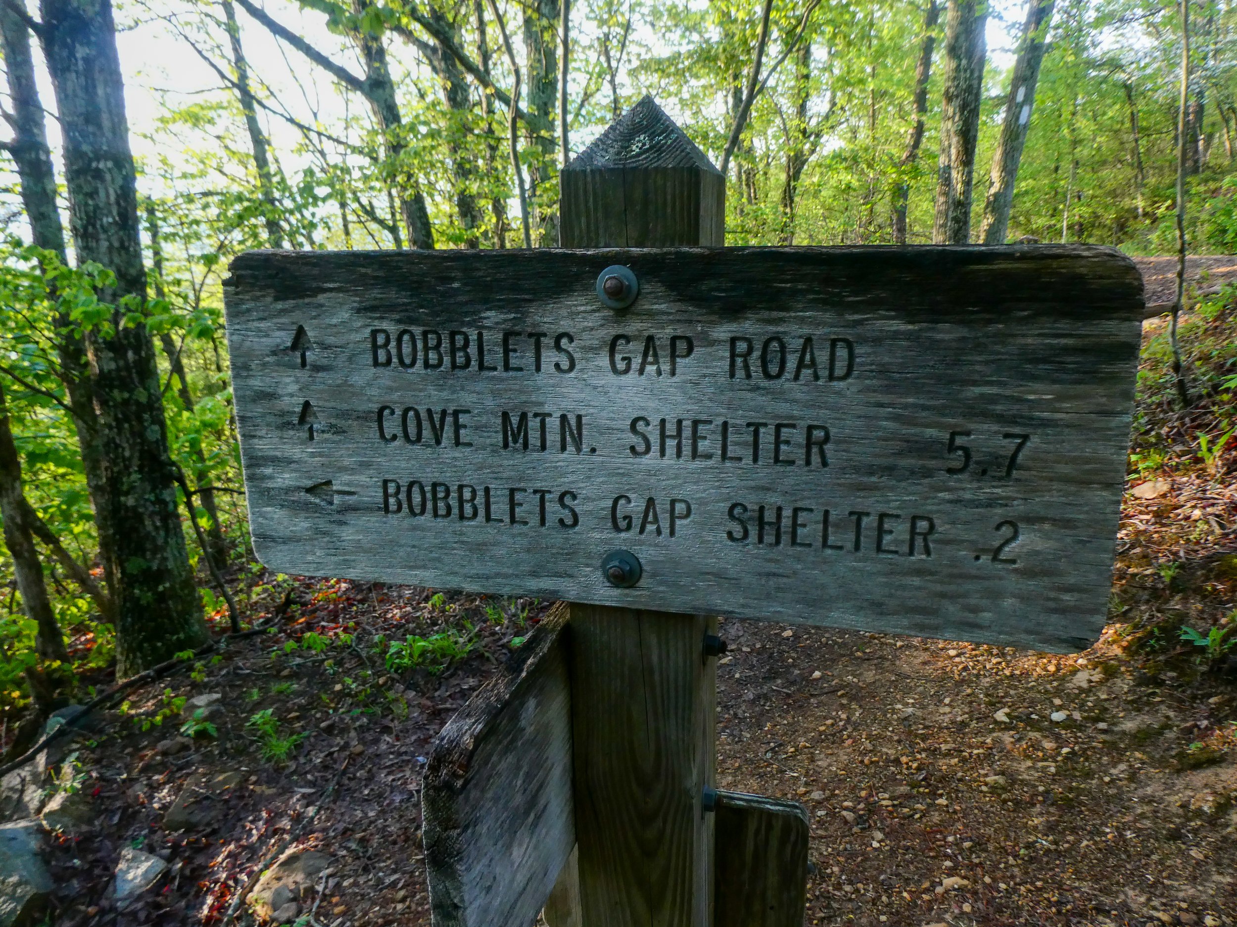
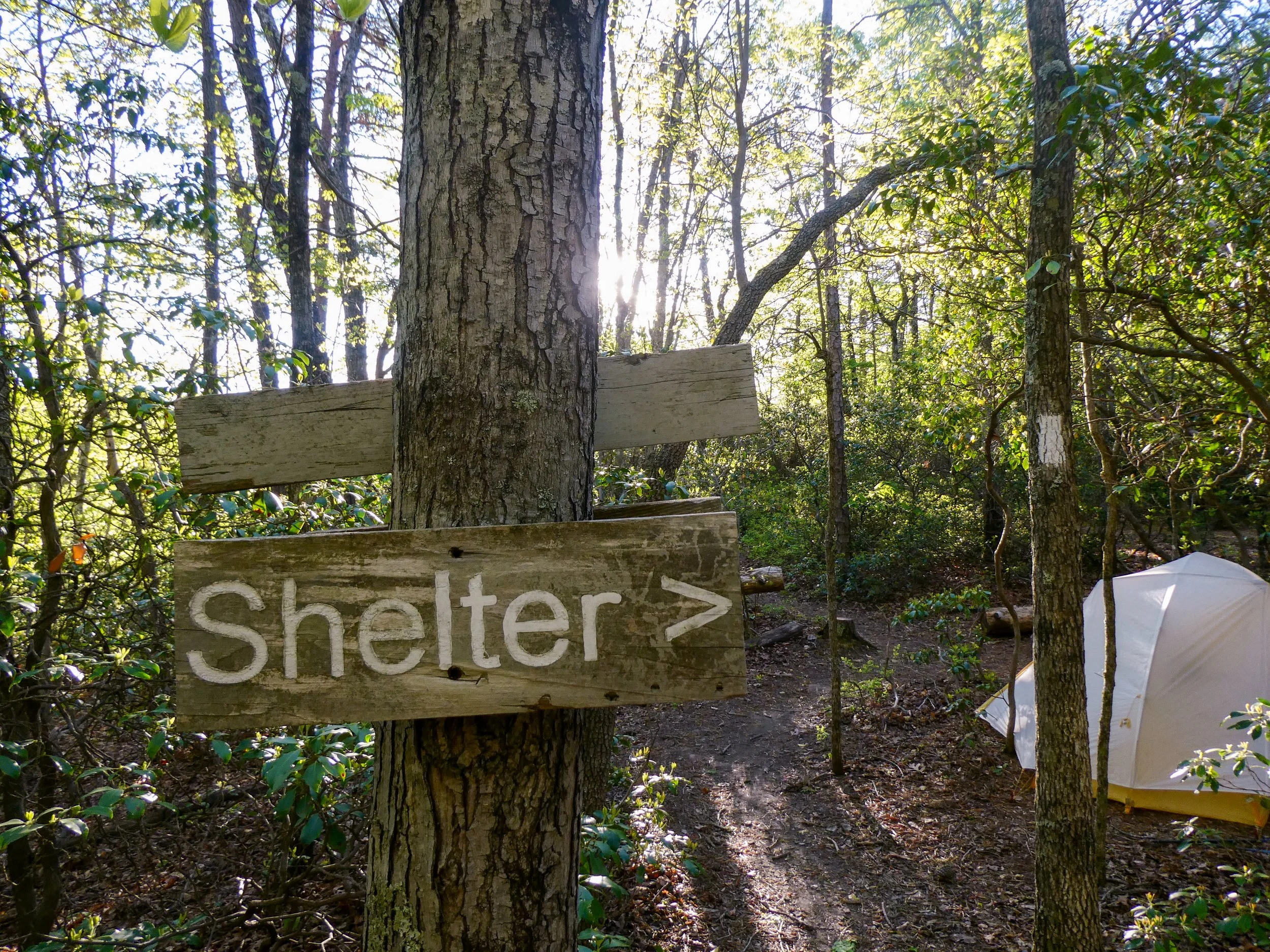
We made it to Bobblet’s Gap Shelter around 7:15pm. The shelter was hidden in a ravine at the base of a steep side trail. I stayed up top at the side trail junction for a bit to call AC. I then made my way down to the shelter and found Push, Overdose, and Blue Bear at the shelter. I was surprised to see Overdose. I told him that I hadn’t expected to see him again and he responded that he’d heard that a lot lately. Overdose and Push seemed to have struck up a fast friendship, which I suppose makes sense given their similar age and marital status. Blue Bear is one of the Little Hotties. He carries a Martin backpacker guitar which he played while we ate dinner.

There was virtually no flat ground surrounding the shelter, so I was forced to pitch my tent on a terribly graded patch near the privy trail. I’ll be sliding around tonight for sure.

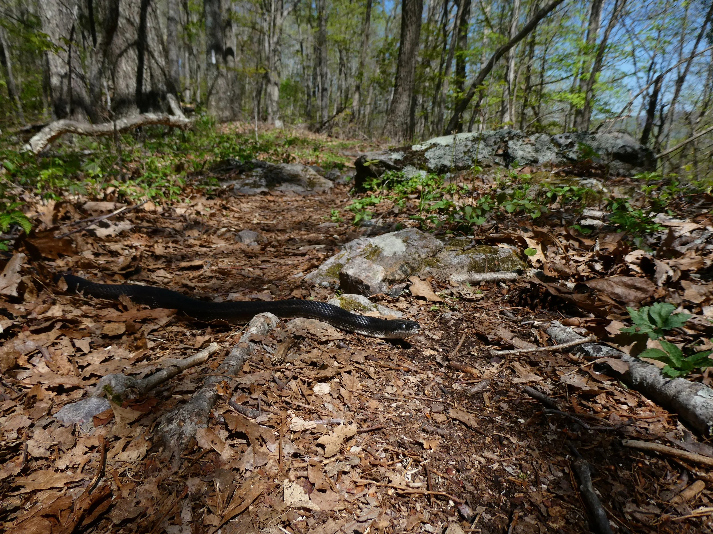
Better watch your step red spotted newts really like chilling on the trail

Quadruple tree!

May 03, 2021 /Jack Boyette
Comment

Hikers Log - trail date: day 56

May 02, 2021 by Jack Boyette

(John's Spring Shelter (mile 711.5)) - Daleville, Virginia (mile 730.3))

I woke up at 3:30am to the sound of obnoxious teenagers screaming as they walked past the shelter. Despite my annoyance, I’ll admit it was an effective alarm. I packed my things and was on trail a little after 4am. Being such a popular spot, the trail up to McAfee Knob was wide and well graded, which made for nice early morning hiking.

I made it to the knob at about 5:20am and found that the screaming teenagers had tried (and failed) to build a small fire in the middle of the trail right before the knob. Otherwise, I was the first hiker at the knob. According to Google, today’s sunrise was technically at 6:30am, but I began taking a timelapse as soon as the first light started to creep over the horizon. Lots of day hikers started showing up just as the sun was peaking over the mountains. Excel arrived and offered to take my obligatory McAfee Knob photos for me. I returned the favor.

Excel explained that she was meeting her husband in Daleville in two days, so she was taking it super easy. We hung around the knob to eat breakfast and then hiked on less than a mile to Campbell Shelter. I needed to use the privy and get water. Afterwards, I chatted with Excel a bit before hiking on without her.

The next 5 miles offered lovely trail and a plenty of great views. The AT then routed along Tinker Cliffs, providing dramatic panoramas for a half mile or so. I took my time through this section, stopping to snack and take lots of pictures. Of my three triple crown experiences, Tinker Cliffs was definitely the most peaceful. I had the cliffs all to myself. 

After Tinker Cliffs, the remainder of the day was almost entirely downhill. I was making decent time. I wanted to get to Daleville as early as possible so that I would have time to resupply, shower, do laundry, and maybe even take a nap before meeting Delta, Puddin, Clover, Katie, and Jasmine for dinner at a Mexican restaurant. To keep pace, I queued up a playlist of every Eminem song from my middle school iPod. It seemed to work as songs like “Lose Yourself,” “Till I collapse,” and “Like Toy Soldiers” drove me past Lambert’s Meadow Shelter, where I briefly stopped to collect water and start soaking my ramen lunch. After another 2.5 miles, I stopped at a nice overlook for lunch.

The next 7 miles followed the ridge as it gradually declined toward Daleville. The ridge was populated by several monolithic rock outcroppings, which provided excellent views overlooking the Carvin Cove Reservoir to the south. The trail then passed under three sets of powerlines and over a set of railroad tracks, before dumping me out at US Route 220, just outside Daleville.

Hay Rock

I arrived just before 2pm. The AT crosses US Route 220 just north of a major exit off Interstate 81. Thus, the area was less a charming trail town and more a sprawling commercialistic interstate pitstop. Fortunately, this meant there were cheap restaurants and motels galore. I walked beside the highway to resupplied at a nearby Kroger. I then met Delta, Clover, Puddin, Retro, and Jasmine (now “Jazz” or “PB&Jazz”) at Three Lil’ Pigs BBQ, which was in the same shopping center. Retro and Jazz were excited to explain that the group had settled on a trail family name: “Dino’s Assorted.” Which I believe referred to a brand of cheap plastic dinosaur toys that they had gotten a hold of. Or maybe it was off-brand fruit snacks. I don’t remember exactly, but the name was fine by me.

I had already eaten lunch, so I didn’t order any BBQ, but I enjoyed catching up with the other “Dinos.” They had apparently spent last night cowboy camping at Tinker Cliffs, where they had run out of water and had to hydrate with vodka😂 Delta was the only one planning to spend the night along the highway into Daleville, so we agreed to meet at the Mexican Restaurant for dinner. I then made my way to Motel 6, which involved an on-foot sidewalk-less crossing under Interstate 81. It was super sketchy and honestly maybe the most unsafe part of my thru-hike thus far. The scariest part was that I needed to do it three more times.

I checked in, showered, tarted my laundry, and took a nap. After my nap, I met Delta at El Pancho Mexican restaurant for dinner, which involved crossing under the interstate again. It was classic Tex-Mex fare. I ordered myself a big burrito smothered in cheese and a Modelo Negra. It hit the spot.

May 02, 2021 /Jack Boyette
Comment

Hikers Log - trail date: day 55

May 01, 2021 by Jack Boyette

(Niday Shelter (mile 687.8) - John's Spring Shelter (mile 711.5))

I woke up at 6:45am and got hiking at 7:45am. I had decided that I would stop at Catawba Grocery for a few supplemental food items, including some extra bars, chips, and meat packets. My goal for today was to get about 3 miles from McAfee Knob, which will make it a ~24 mile day. Including a stop at Dragon’s Tooth as well as Catawba Grocery, I expect it might be another late evening of hiking. Fortunately, I was getting a fairly early start. Tomorrow, I’m hoping to dawn hike to McAfee Knob and then end the day right outside of Daleville. That way I can hike in early the following day and basically have a zero day while only paying for one night in a hotel. Or maybe I’ll get into Daleville tomorrow. As always, only the trail will tell.

After almost 2 miles, I reached a large foot bridge over Craig Creek, which appeared to be a popular car camping spot. I then began a steep, 1,500 foot climb to the ridge of Brush Mountain. As I climbed, I was passed by a US Army recruiter whoo was joggin up the mountain. He stopped and walked with me for a bit, explaining that he was taking a group of Army recruits up to the Audie Murphy Memorial on the summit of Brush Mountain. The recruits were nowhere to be seen. Presumably they couldn’t keep up and were lagging behind, huffing and puffing up the mountain. I chuckled to myself. His behavior reminded me of my own when I was a canoe guide. At the first portage of every trip, I would sling a canoe onto my shoulders and blaze down the trail. I always thought of it as a reality check for my crew. I wasn’t going to hold their hand. I taught them what to do, now they had to execute what they had learned. Eventually, the recruiter jogged on.

At the summit of Brush Mountain, I briefly stopped at a memorial to Audie Murphy, the most decorated soldier of WWII, who died in a plane crash on Brush Mountain in 1971. He earned every military combat award for valor available from the United States Army, including the Medal of Honor, Legion of Merit, Distinguished Service Cross, and three Purple Hearts. He also received French and Belgian awards for heroism. Impressive.

I hiked passed John and Kayla and then stumbled on the remains of what appeared to be a controlled burn along the northern side of the ridge. The burn must have been recent because the ground was still smoldering as the trail wound down the northern slope of Brush Mountain. In the valley below, I ran into Lighthouse at a large campsite next to a bridge over Trout Creek. Lighthouse had stopped for lunch which he explained was a blueberry smoothie. Apparently, he has powdered meal replacement smoothies for lunch just about every day, which must be pretty expensive. As I was chatting with Lighthouse, John and Kayla caught up and explained that the smoldering slope of Brush Mountain was no controlled burn. They had run into a forest ranger who explained that there had been a small forest fire. Fortunately, the fire was only a small brush blaze and was easily contained.

I continued over Trout Creek and hiked up the next ridge. From there, I could see wispy columns of smoke rising from the Brush Mountain forest fire remains. Along the ridge, I also spotted my first pink lady slippers of the trail, which I initially mistakenly identified as carnivorous plants. Although they vaguely resemble pitcher plants, pink lady slippers are actually an orchid species. These orchids form mycorrhizal relationships with fungi, which are necessary for germination and growth. This makes pink lady slippers essentially impossible to cultivate, so they have to be appreciated in nature.

The next 3.5 miles routed me along a hot, dry, and exceptionally rock ridge. The rocks were a fun change of pace, although the trail was a bit tough to follow at times. I ran into a day hiking couple who were looking for Dragon’s Tooth. I explained that they were headed the wrong way and helped orient them northbound on the AT. I hiked on, admiring the occasional views offered from ledges along the ridge. I reached Dragon’s Tooth, which was both bigger and busier than I had expected. I ate lunch near the base of the tooth, surrounded by screaming children. As I ate, I reassessed my food situation and did a little mental math. I concluded that I should have enough food to get to Daleville tomorrow, as long as I dawn hike tomorrow morning. So I shouldn’t need to stop at the Catawba Grocery. After lunch, I climbed up to the top of the tooth for some spectacular views.

The hike down from the Dragon’s Tooth ridge got crazy technical. Most of the time, my trekking poles were utterly useless as I scrambled hand over hand down rocks and ledges. The descent was made all the more difficult by gaggles of day hikers who seemed to bottleneck the trail every few meters. I ended up scaling down some sketchier ledges in an effort to get past these throngs.

The afternoon was a scorcher, and my need for water soon outpaced my supply. As the last drop of water splashed from my bottle, I checked Guthook and was disappointed to learn that the next marked water source was in 1.7 miles. This was my first time truly running out of water on trail. 1.7 miles probably wasn’t dangerously far to hike without water, after all, I had felt pretty hydrated most of today, but I knew it would be unpleasant. As I hiked, I kept my eyes peeled for any unmarked streams. There had been many water sources earlier in the day that were not marked on Guthook. Unfortunately, this section was bone dry.

As I was slowly dying of dehydration, I realized I must have missed the 700 mile mark. It should have been on the ridge before Dragon’s Tooth. Oh well, Dragon’s Tooth will just have to serve as my 700 milestone🎉

After 0.8 miles, I reached VA Route 624, which is the road to Catawba Grocery. Across the road was a small footbridge over a stream not marked on Guthook. I consulted the app, which warned that “the water here is not good for drinking, as it runs beside the road and past many cow pastures upstream. I crossed the bridge and stared longingly at the water as it flowed beneath me. The next 0.9 miles involved a single, steep, pointless up and down (PUD), but I was highly motivated to reach the water source on the other side. After what felt like forever, I finally made it to the small brook marked on Guthook and chugged its cool, lifegiving water.

I soon found myself again hiking through cow pastures. Yesterday, John and Kayla had warned me about a monstrously steep hill at the end of a cow pasture. I soon found myself approaching the hill, which climbs over 300 feet in 0.1 mile. I might have done steeper climbs already, but for whatever reason, this one felt tougher. I think it might be because it’s up an open field, meaning that there’s no protection from the sun. Additionally, and maybe most critically, you can see the top of the hill in the distance, and without other trees or rocks for reference, it just feels like you’re not making any progress. Fortunately, the climb put me most of the way onto Sawtooth Ridge, which held Johns Spring Shelter, a little less than 5 miles away.

After 3.7 miles and a couple nice views, I made it to McAfee Knob parking lot, which was about a mile to the shelter. The parking lot serves as the trailhead for McAfee Knob, so I was soon surrounded again by day hikers. Some were on their way back from the knob, others were heading out, presumably in hopes of catching the sunset.

Photos never do steep hills justice… but trust me, this one was TOUGH

I soon made it Johns Creek Shelter. After setting up my tent I joined a group of hikers around the picnic table for dinner. I enjoyed chatting with the group, which included a philosophy professor who now teaches math to students with emotional trauma. Most of them were from Pennsylvania, and they warned me that the state really is as rocky as its reputation would lead a hiker to believe. As I crawled into my tent, I set my alarm for 4am with hopes of catching the sunrise over McAfee Knob.

Last drop of water both bottles are now empty guess I’ll just die now

May 01, 2021 /Jack Boyette
Comment

Hikers Log - trail date: day 54

April 30, 2021 by Jack Boyette

(Tentsite (mile 665.8) - Niday Shelter (mile 687.8))

I got hiking this morning at about 8:50am. I skipped breakfast in camp but motivated myself to get moving with a Honey Bun. I’m not sure where I’ll end up today. My stretch goal is a shelter in 22 miles, but there are a lot of ups and downs today. Steeps ones too. So we’ll see what happens. I’ve had a lot of long days lately.

I inventoried food last night, and I think I’ll have enough food to make it to Daleville, but I’ll need to reassess tonight to be sure. Tomorrow, I’ll have the chance to stop at the Catawba Grocery for a glorified gas station resupply. If I do 22 miles today, and another 20+ day tomorrow, then I should have a manageable hike into Daleville on the following day. With that plan in mind, I think the only resupply items I might want would be a few extra bars, but I wasn’t sure. I suppose these are the dilemmas of a thru-hiker.

I made it almost 4 miles to War Spur Shelter for breakfast. The shelter was really nice and I couldn’t help thinking it would be a lovely spot for a trail zero. I sat on a bench in a scenic clearing while eating my breakfast. Afterwards, I used the privy and found shelter log entries from Katie and Jasmine. I stopped at the creek just beyond the shelter to wash my face and fill my water bottles. As I was kneeling over the water, I was thrilled to spot a small crawfish just below the surface. Part of me wanted to stop and look for salamanders, but it was already 11:30am, and I had many more miles to cover.

Over the next 2.5 miles, the trail climbed nearly 1800 feet. It was an intense climb and I released a rather barbaric victory yawp when I finally summited the ridge.

My barbaric victory yawp

At the southern end of the ridge, I took a short side trail to Kelly Knob, an imposing set of cliffs with excellent views to the south. To get to the best views, I had to hop over some spooky crevasses, which was well worth it.

After another mile, I stopped for lunch at Laurel Creek Shelter. Another 2 miles brought me to a series of rolling pastures. The sun blended with steady wind to make for lovely hiking. As I walked, I watched butterflies visiting yellow wildflowers which populated the fields and danced in the wind.

I caught up to John, Kayla, and Aurora at a road crossing with VA Route 42. We started hiking together and John and Kayla explained that they had section hiked this portion of trail before. They called it the “Triple Crown.” I had never heard of the AT Triple Crown, and they explained that it referred to the series of iconic landmarks within this section of trail, including the Dragon’s Tooth, McAfee Knob, and Tinker Cliffs. I knew about the Dragon’s Tooth and McAfee Knob (famous for being the most photographed spot on the AT), but this was my first time hearing about Tinker Cliffs, so I was excited to discover what they had in store.

We soon stumbled on the majestic Keffer Oak, the largest oak tree along the southern AT. This incredible arboreal behemoth is estimated to be 300 years old. It was quite a site to behold and I made sure to let the tree know that it was “a good tree.” I think trees appreciate being appreciated.

Immediately following the Keffer Oak was our last big climb of the day. We made our way under two sets of powerlines and up to the ridge of Sinking Creek Mountain. Along the ridge, we hiked beside the mysterious Bruisers Knob cairns, which were supposedly constructed by early farmers to mark property boundaries. John suggested aliens as a more likely explanation. I’d say Occam’s razor cuts this one like butter. It was clearly aliens😂

The next three miles got pretty technical as we hiked along a rocky knifes-edge ridge requiring lots of rock scrambling. I was impressed with how well Aurora handled herself on the tough terrain, but even she had to be encouraged over some of the bigger rocks. As we moved along the ridge, we were treated to excellent views to the southeast.

At mile 685.2, we encountered a sign marking the Eastern Continental Divide. I consulted Guthook to learn what this meant. Apparently, all waters on the west side of Sinking Creek Mountain flow into the Mississippi River and on out to the Gulf of Mexico, while all waters on the east side flow into the James River and on out to the Atlantic Ocean. Pretty neat.

After a steady 3 mile descent, we reached Niday Shelter. I set up my tent and then broke a large tree branch trying to hang a bear bag. It was pretty stupid on my part. I got my line stuck and ended up ripping a sizeable branch out of the tree trying to recover it. The branch had been alive, so I felt really bad and apologized profusely to the tree. My line was recovered, but it hadn’t been worth hurting the tree.

SCHMOO - an acronym: smile, crouch, and heave a mighty organic object

April 30, 2021 /Jack Boyette
Comment

Hikers Log - trail date: day 53

April 29, 2021 by Jack Boyette

(Rice Field Shelter (mile 644.2) - Tentsite (mile 665.8))

I woke up around 7:30am and climbed out of my tent to discover a beautiful view from Rice Field. The field overlooked a valley filled with low-hanging clouds. The clouds creeped slowly through the valley, with small mountains and ridges rising through like rocks in a stream. Last night I had noticed lights from a distant town in the valley, but I hadn’t expected a view this good. After breaking down my tent, I sat for a while admiring the view. Unfortunately, I was out of water, so I needed to get moving if I wanted to eat breakfast.

I started hiking at 8:20am. I didn’t really have a goal in mind as far as a destination. I was chafing pretty bad yesterday, so I hoped that wouldn’t be a problem today. Chafing could really put a damper on my mileage. My biggest consideration was getting to Daleville in five days, where I’m planning to nearo. There’s also the Four Pines hostel between here and there, so I could potentially stop in there if I need a supplemental resupply or if I’m just in desperate need of a resupply. Otherwise, there are some big landmarks before Daleville, including the Dragon’s Tooth and McAfee Knob, so I have a lot to look forward to.

About a mile past the shelter, I stopped under some power lines, sat on a rock, and called Anna Claire. We chatted for a while and then I continued on to the first water source about a half mile later. I ate breakfast at the spring and filled up 2 liters of water for a 10.5 mile carry. The first 4 miles should have made for easy morning hiking along the ridge. Unfortunately, the ridge must have recently suffered a blow down and I was forced to constantly bushwhack to avoid trees and limbs strewn across the trail. It felt like I was spending more time off the trail than on the trail as I serpentined along the ridge. Eventually, I reached a short series of meadows. The trees were in full bloom and I was treated to excellent views to the north. At this point, I realized that I had spent the morning hiking along the Virginia/West Virginia border. To my right, towards the south, was Virginia. To my left, towards the north, was West Virginia.

Views of West Virginia to the north

The day was quickly revealing itself as another scorcher. About 2 miles beyond the fields, I was surprised to find a nice seeping spring just off the trail. I was about 6 miles into what I had expected to be a 10.5 mile carry, so this was a welcome surprise. I stopped at the spring and discovered, to my delight, a gaggle of stream salamanders.

I don’t think I realized this at the time, but there are at least two salamanders in this picture

After 1.5 miles of steep climbing, I came over the ridge and was nearly attacked by a groundhog😅 I don’t really know how else to explain it. I was hiking along, minding my own damn business, when I heard rustling, looked up, and noticed a brown furry creature ahead and to the right of the trail. At first, I thought it was a squirrel. But no, it was too big to be a squirrel. Was it a beaver? That didn’t make any sense. Sure enough, it was a groundhog. It stared at me and I stared back. The rodent wasted no time and charged down the trail. It was wild. For one thing, I’ve never seen a groundhog this big in my life. Further more, I’ve never seen a groundhog move this quickly. It ran right at me. As I fumbled around, trying to get my camera out, the groundhog darted past, inches from my feet, ran up the hill and disappeared into a group of rocks. I stood there, maybe a little in shock, but mostly just confused. Definitely not a wildlife encounter I was expecting.

I hiked on, past a trail junction with the Allegheny Trail, and then continued 2.5 miles downhill to Pine Swamp Branch Shelter for a late lunch. While I ate, I began chatting with a mother and son pair of hikers I had briefly encountered at the Econolodge in Marion. They introduced themselves as “Snake Whisperer” (mother) and "Numbers" (son). Numbers is a triple crowner who has hiked the PCT twice, the Arizona Trail, and probably other trails he didn’t even mention. Numbers and Snake Whisperer were doing a section of the AT together. We talked for a while about gear and food. Honestly, I was taken aback by how humble and down-to-earth Numbers was. Although he is by far the more experienced hiker, he was super interested in my food strategy and stoveless set up. It was a cool interaction.

I left Pine Swamp Branch at about 3:30pm. Bailey Gap Shelter was in about 3.9 miles, but I definitely wanted to get further than that. The next shelter after Bailey Gap was in about 12.7 miles, which would make today a ~23 mile day. I wasn’t really feeling like another late arrival in camp, so I figured I’d maybe aim for a marked campsite on the ridge between the two shelters. Otherwise, I might grab a nice stealth site if one presented itself. I’m a little doubtful about stealth camping options though. The ridges have been densely populated with widow-makers and fallen trees, and the wind was pretty crazy last night. I guess we’ll see what happens.

After 2.4 miles, I made it to a bridge over Big Stony Creek and was struck by a sudden, all-consuming need to dig a cathole. The next 1.5 miles included some really steep uphill and light rain. I passed Bailey Gap Shelter and continued to the top of the ridge where I was hoping to camp. I stopped briefly at the first water source along the ridge, which was barely more than a trickle, bubbling from a bank along the right side of the trail. As I was filling my bottles, I met "Overdose," a thru-hiker who is finishing his triple crown. Overdose complained that his pace had been really slow all day. At this point, it was about 6pm, and I had 3 more miles to go until the marked campsite. Overdose had 7 more miles to the next shelter. I offered that we could hike together and maybe motivate each other to move a bit faster.

As Overdose and I continued along the ridge, he explained that he is married and lives in Reno, Nevada, although he’s originally from Orlando, Florida. He previously hiked the PCT and CDT, and is now hiking the AT mostly out of a sense of obligation to finish the triple crown. From what I could tell, he didn’t seem too fond of the AT, so I switched topics and we chatted about amphibian chytrid fungus for a bit. We encountered John and Kayla near a short spur trail to the Wind Rock overlook. They were calling for Aurora, who had apparently decided to run off into the woods. Kayla explained that Aurora does this sometimes, possibly as a rebellion when she’s tired and doesn’t feel like hiking any more. We offered to help, but they insisted that they could handle it, so we wished them luck and continued on.

We made it to my campsite around 7pm. I said farewell to Overdose, knowing I’d probably never see him again. The rain held out long enough for me to set up my tent, eat dinner, and soak my feet. As I was about to turn in for the evening, John and Kayla arrived, and I was relieved to see Aurora in tow.

April 29, 2021 /Jack Boyette
Comment

Hikers Log - trail date: day 52

April 28, 2021 by Jack Boyette

(Wapiti Shelter (mile 618.2) - Rice Field Shelter (mile 644.2))

I woke up at about 7am and ate breakfast with a thru hiker couple named “Roadtrip” and “Paradise.” The couple had been in their tent when I reached the shelter last night, so I was just meeting them now. Strangely, I realized I recognized them from Instagram. In the weeks before I started my hike, I had kept track of AT-related geotags and had seen them start their thru-hike at Amicalola Falls. They had started long before me, but explained that they hike slowly and had gotten off trail for a bit as well. After Roadtrip and Paradise started hiking, I chatted with Doc, who gave me his phone number told me he and his wife would offer me a place to stay when I got to Rockfish Gap Just south of Shenandoah National Park.

I started hiking around 8:30am. I passed Roadtrip and Paradise just before the last spring before a 8.2 mile water carry. I climbed for a mile and was rewarded with excellent views over an area which Guthook identified as the Wilburn Valley.

Early morning panorama overlooking the Wilburn Valley

The goal for today is to pull a hero in and out of Pearisburg, which was 17.4 miles from Wapiti Shelter. A relatively short 0.7 mile road walk should get me into town, where I’m hoping to secure a small supplemental resupply. I expect it should take me five days to get from Pearisburg to the next resupply in Daleville, so I need an extra day of food. Ideally, I would like to set up camp at a stealth site near the road into town, walk in, resupply, grab dinner at Dairy Queen, and get out of town. There are almost always campsites near roads, so I think this should be doable even though there’s nothing marked on Guthook or AWOL. We shall see.

Over the next 6 miles, the trail continued lazily along the ridge, passing over the Ribble Trail blue blaze and Big Horse Gap Road. At mile 625.5, I crossed the road leading to Wood’s Hole Hostel, one of the oldest and most iconic hostels on trail. Started in 1986, Wood’s Hole is now famous for its organic, partially homegrown meals and free afternoon yoga class, offered every day at 4pm. I felt a little sad to be passing Wood’s Hole without a stop, but that’s just how it worked out. So it goes.

At mile 626.8, I noticed a small sign marking a short side trail to a “VIEW↑.” I took a chance and was glad I did. I was treated to a wonderful panorama of the Wilburn Valley, this time looking towards the southeast. Directly to the south, I could see the ridge I had been hiking earlier this morning. As I made my way back to the trail, I spotted a garter snake which quickly darted away through the leaves.

Today I passed Wood’s Hole Hostel, one of the most famous hostels on the AT. Unfortunately, I was only a couple miles into the day, so I decided to hike on

I always stop for views

Definitely worth a stop :)

After another mile I reached Doc's Knob Shelter, where I stopped to eat lunch. As I was eating, a thru-hiker couple reached the shelter accompanied by a black lab. They introduced themselves as John and Tracy, clarifying that they had not yet found suitable trail names. They introduced their canine companion as “Aurora.” I learned that John and Tracy were students at MIT who had taken a gap year to work and thru-hike. I asked if they had met Delta. They hadn’t, although they had heard there was another MIT student thru-hiking this year. As I finished my lunch, John noticed someone’s abandoned bear line stuck in a tree in front of the shelter. Apparently, he always tries to get bear ropes unstuck whenever he finds them. I watched with bewildered amusement as John attempted to get the rope out of the tree. When I left the shelter to continue hiking, he was still at it. I never learned if he was successful.

Doc’s Knob Shelter, with a very conveniently located spring right in front under the porch

I stopped for Lunch at Doc’s Knob, elevated my legs, and let my feet breath

The next 3.7 miles beyond Doc’s Knob Shelter involved more rolling ridge hiking through forests thick with rhododendron. Through this section I listened to the album “Strange To Explain” by Woods. This is the eleventh studio album from Woods, but the first and only album that I’ve listened to. I like it quite a lot. It’s a folky, psychedelic, and dreamy album, with a generous serving of mellotron. As the band name might suggest, this is good music to listen to in the woods. After passing under a huge set of powerlines, the trail offered excellent views to the east for the next 2 miles, culminating in the Pearis Ledges.

Excellent views from the Pearis Ledges

Today has been hot, and the trail has been super dry. Just beyond the Pearis Ledges was a blue blaze to a reliable spring. I needed water, but unfortunately the spring was 0.2 miles off trail. I sucked it up, dropped my pack, and hurried down to the spring. After collecting water, another half mile brought me to the short side trail for Angel’s Rest, a pride-rock-type outcrop with excellent views overlooking Pearisburg. After admiring the views, I stopped to dig a quick cat hole as I made my way back to the trail.

Water has been super sparse today, so I sucked it up and made the 0.4 mile round trip for water

View from “Angel’s Rest” overlooking Pearisburg

I ran into John, Tracy, and Zero when I finally returned to the trail, and we hiked together for the descent into Pearisburg. As we made our way down the ridge, John and Tracy discussed their ultralight philosophy. They’re way more strict than I am. Case in point, they also received AT hang tags from Paperclip, but decided not to keep them because the tags registered on their scale (surely a fraction of a gram😂). Consequently, their packs are TINY. They don’t even need hip belts!

This power line draped precariously low over the trail, it was maybe only a couple inches above my head

After 2 miles of downhill, we reached the first road into town, which supposedly leads directly to Dairy Queen. I had been on the lookout for stealth sites, but none presented themselves, so I opted to take the 0.7 mile road walk with Zero. The walk was easy, and sure enough, we were lead directly to DQ. But before I could grab ice cream, I needed to stop at Food Lion to grab my small resupply. 

After Food Lion, I returned to DQ, where I found John and Tracy. The restaurant was closed to indoor dining, so we joined the line of cars for the drive-thru. I ordered two small Blizzards and a 6pc chicken tenders basket. We sat at tables in front of the DQ where I ate both Blizzards and opted to pack out most of the tenders and fries. As we were about to head out, Push appeared and I explained that he needed to join the drive thru line to order. As I was chatting with Push, Tracy flagged down a truck and asked if we could hitch a ride back to the trail. I hopped in the truck bed with Tracy, John, and Aurora and we were soon back at the trail head.

After grabbing some dinner at Dairy Queen, I hitchhiked out of Pearisburg with two fellow thru-hikers, John and Tracy, along with their hiking companion Aurora

Over the next mile, I chatted with John and Tracy about my research interests, including frogs, chytrid, and CRISPR. We passed a small waterfall and soon made it to the second road into Pearisburg. There, we encountered a large group of thru-hikers gathered in a parking lot. I didn’t recognize any of them, but John and Tracy did. The group was zeroing in Pearisburg at an airbnb. They had a puppy with them. I have no idea where it came from, but the image of a girl sitting in the grass, puppy in her lap, rolling a giant blunt will live rent free in my mind for the rest of my life.

John and Tracy stayed to chat with the group and I hiked on. I took a wrong turn and ended up in an old cemetery watched over by an ancient white oak. I backtracked and was soon back on trail. A short 0.3 miles brought me to US Route 460 and a large bridge over the New River.

I took a wrong turn and ended up in an old graveyard featuring an ancient white oak

The trail routed over a huge bridge crossing the New River

This chemical plant just outside of Pearisburg smelled absolutely awful and made the last few miles pretty miserable!

Beyond the bridge, the trail routed past a rank-smelling chemical plant. The climb out of town was rough. Not only was there a lot of uphill, but the smell of a nearby landfill hung thick in the hot afternoon air, filling my lungs and making me feel ill. There was a stream about a mile beyond town, but spooky signs warned about pollution from landfill run-off. This section of trail sucked. There’s no polite way to put it. There were gross reminders of humanity everywhere I looked. Trash, old fencing, and that god-forsaken smell! I had already hiked over 18 miles today and I was tired. I had hoped I could find a campsite on the outskirts of town, but the smell and lack of clean water forced me onwards and upwards. The afternoon was hot, I was thirsty, and I was chafing like crazy. I tried using Vaseline to minimize friction, which maybe helped a little. Emphasis on “maybe.”

Stairway to heaven

After 5.8 miles of climbing, as the sun was fading in the sky, I made it to the first clean water source beyond Pearisburg. I had been out of water for a while. I sat on a rock, and chugged the cool spring water. I was exhausted.

After another 0.6 miles, I made it to Rice Field Shelter at about 8:20. To the north, I could see the lights of a small town which I later learned was Peterstown. There was enough residual light to hang a bear bag. Barely. I’m not sure why I even bothered. I ended up setting up my tent in the dark, which was huge pain in the ass given the darkness, my own exhaustion, and the rock-infested ground. Eventually, one bent Easton stake later, I was successful. I crawled into my tent and gobbled down my remaining chicken tenders and fries. As I ate, I heard John and Tracy arrive. Today was by far my longest day of hiking. Including the walk into town and all my blue blaze detours, I easily hiked over 27 miles! Sleep came easy despite strong winds.

Into Pearisburg just to get some Dairy Queen then back to the trail

April 28, 2021 /Jack Boyette
Comment

Hikers Log - trail date: day 51

April 27, 2021 by Jack Boyette

(Lickskillet Hollow (mile 605) - Wapiti Shelter (mile 618.2))

After a pancake breakfast, AC and I left our Airbnb yurt in West Virginia, stopped at the Cathedral Café for lunch, and got back to trail head around 1:45pm. We sat in the tailgate of her Subaru Crosstrek while I finished the cassoulet and baklava ice cream that we had prepared yesterday. It was delicious! Many hikers walked past while we sat at the trailhead including Dr. Cheese, Calypso, Maverick (an older gentleman I met in the Smokies), Meatsuit, and Cap'n. A couple of them mistook AC’s car for trail magic, which was probably a bit disappointing for them😂 AC and I both agreed that it would be fun to do trail magic in the future.

After a tough "see ya later," I got hiking around 2:30pm. Despite my late start, I wanted to make it as far as possible. The ambitious part of me thought that Wapiti Shelter, 13.2 miles ahead, should be my goal. I made it about half a mile and had to dig an emergency cathole. Afterwards, I met a thru-hiker named "Zero" from Macon GA. Zero got his trail name because he has not taken any zero days yet, which is impressive, considering we’ve hiked over 600 miles (and I’ve already taken four zeros). He has worked in commercial contracting and started his thru-hike almost two weeks after I did. I enjoyed chatting with Zero, and we ended up mostly hiking together for the next 4 miles.

During this time, I was stoked to spot my first rat snake on trail! It was hard to miss, stretched out perpendicular across the trail like a black hose. The day was hot, so I’m sure the snake was enjoying the afternoon sun. As I approached to get photos, the snake rustled the tip of its tail in the leaves in an effort to imitate a rattlesnake. When this display failed to put an end to the photo session, the rat snake opted to slowly slither away.

This is the first rat snake I have encountered on trail!

Crossing a large, narrow swinging suspension bridge over Kimberling Creek

This bridge was huge!

Zero and I crossed a very impressive swinging suspension bridge over Kimberling Creek, which might be the coolest footbridge I’ve crossed on trail. Afterwards, I stopped to collect water and Zero hiked on. I hiked another 2 miles, dropped my pack, and took the 0.3 mile side trail to Dismal Falls, which was a nice spot.

Dismal Falls is found at the end of a 0.3 mile side trail off the AT

The trail followed Dismal Creek for the next 7 miles. Hiking near water is always convenient because it means I don’t need to carry much. I quickly lost count of the number of small bridges and stream crossings. Much of this section was dominated by dense tunnels of rhododendron, but there was also a short stretch in a beautiful pine forest. The golden hour light bathed the trees in a warm glow and I spotted a group of deer prancing through the undergrowth. I saw deer two days ago on my road walk to Lickskillet Hostel, but these were my first deer spotted while hiking on trail, and I was again struck by how big they looked.

As I hiked, I spent a lot of time considering my resupply options. The next resupply spot is Pearisburg, which I’ll reach tomorrow. After that, the next major grocery store is Daleville, which is at mile 730.3. That’s 112.1 miles from where I plan to camp tonight. Between Pearisburg and Daleville is a potential gas station resupply. So, I really need to figure out how many days it’s going to take for me to get from Pearisburg to Daleville. I resupplied with AC, so right now, I’ve got four full days worth of food, plus a dinner for tonight. That makes the timing of hitting Pearisburg tomorrow a little awkward. I think probably the best approach will be to stop in Pearisburg to grab things I can’t get at the gas station resupply (e.g avocados), since I can probably find most basics at the gas station (e.g. ramen). I need to sit down tonight and take an inventory of my food, consider the mileage, think about how many days it will take, and figure out what exactly I need to pick up in Pearisburg. This will be the hardest I’ve had to think about a resupply😅 I might find that I just need one or two non-essential items. If so, I could skip Pearisburg altogether and roll the dice on a gas station resupply. Making a few substitutions won’t be a big deal. That’s just how it is sometimes.

About 6 miles past Dismal Falls, I reached a small pond just before Wapiti Shelter. I stopped briefly to watch the fish swimming in the shallows, and then made my way to the shelter at just about 7pm.

A trail crew appeared to be renovating the shelter. Logs and lumber were strewn around the campsite in a haphazard manner. I set up my tent and then backtracked a bit to soak my feet in Dismal Creek. The water was painfully cold, but afterwards my feet felt rejuvenated. I made my way back to the shelter and met two older gentlemen named “Doc” and “Chief.” Doc is a retired state veterinarian from Virginia who thru-hiked in 1975. He showed me a tattoo on his calf, which had ‘75 imbedded in the AT logo. Doc was an abundantly cool dude. I asked him about how the trail had changed since 1975 and he explained that there used to be a lot fewer bridges. A thru-hike in 1975 involved regularly wet feet.

Oh, and apparently this shelter is known as “the murder shelter.” Doc explained that a man from Pearisburg murdered two hikers here at Wapiti Shelter in 1981. I later learned that the man’s name was Randall Lee Smith. He served 15 years for the murders, and then was released on a 10-year probation despite outrage from locals and the hiking community. In 2008, he disappeared from his home and was found and then attempted to kill two fishermen in 2008. He died after stealing and crashing one of the fisherman’s’ truck. Spooky👻

I found some ramps and added them to my ramen before hanging a bear bag and retiring for the evening.

Foraging wild leeks for a gourmet ramen bomb four Michelin stars

Wapiti Shelter featuring "Doc" (standing), a retired state veterinarian from Virginia who thru-hiked in 1975

April 27, 2021 /Jack Boyette
Comment

Hikers Log - trail date: day 50

April 26, 2021 by Jack Boyette

Zero day with AC!!!!

A peak inside our Airbnb yurt in Fayetteville, West Virginia

Picnic under the New River Gorge Bridge

April 26, 2021 /Jack Boyette
Comment

Hikers Log - trail date: day 49

April 25, 2021 by Jack Boyette

(Helvey's Mill Shelter (mile 594) - Lickskillet Hollow (mile 605))

I woke up this morning at about 6:45am. It had been raining on and off last night, but at this point the rain seemed to have let up. I packed all my wet gear, ate breakfast, and realized I needed to collect water for a 7 mile carry. Unfortunately, the shelter’s water source was located down a long side trail at the bottom of a deep ravine. I had no choice but to make the pilgrimage to fill my bottles at the bottom of the ravine. The water trail felt like a never-ending series of switchbacks, and by the time I finally reached the creek, I felt myself growing anxious about how far I needed to hike this morning.

I finally started hiking at about 8am, giving me approximately 4 hours to hike almost 11 miles to Lickskillet Hostel where I was planning to meet AC. So, I needed to set a pace of about ~3 miles/hour, which is fast, but doable. I knew I would need some good music to motivate me, so I put my earbuds in and queued up the hypest playlist possible. The hard-hitting, bombastic sounds of Peewee Longway’s “The Blue M&M 3” and Benny the Butcher’s “Butcher on Steroids” helped me maintain warp speed as I tread my way along the rolling ridge.

After 6 miles, I reached the 600 mile mark! I stopped briefly to release some celebratory yawps and take pictures, but I was soon moving again.

The next 5 miles were much the same, a steady rollercoaster of small ups and downs along the ridge. I felt really good as I hiked. I felt strong. I felt happy to be flying down the trail at top speed, knowing that AC and I would be together soon.

I made it to Price Ridge Road, which runs through Lickskillet Hollow, at 11:35am. Lickskillet Hostel was a half mile road walk to the south. As I began the road walk a family of large deer darted across the road and up the sloped embankment. From there, they eyed me cautiously. These were the first deer I had spotted since starting the AT. They clearly appeared to be white-tailed deer, but they also seemed larger than the deer in Georgia. Maybe they were a different subspecies? Or maybe this was a case of Bergmann’s rule in action?

As I was completing the road walk, I glanced down into a roadside ditch and noticed what appeared to be an unopened bottle of beer. Closer inspection revealed that it was indeed a wholly intact, sealed Deschutes Fresh Squeezed IPA. The ditch had kept it nice and cool, so I scooped it up, threw it in my packed, and internally debated whether I should drink it as I continued my road walk. I made it to Lickskillet Hostel at about 11:45am, and found the building completely deserted. It was a really cool open concept, set up in an old church. There were several bunks arranged along one wall, as well as a kitchen area, three hammocks, a pool table, and a big movie watching station. Paint Splash had painted a number of murals in the entranceway and a two part sunset scene along the wall of beds.

Lickskillet Hostel is housed in an old country church building

Yesterday, I had hoped to do my laundry at Lickskillet, but at this point I realized that I didn’t have time (or quarters). Instead, I opted to wait for AC on an old church pew in front of hostel. I finally decided to drink the ditch beer, and cracked it open with my trekking pole. Now, I’ve done some questionable things on trail. Especially when it comes to finding and eating food on the ground. But this felt particularly cretinous. Don’t get me wrong… I had no regrets. It was cool and refreshing. I felt nice, sitting there after a big morning, sipping my ditch beer😁 Cheers to 600 miles!!!🍻🍾🎉

Cheers to 600 miles!!!

Lickskillet is filled with murals painted by Bobbie Drelick AKA “Paintsplash”, who has painted murals for many hostels I have visited. I believe she painted many of these murals while completing her own thru-hike!

Less than 1,600 miles until Katahdin…

A peak inside Lickskillet Hostel

April 25, 2021 /Jack Boyette
Comment

Hikers Log - trail date: day 48

April 24, 2021 by Jack Boyette

(Walker Gap Campsite (mile 571.3) - Helvey's Mill Shelter (mile 594))

I woke up at 6:35am and packed as quickly as possible. After eating breakfast in camp, I started hiking at about 7:45am. I was the last person to leave camp. Hopefully, I could get at least a couple hours of hiking in before the rain started. The morning air felt really nice, and although the sky was overcast, the clouds didn’t look too spooky. Definitely rain, but probably not any crazy thunderstorms.

My goal for the day was to hike as far as possible. AC is picking me up tomorrow in Bland, VA. We have an Airbnb yurt in West Virginia that I’m super excited about. Unfortunately, I don’t think the yurt has a washer and dryer. So ideally, I think I should try to do laundry before AC picks me up, but it doesn’t look like there is anywhere in Bland where I can wash my clothes without staying the night. AC is projecting that she’ll get to Bland sometime around 12:00pm - 1:00pm, so potentially I could hike a little past Bland tonight, and then tomorrow morning I could make my way to Lickskillet Hostel and do my laundry while I wait for AC. The road into Bland (Interstate 77) was 21.1 miles away and Lickskillet Hostel was another 12.6 miles beyond that. It was an ambitious plan that might not be possible. We’ll just have to see if the weather and my body cooperate.

Elevation held pretty steady for most of the morning, with lots of rocky ups and downs along the ridge. After 6.5 miles, I passed Mr. Darcy, who explained he’s a slow hiker, just before the trail began to descend from the ridge into a gap. Around this time, the clouds to the south started growing ominous, but the rain continued to hold out. At this point in the morning, I was listening to Brother Ali’s newest record “Secrets and Escapes.” Brother Ali is hands down my favorite musical artist. This project is a bit of a departure from Ali’s usual material, at least in his approach to its creation. Ali is an incredible songwriter, who usually creates painstakingly polished raps with strong thematic and narrative focus. His music is beautifully dense and powerful. “Secrets and Escapes” was created in a much looser, spontaneous manner. The album is produced entirely by Evidence, using an old school physical sampler and 2-track compressor, and was recorded entirely in Ev’s garage studio. In interviews, Ali has explained that he recorded many of the tracks in the moment, bar by bar. More of a stream of consciousness - a bit like freestyling. I knew none of this when I first heard the album. My first listen left me a bit confused. It wasn’t what I expected. But over time, the project has continued to grow on me. Highlights include “Red Light Zone,” “They Shot Ricky,” and “Father Figures” (which, Ali has explained, is the only song he wrote ahead of time).

The trail descended from the ridge for about 2.8 miles towards Jenkins Shelter near Hunting Camp Creek. Just before I reached the shelter, I was passed by a man hiking at a furious pace. As he breezed past me, I noticed that he had trekking poles but wasn’t even using them. Instead they were strapped to his pack, as I might do if I was in town. When you hike as fast as he was, trekking poles must just get in the way. When I reached the shelter I found Mr. Speed Racer, who introduced himself as “Skywalker,” which I think was simply a reference to his legal first name, Luke. As we ate lunch, ASAP and Delta reached the shelter. Soon afterwards the rain started. Skywalker finished his lunch, slung his pack on, and began to hike off at a brisk pace. ASAP shouted: “Slow down!” after him, to which Skywalker replied: “Hike your own hike!” Fair enough, I suppose.

After 4.5 miles of hiking in mild rain, I crossed over Laurel Creek on an impressive footbridge. At this point in the afternoon, I had wandered down a bit of a musical memory lane and was listening to Hollywood Undead, a band from LA who’s genre can fairly be classified as rap-rock. Hollywood Undead’s music was huge for me in middle school, and many of their songs (e.g. “Young” and “This Love, This Hate”) were anthems of my formative years. My first concert was Hollywood Undead. My buddy Connor and I saw them at the Tabernacle in Atlanta, chaperoned by my father, while they were touring off their 2011 sophomore project “American Tragedy.” It was awesome. As I hiked, I listened to their debut 2008 album “Swan Songs,” followed by the “Swan Songs B-Sides EP,” and finally “American Tragedy.” I loved these albums back in the day. Returning to them a decade later, I found that my old favorites still brought a lot of joy. I’ll admit that even back in middle school I found some of their songs cringey, and those songs certainly didn’t hold up.

For the next 6.3 miles, I queued up a string of high school throw backs, including albums from Tacoma, WA rap crew ILLFIGHTYOU and Atlanta rapper ILOVEMAKONNEN. It was no longer raining so much as it was misting. I hiked by two overlooks at mile 587.3 and mile 588.8, but was mostly treated to views of clouds. I briefly caught up to ASAP who explained that he was meeting a friend in Bland and asked if he could take my picture. He liked to take pictures of fellow hikers and people he met along the way so that he could remember them.

At mile 591.2, I reached the south end of a long 1.5 mile road walk which led over Interstate 77. The road walk was exposed, windy, and cold. Overall a fairly miserable affair. On the other side of I-77, I was happy to be routed back into the woods, which offered relief from the wind. Another 1.4 miles brought me to Helvey's Mill Shelter, which was located about a quarter mile off the trail. When I reached the shelter, I found Push, Excel, and Skywalker huddled inside. I set up my tent behind the shelter, but opted to sit in the shelter for dinner. Skywalker offered me foraged ramps (a wild leek) and explained how to spot them. I added the ramps to my ramen and it was delicious! Nothing quite like a fresh veggie on trail. Skywalker explained that he lived in a tiny home outside Asheville where he foraged professionally. He apparently made a killing supplying local chefs with gourmet mushrooms and seasonal veggies like ramps. Apparently, he had gotten most of his AT gear in a trade with the owner of Mountain Crossings for a massive amount of gourmet mushrooms!

After dinner, I hung my bear bag with Excel and then made a stop at the privy before bed. The privy was entirely exposed to the elements, with a single large wall of plywood installed to breakup the line of sight between the privy and the shelter. It was private enough.

After 22.7 miles - which I think is my longest day so far - I was feeling pretty tired. Feeling good, but tired.

April 24, 2021 /Jack Boyette
Comment
  • Newer
  • Older

© 2023 John Boyette