Amphibian Ecology & Evoloution

with John Boyette

  • About
  • Research
  • Outreach
  • Hikers Log
  • Photography
  • Illustration
  • Contact

Hikers Log - trail date: day 47

April 23, 2021 by Jack Boyette

(Reed Creek Campsite (mile 552.5) - Walker Gap Campsite (mile 571.3))

I slept in this morning until about 8am. I wanted to get moving so I opted to skip breakfast in camp. I ate a bar and started hiking at about 8:40am. When I left, the biscuits and gravy crew had not packed and were still milling about camp. My goal for the day was to hike about 18 miles to a campsite just past Chestnut Knob Shelter. I could stay at the shelter, but adding an extra mile to the end of my day will make it easier to get another 18-20 miles in tomorrow, which should put me right outside Bland, VA. I guess my real goal is to just get as many miles in as possible. Everyone has been telling me that there is crazy rain and possible flash floods forecasted for tomorrow. So that should be fun. The morning air felt nice. It was cool, but not as cold as yesterday - and certainly not as windy. I hiked about a mile and ate breakfast on a rock next to a creek in a grove of mountain laurel.

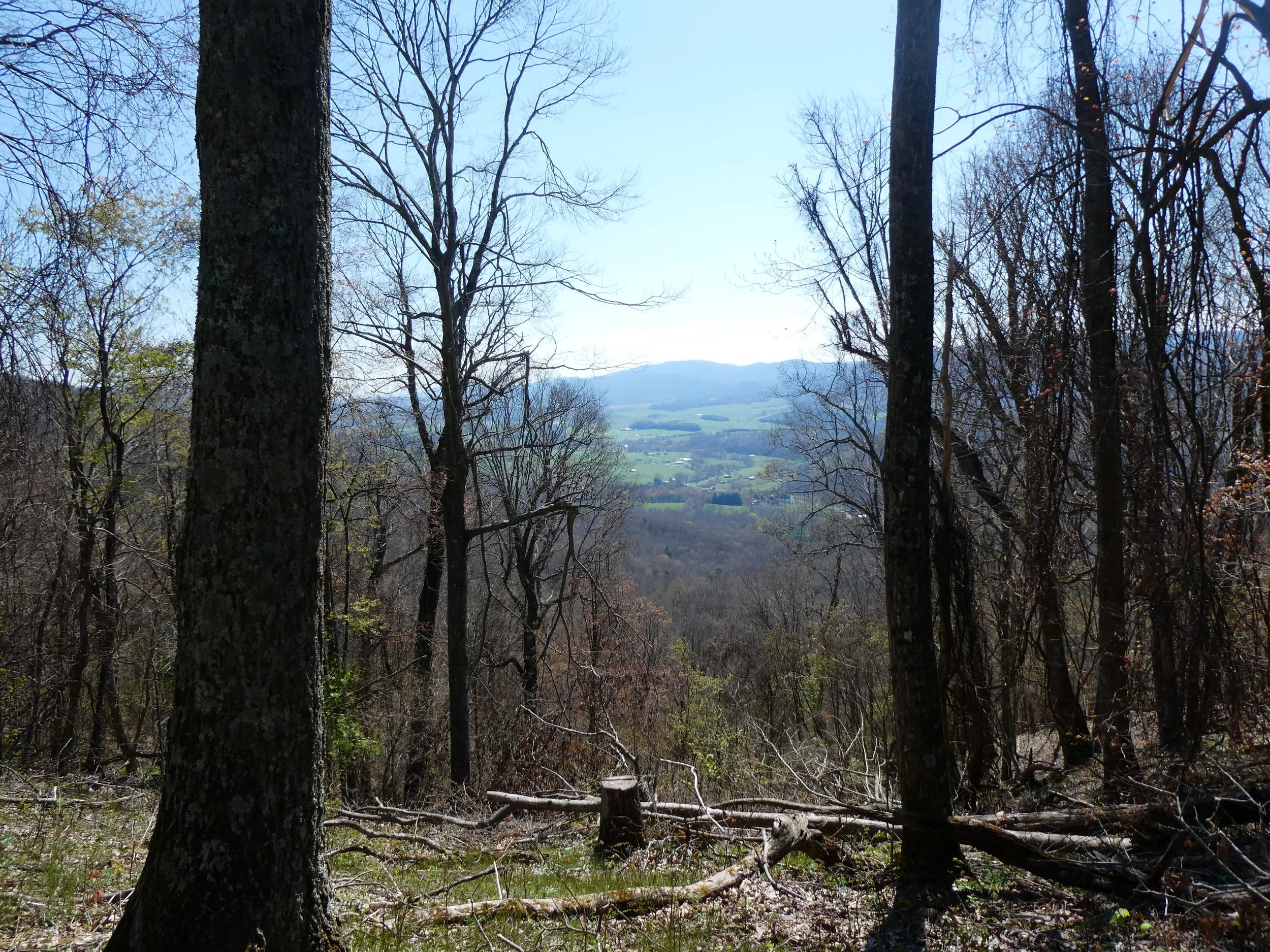
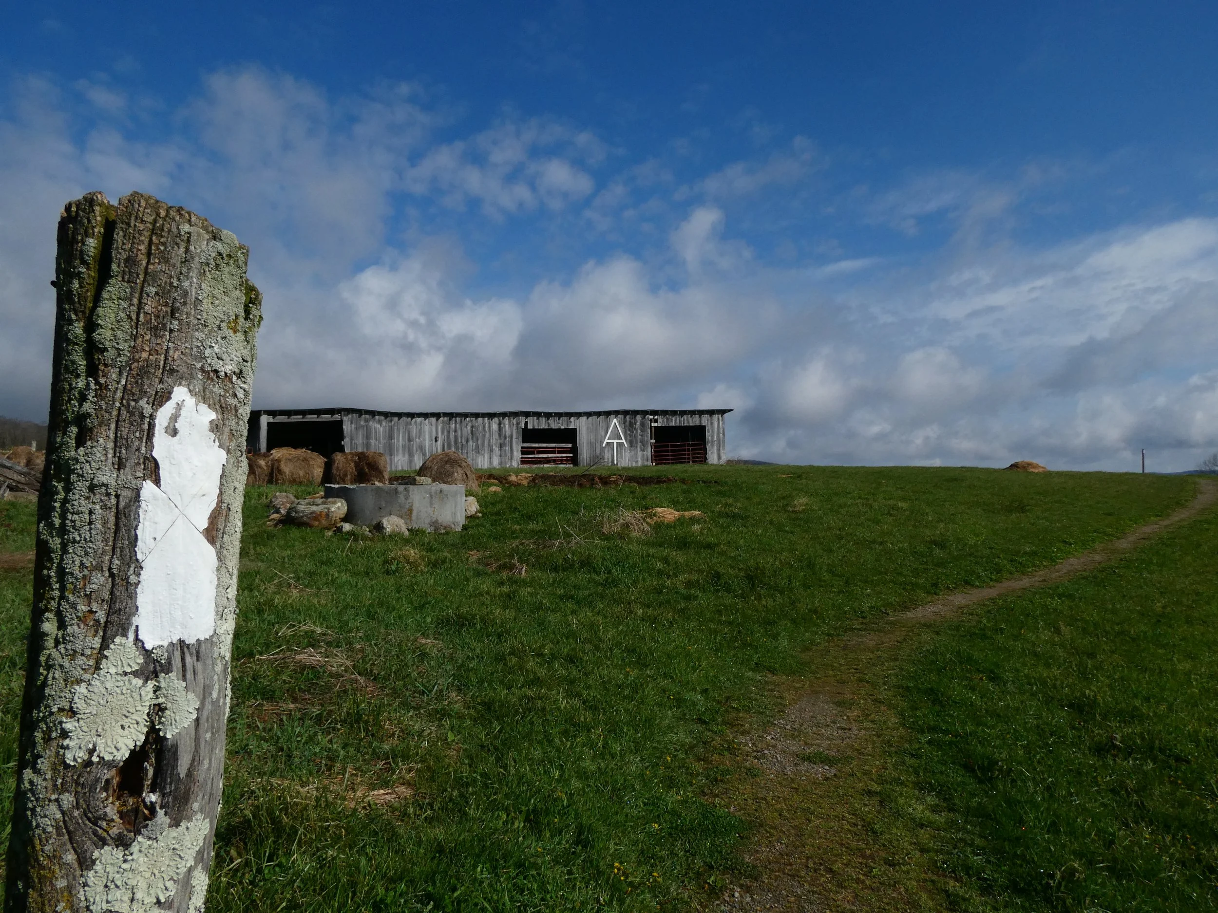
The first 3.3 miles involved a steady climb and then descent over a ridge, treating me to a handful of fine views framed by trees. On the other side of the ridge, the trail routed through more farmland. I briefly walked along a small state road with AT blazes charmingly painted directly on the asphalt. Beyond the road, the trail entered an expansive, vividly green pasture. I admired an old tractor and several large pieces of antique farm equipment that lay to the right of the trail as I climbed up a large hill. At the top of the hill, I was treated to a panoramic view towards the southeast, allowing me to admire the rolling green hills as well as the ridge I had just crossed.

This section of the trail passes through a lot of privately owned land. The landowners have established scenic tread right-of-way easements with the AT, allowing hikers to pass through without camping

This section of trail routes through a lot of private land. There were multiple signs posted explaining that “For the next 10 miles, The Appalachian Trail traves through a narrow corridor that includes scenic tread right-of-way easements through private property.” Big thanks to all the landowners who let weirdos like me bumble through their property.

Given all the cow pastures, the trail featured many hiker ladders over barbed wire fencing on the perimeters of pastures. After crossing the North Fork of the Holston River on a concrete bridge, I encountered the largest hiker ladder I’ve seen. The thing was taller than me! The rungs alone were easily eight feet tall. I ended up crossing over it and back a couple times so I could get a good video.

This is the biggest hiker ladder I’ve seen! It was taller than I am!

About a mile later, I reached VA route 42, home of Bear Garden Hiker Hostel. I didn’t stop to check out Bear Garden, but I did notice a sign warning: “NOTICE: BRIDGE CLOSED AHEAD.” Apparently, the bridge over Lick Creek, 5.4 miles to the north, had washed out. The sign cautioned that the creek is usually no more than knee-deep, but may become hazardous after heavy rain. After another 2 miles, I stopped at Knot Maul Branch Shelter for lunch. As I was about to head out, Painless caught up and explained that even though it was early, he was planning to stay at the shelter because he didn’t want to cross Lick Creek today.

UH-OH…

I stopped for a brief lunch at Knot Maul shelter. As I was about to leave, Painless (in blue) reached the shelter and explained that he was staying there for the night

A cool old bridge over Knot Maul Branch

Another cool old bridge, this one crossing Lynn Camp Creek immediately downstream of where it is joined by Knot Maul Branch

The next 3.5 miles to Lick Creek were pleasant, involving a number of creek crossings over old, mossy bridges. When I reached Lick Creek, I was pleasantly surprised to find that someone had installed an overhead pully system and left a pair of fugazi Crocs so that hikers could wade across without getting their trail shoes wet. I donned the Crocs, shuttled my Altras across, and then stepped into the creek. The water took my breath away. It was only ankle deep, but it was painfully cold. I didn’t have trouble navigating the creek, but I had to take a moment on the other side to let my feet recover. I then shuttled the Crocs back to the other side and continued on.

Someone was kind enough to set up this pully system to transfer hikers’ shoes across Lick Creek. They also left a pair of fugazi Crocs to wear while fording the creek

Trying to warm my feet a bit after the freezing crossing - notice how red (and cold) they are :(

The next 4 miles involved a gradual climb up Chestnut Ridge. During the climb, Delta caught up to me and we began hiking together. As we climbed the ridge, views opened up all around us, especially to the south and east. We stopped to collect water from a piped spring feeding a pond. As we rejoined the trail, I was surprised to see Push hiking up the ridge. I did not expect to ever see Push again. He was back on trail after some time off to attend his father’s memorial service. Delta and Push had met last night, and together we continued up Chestnut Ridge, occasionally stopping to appreciate the views and record Push’s daily video log, which he posts on his YouTube channel The Weight on My Shoulders: Jon Hikes the AT.

After 2 more miles of climbing, we reached the stunning Chestnut Knob Shelter. The shelter was converted from old stone fire wardens cabin, built sometime around 1929. The cabin fell into disrepair and was eventually refurbished in 1994 by the Piedmont Appalachian Trail Hikers and the Konnarock Crew. Over the span of three weeks, they replaced the original low, flat roof with an offset gable roof and installed plexiglass panes under the overhangs. Concrete was mixed by hand and spread to create a new floor. New bunks were built. Overall, it was a very impressive shelter. Chestnut Knob offered excellent views of Burke's Garden, a massive crater formed by a limestone sinkhole known as “God’s thumbprint.”

The beautifully located Chestnut Knob Shelter was originally built around 1929 as a fire warden’s hut and was refurbished in 1994

Chestnut Knob Shelter overlooks Burke’s Garden, VA, a bowl-shaped valley carved from the top of a mountain - AKA “God’s Thumbprint”

Delta opted to stay the night at the shelter, but Push and I decided to tread the next 1.5 miles to Walker Gap Campsite in hopes of avoiding the brutal wind on Chestnut Knob. As we made our way down from the knob, Push and I discussed his time off trail and his complicated feelings about being on trail away from his son and wife. We made it to Walker Gap and met an older gentleman named “ASAP” as well as “Mr. Darcy,” who I briefly met at the Wicked Chicken as I was leaving Damascus. I chatted with Mr. Darcy over dinner. He will be starting a masters in English literature at University of Glasgow in the fall. After dinner, I made my way about 100 yards down a gravel road to a piped spring to collect water and find a cathole spot. I then returned to camp, hung my bear bag with Mr. Darcy, and retired early for the night.

Fording a river in a mysterious pair of fugazi Crocs

April 23, 2021 /Jack Boyette
Comment

Hikers Log - trail date: day 46

April 22, 2021 by Jack Boyette

(Mount Rogers National Recreation Area HQ (mile 534.3) - Reed Creek Campsite (mile 552.5))

After a hardy continental breakfast of bananas and sugary cereal at the Econolodge, Delta, Meatsuit, Highlander and I caught the 9am shuttle downtown. After filling up my water bottles at a gas station, we waited outside the Marion post office for an 11am shuttle back to the trail. I was feeling pretty good this morning. I did almost nothing yesterday, which is exactly what I had needed. Maybe most notably, I HAD consumed a pint of strawberries, a whole bag of grapes, four bananas, a box of Cheez-its, and a box of wine. Nutritious💪😤

As we loaded onto the bus, Detox and Painless hopped on board and we exchanged enthusiastic greetings. This was the first time I had seen them since Fontana, which seemed so long ago. The trail is strange in the way fellow hikers move in and out of your bubble. It’s a wonderful aspect of the trail community that ensures an unpredictable but healthy balance of new and familiar faces. Seeing a hiker again after a long stretch of trail is like seeing an old friend. It’s nice.

This coming Sunday, I’ll be meeting AC in Bland, VA. This gives me about 3 days to hike 60 miles, which should be pretty doable. My goal for today was to find a campsite after 15 miles or so. The bus dropped us off at the Mount Rogers National Recreation Area HQ. As we started hiking, I was immediately surprised by the cold. The last couple days had been gorgeous - really hinting at the impending spring, but it suddenly felt like winter again. I stopped briefly to put on my rain jacket and gloves for warmth.

After about a mile, the sky began lightly dusting snow as we climbed a big hill. The cold and wind persisted as we gained elevation. The snow flurried lazily on and off for a while as we hiked along the ridge towards Glade Mountain. After about 6 miles, Delta, Meatsuit, Highlander and I stopped and ate lunch on a couple fallen trees just off the trail. After lunch, the others continued on while I lagged behind to prep my dinner.

I couldn’t tell you which one is Walker Mountain

I continued solo along the ridge of Glade Mountain, which soon began descending, offering a nice view on the way down. The trail moseyed alongside Vaught Branch, a rocky and scenic creek, for about a mile and a half, crossing six times via rock hops and logs. The air was still cold, but the descent offered some relief from the wind and the sun was beginning to warm me through my rain jacket, which I was wearing for a little extra insulation. I briefly hiked past Chatfield Memorial Shelter, which was right beside the trail and appeared to have a nice privy. 1.7 miles past the shelter, I passed under two sets of extremely large and loud power lines and encountered Painless, who was taking a break next to the trail. We chatted briefly and then I continued on to the Settlers Museum. The museum exhibits buildings, artifacts, and reenactments from way back when. The museum was closed, so I only got to admire the old school building next to the trail. A sign above the door was inscribed “LINDAMOOD SCHOOL 1894,” which I’ll admit sounds old, but is 1894 really SETTLERS old?

The trail briefly passes through the Settlers Museum, a collection of well preserved buildings from the late 19th century

An old school building with “LINDAMOOD SCHOOL 1894” inscribed above the door

After crossing VA Route 615 at the Settlers Museum, the trail routed through a picturesque meadow, across a small stream on a tiny footbridge, and then through a narrow corridor of trees, surrounded on either side by vividly green pastures. The surrounding meadows reminded me of the old Windows XP wallpaper. As the trail neared Interstate 81 and the town of Atkins, houses, farms, and other signs of civilization could be seen in every direction. Nevertheless, I was struck by the area’s beauty. The narrow corridor of trees made for a wonderful tunnel of spring buds and blooms. All around me, trees were in every stage of spring, from dense green buds to brilliant flowers.

Spring is about to pop

About two miles past the Settlers museum, the trail crossed the Middle Fork of the Holston River and over a set of railroad tracks. On the other side of the tracks, the trail descended into a marshy wetland area and continued over a long boardwalk. I kept my eyes open for frogs, but wasn’t able to spot any. The trail emerged back into a meadow which wound its way towards I-81, eventually dumping me out on Lee Highway. Ahead in the distance, I could see Delta, Meatsuit, and Highlander, who were making their way towards El Burrito Loco, a Mexican restaurant in a gas station next to the trail. I stopped briefly outside the gas station and considered stopping for a burrito. I had already prepped my dinner, so I decided against it and continued on. The trail routed me under I-81 and then back into a small stand of trees adjacent many cow pastures.

Brief road walk through the outskirts of Atkins, VA and under I-81

I stopped at Dry Run Creek and collected a little water against the guidance of Guthook. I would be needing the water for post-privy sanitary purposes. I then crossed the creek on a small bridge and continued along a narrow board walk that seemed precariously weathered. The trail followed along the creek for a bit, passing the old Davis Cemetery and crossing a little country road before wandering into a large cow pasture. The pasture was clearly active, judging my the copious cow turds and actual cows moseying in the distance. All in all it was a pretty field.

Hiked through a cow pasture

This tree decided to get funky

Wow… this felt good

A hiker ladder led the trail back into more pristine forest and I soon encountered a sign claiming “1/4 GA → ME!” Wow… I had to stop to take in the weight of this moment. I felt proud of how far I had come and in awe of how far I still had to go. I had already seen so many amazing places and met so many cool people. I wondered what the remaining 3/4 of trail had in store for me.

I also did some quick mental math. Today was day 46, so at my previous pace, it will take me 184 days to finish the trail. That was over a month longer than my goal of ~150 days, but I knew the estimation was unfair. I had started slow. My trail legs have developed and I can now bang out 20+ mile days more regularly. I don’t think I have anything to worry about.

A mile later, I stopped at the site of the Davis Path Shelter to use the privy. The shelter is no longer there. All that remains is a few support columns and the shelter steps, which now look like short, lonely bleachers overlooking the trail. I had been thinking about camping at Davis Path, but my privy stop required most of my remaining water. I now didn’t have enough water to cold soak, so my options were: 1.) hike another 4 miles to the next water source/campsite; or 2.) not eat dinner. I definitely wanted to eat dinner and I was feeling pretty good, so I opted to hike on.

A bit beyond the shelter, I encountered a small orange smiley face gummy wedge in a crack of bark on a tree. I smiled to myself, shrugged, plucked it off the tree and plopped it in my mouth. Leave no trace… am I right?😂 The thought briefly crossed my mind that it could be drugged, but fear not, my perception of reality remained unaltered for the rest of the evening.

I hiked another 4 miles to Reed Creek campsite, which was a nice, open creek side site surrounded by thick rhododendron. Two thru-hikers, “Captin” and “Fireball,” were already at the site. Fireball was accompanied by her friend “Good Fortune,” and together they had set up a nice fire. As I set up my tent, the rest of their trail family began trickling in. Their ranks included “Chill,” “Voicemail,” “High Class Frat God” referred to simply as High Class, and “Lennaeous.” This was the trail family that Meatsuit and Highlander hiked with most of the time. I had seen some of them around before. I’m pretty sure I had almost tripped over Chill’s unconscious body at the Broken Fiddle Hostel in Damascus. He had been splayed out, shirtless with sunglasses, in the backyard of the Broken Fiddle. I also briefly met Fireball while hiking with Delta. At the time, I believe she was completing a small section with her mom. Everyone was wearing uniquely colored and patterned shorts, as if they had all gone shopping together together to pick out the most obnoxious, flamboyant outfits possible - which they very well may have done. I learned that Voicemail was right out of high school and that Captin was a blogger for The Trek, a popular thru-hiking website that hosts blogs for current thru-hikers.

Chill gathered an absurd amount of firewood, which he yoked over shoulder back to camp. He then began orchestrating a sophisticated dinner plan. Everyone produced an ingredient from their respective packs. They were making a luxurious breakfast on trail, including precooked sausage, bacon, hardboiled eggs, biscuits, and gravy. The biscuits baked on rocks around the fire ring while Chill cheffed up the gravy. I was offered some biscuits and gravy and I gratefully accepted the warm treat.

I had ended up hiking about 18.2 miles today. Considering that I started at nearly 11:30am, I think this was a pretty cool accomplishment.

Spring is in the air but so is flurrying snow this weather is weird

A yummy surprise :)

April 22, 2021 /Jack Boyette
Comment

Hikers Log - trail date: day 45

April 21, 2021 by Jack Boyette

Zero day in Marion, VA

April 21, 2021 /Jack Boyette
Comment

Hikers Log - trail date: day 44

April 20, 2021 by Jack Boyette

(Trempi Shelter (mile 524.3) - Mount Rogers National Recreation Area HQ (mile 534.3) *overnight in Marion, VA*)

I left camp with Delta, Katie, Jasmine, Meatsuit, and Highlander. It was a beautiful morning, and we made good time over easy terrain. The goal was to make it 10 miles to the Mount Rogers National Recreation Area headquarters on VA Route 16 by 2:15pm. A regular bus supposedly stops by every afternoon to shuttle thru-hikers into Marion, where I was planning to zero at the Econolodge.

After 2 miles, we crossed the South Fork of the Holston River on a large foot bridge. A fly fisherman had just arrived and was wading out into the river, and Highlander commented that he surely wouldn’t catch anything this time of day. As we continued on, Meatsuit shared stories of his time as an arborist and electrical lineman, including the numerous times he had suffered terrible shocks working on powerlines. Highlander also shared that this was his second thru-hike attempt. The first time, he ran out of money in Harpers Ferry. This time around, he had saved more money, and was determined to make it to Katahdin, although he was in no rush to get there. I asked him when he thought he might finish, and was surprised when he estimated: “August, maybe September. Really just anytime before mid October when they close Baxter State Park.”

As we hiked on, the group spaced out a bit and I put my headphones in as we climbed an unnamed ridge. I opted for the album “So Long Forever” by Palace. This is a favorite of Anna Claire’s, and I also enjoy it quite a bit. The album is a monument of cinematic alternative rock, full of anthemic, spacey songs that make for a fitting hiking soundtrack. About 2 miles before VA Route 16, we all stopped at an overlook marked with a sign stating: “View of the Rye Valley.” Delta, Meatsuit, and Highlander had decided to join me for a zero day in Marion, and Meatsuit took the opportunity to call and reserve a room at the Econolodge.

View of the Rye Valley

About 2 miles later, we reached Partnership shelter, which is located just behind the Mount Rogers National Recreation Area headquarters and a stones throw from VA Route 16. Partnership is one of the largest and best equipped shelters on the AT, with 2 floors, a water spigot, and a hot shower. The shelter is also affectionately known as “the pizza shelter” because pizza shops in Marion will deliver to the trail. In fact, we found take-out menus from multiple restaurants in Marion left at the shelter. On the second floor of the shelter, I found an abandoned ultralight trowel and water bottle bidet attachment. Meatsuit was happy to take the trowel, but he opted to leave the bidet😂

Stopped for lunch at Partnership Shelter AKA “The Pizza Shelter”

We hung out at the shelter for lunch and I basked in the midday sun. At 2:00, we made our way to the road and waited for the shuttle bus on a grassy slope. The 2:15pm shuttle turned into a 3:00pm shuttle, arriving just as we were beginning to give up hope. Our first stop in town was Taco Bell, where we were required to walk through the drive thru to order. We ate sitting on the curb in proper hiker-trash fashion. Apparently, this was Katie and Jasmine’s first time eating at Taco Bell, and I think they both agreed it was love at first bite. We then made our way to Walmart for resupply, and I stopped at Ingles for produce. The goal was to load up on berries and fruit for my zero day. Got to get my vitamins while I can!

Afterwards, Katie and Jasmine headed back to VA Route 16, hoping to hitch back to Partnership Shelter for the evening. Delta, Meatsuit, Highlander, and I made our way to the Econolodge. I had my own room, but the others were hoping to crash in Meatsuit’s room without paying. Check-in went smoothly, but apparently the hotel staff was suspicious. They watched on the hotel camera as Delta and Highlander piled into Meatsuit’s room. The staff called the room and demanded that Delta and Highlander pay.

Waiting for the shuttle into Marion, VA

April 20, 2021 /Jack Boyette
Comment

Hikers Log - trail date: day 43

April 19, 2021 by Jack Boyette

(Stealth Campsite (mile ~506) - Trempi Shelter (mile 524.3))

It rained last night, which was unfortunate for Katie and Jasmine who were cowboy camping. They both have hammocks and rain flies, but they usually opt to just sleep on the ground, exposed to the elements. I crawled out of my tent to find them both still fast asleep in their soaked sleeping bags. It looked like there might have been a scrambled attempt during the night to wrap themselves in their rain flies, but the improvised bivy sacks didn’t seem to have done much good. As they started to stir, they seemed mostly unphased by the situation.

“A positive mental attitude is the best rain gear.”

I ate breakfast in camp and started hiking around 9am. The first 1.3 miles took me over a long grassy ridge with fine views to the west. As I climbed down from the ridge, I could see “The Scales,” a large cattle corral in an open grassy meadow. The Scales is a popular campsite with two vault toilets, a bear box, and a number of established fire pits. It’s accessible via a forest service road, and there was a single white SUV parked in the middle of the meadow. I was half expecting to find Delta, Meatsuit, Highlander, or any of the Little Hotties still in camp, but the Scales were abandoned at this point in the morning. The only residents were mounds of pony and cattle dung. I stopped to use the facilities, which were sadly filled with trash, and then took time to read a couple informational signs explaining the history of the Scales. Apparently, the area has historically been (and still is) used for cattle grazing. Back in the day, ranchers would weigh their cattle at the Scales before herding them down the mountain to market. This helped maximize profits because the cattle usually lost weight during the journey down the mountain. Neat🙌

The facilities at “The Scales”

Beyond The Scales, the trail briefly climbed to about 5,000 feet in elevation before beginning its steady decent from the Mount Rogers/Grayson Highlands ridge. After about 1.7 miles, I passed Old Orchard Shelter, which seemed like a really nice, open campsite. After another 1.6 miles, I made it to the Fox Creek Trailhead parking lot where the AT crosses VA State Route 603. At the parking lot, I was greeted by an older trail angel named John. He was accompanied by his canine companion “Angel,” which struck a chord in my heart by reminding me of one of my childhood dogs, also named Angel. Both were super-soft shepherd mixes, which made the coincidence even more striking. So far on trail, I’ve met a dog named “Doc” and a dog named “Angel.” Maybe I’m being visited by the spirits of my childhood pets?

John motioned to his tailgate, where he revealed a cooler full of McDoubles. I was apparently the first thru-hiker to pass by this morning, so he encouraged me to take multiple. I helped myself to two, along with a bag of chips. While I ate and chatted with John, another thru-hiker emerged from the rhododendron. He wore a sedge hat made with a floral printed synthetic fabric and introduced himself as “Hopper.”

Stumbled onto trail magic McDonalds at Fox Creek trailhead (where trail crosses VA State Route 603) from John and his loyal companion Angel

Crossing VA State Route 603

After chatting a bit more with John, I thanked him for the trail magic, and I hiked on with Hopper. As we climbed out of the gap, we spotted a large hawk in the trees above. Unfortunately, I wasn’t able to get a good picture. Hopper explained that he hasn’t taken any zero days yet, mostly because he wants to avoid towns. After 2 miles of climbing, we reached the ridge and I stopped to try and send a voice message to AC. I then began descending the north side of the ridge and briefly caught up with Hopper before stopping at Hurricane Mountain Shelter to call the Econo Lodge in Marion, Virginia, where I booked two nights. I was feeling good physically, but I needed a zero day for some mental rest.

As I descended from Hurricane Mountain, I met “Ducky,” a flip-flopper who had started her hike in Harpers Ferry, West Virginia. A flip-flop is an unconventional way of doing a thru-hike, usually involving a start somewhere in the middle, after which flip-floppers usually hike south to Springer Mountain. They then travel back to their starting point and hike north to Katahdin. Our interaction was brief, but she seemed cool, and I offered that maybe we’d see each other again somewhere up north. The trail rolled lazily for a few miles, crossing a number of streams. I was in the mood for music and opted for Mark Kozelek and Jimmy LaValle’s “Perils From The Sea.” This is a hauntingly beautiful album, and has quickly become a trail favorite of mine.

About 3.1 miles after Hurricane Mountain, I encountered a sign explaining that the trail ahead was closed. Apparently, the bridge crossing below Comers Creek Falls had been removed due to structural instability. The sign encouraged hikers to take a detour involving a nearly 2 mile road walk. I checked Guthook and other hikers seemed to be consistently reporting that Comers Creek was easily passable via rock hopping. The sign acknowledged this but warned that in periods of high water, the creek is not safe to cross. I love waterfalls and I would much prefer to avoid a long road walk, so I took a chance and turned right toward Comers Creek Falls. I saw the falls, crossed easily, and did not die. No regrets.

Crossing Comers Creek Falls at the site of an old bridge that was removed due to safety concerns

Because this section of trail is technically closed, I suspect I may have been one of the first hikers to cross this sparkling new bridge

I’m glad I didn’t have to do this road walk

Well… looks like I’m headed the right direction

Beyond Comers Creek Falls, I switched up the music vibe. I opted to work my way through the first two Outkast albums “Southernplayalisticadillacmuzik” and “ATLiens.” These albums are both mid-90’s hip-hop classics. Together, they brought southern hip-hop to the forefront of cultural and aesthetic relevance, serving to shake the dominance of the New York and LA scenes. I love both of these albums, but I must admit that I have often neglected them in favor of Outkast’s third project “Aquemini” - my personal favorite. Upon this listen through, I was particularly struck by the “True Dat” interlude from Southernplayalistic-, in which Big Rube of the Dungeon Family crew presents the basic principles and fundamental truths of being an Outkast. All in his slow, southern-fried, molasses-dripping, spoken word delivery. This line in particular struck me as I put one foot in front of the other, attempting to walk from Georgia to Maine:

“Now look at yourself, are you an OutKast? I know I am
As a matter of fact, fuck being anything else
It's only so much time left in this crazy world”

About 2.7 miles past the falls, I stopped at a small campsite around mile 521.6 for break and a snack. The campsite was little more than a tiny, mossy clearing. It struck me as particularly beautiful as the afternoon filtered through the branches above. Through the trees to the southwest I could see the Grayson Highlands ridge and I tried to guess which hump was Mount Rogers.

After another 2.8 miles, I made it to Trempi shelter where I found Delta, Meatsuit, and Highlander. Meatsuit and Highlander were crashing in the shelter along with a chain-smoking lady from Florida whose name I don’t remember. She was headed southbound as part of a LASH (long-ass section hike). Katie and Jasmine arrived later, explaining that they had stopped for a while to dry their sleeping bags in the sun. As we all ate dinner around the picnic table, Delta shared that he had taken the road walk detour around Comers Creek Falls, which had been absolutely miserable. Apparently, the road had recently been paved and the smell of tar was still strong, making for a nauseating 2 miles. Although I felt bad for Delta, this tidbit made me feel extra satisfied with my decision to see the falls.

At Trempi Shelter I found Delta, Katie, Jasmine, Meatsuit, and Highlander

April 19, 2021 /Jack Boyette
Comment

Hikers Log - trail date: day 42

April 18, 2021 by Jack Boyette

(Whitetop Mountain Campsite (mile 492.7) - Stealth Campsite (mile ~506))

I woke up at about 7:30am this morning. I took my time getting out of my tent only to realize that I needed to dig a cathole - like, immediately. After breaking down my tent, I ate breakfast at a small fire with Simple Man. We both agreed that today was going to be something special. I was only planning to hike about 12 miles to a campsite just beyond the boundary of Grayson Highlands State Park. I didn’t want to feel rushed today. I wanted to take my time and stop at every beautiful view, admire every cool tree, and make quick friends with all the ponies. I was also excited to get rid of the whole pound of carrots I had packed out from Damascus😂

Notably, the trail would also be passing Mt. Rogers today. The tallest peak in Virginia was accessible via a half mile side trail. Unfortunately, the peak is completely forested and doesn’t offer any views. I figured I’d probably check it out anyways. Afterall, I’ll be hiking in Virginia for the next 500 miles or so. I might as well bag the tallest peak while I have the chance.

I started hiking a little after 9am. After 2 miles, I reached Elk Garden trail head, a popular parking area for day hikers and weekenders visiting Mt. Rogers and the Grayson Highlands. After crossing the road, I passed through a cattle gate and into a stunningly green pasture. The trail quickly summited a small hill with beautiful panoramic views of the surrounding meadow. The trail left the meadow and began climbing the Elk Garden ridge. I was immediately struck by the beauty of the forest. The trees, moss, rocks - everything was so vivid. Today was a Sunday, so as I climbed the ridge, I passed many groups returning from their weekend excursions. I passed two groups of Boy Scouts and what seemed like maybe a college sports team. I hoped this meant that there wouldn’t be many people in the Grayson Highlands.

I listened to my J+AC playlist this morning. Two standout tracks were “You Make Me Smile” by Mamalarky and “Can I Call You Tonight?” by Dayglow. Both songs are fun, lighthearted, dreamy pop tracks with a healthy serving of psychedelia. The songs blended well with my fantastical surroundings and established major positive vibes.

I found myself fascinated by the seemingly rhythmic pattern of decay across the surface of this rotting tree

After about 3.5 miles, as I was approaching the Mt. Rogers spur trail, the trail emerged from the forest and I spotted my first ponies! A pair was standing in the middle of the trail. The first was a mottled brown and white while the second was a solid chestnut. They were both curious, and approached me without much hesitation. I assumed they expected snacks, but when they started incessantly licking me, I realized they were after my sweat. Hikers must serve as reliable salt licks for these ponies😂 I sat with my new friends for well over an hour as I fed them carrots and helped them reach their electrolyte quotas. Sitting on a rock next to the trail, I watched lots of hikers experience the ponies for the first time. Reactions ranged from joy and excitement to discomfort and mild fear as the ponies approached each new potential salt lick. Simple Man, most of the Little Hotties, and Lighthouse all passed along.

Eventually, Katie and Jasmine showed up. I hadn’t seen Katie and Jasmine since the day after 19E. They had left trail around Hampton to spend time with some college buddies. I offered them carrots and warned them that the ponies did a poor job distinguishing carrots from fingers. I held up a couple bloodied fingers to prove it.

A close encounter with the pony kind

I quickly befriended the residents of the Grayson Highlands

Notice the braid, courtesy of Katie

At this point, I was nearly saturated with pony saliva. After we ran out of carrots, the ponies started chewing on the straps of Jasmine’s pack and we decided to move along. A quick jaunt around the bend brought us to the Mt. Rogers spur trail junction. Katie and Jasmine had both been to the summit before and they warned me that it was super underwhelming. This insight, combined with a fear that ponies would eat my pack if I set it down, discouraged me from taking the side trail.

We continued another ~0.2 miles to Thomas Knob Shelter. Behind the shelter, we found a nice view where we chilled and ate lunch. Katie busted out her battery powered radio, which seemed to only pick up pop country stations. She explained that some hikers had started calling her “Retro,” presumably in reference to the radio. She seemed unsure if she liked the trail name, and at this point, I’m not sure if Katie or Jasmine will ever have trail names in my mind.

We hiked on and soon encountered the 500 mile mark! Pretty cool, I must say😁

500 miles feels pretty darn good!!!

Just beyond the 500 mile mark, where the AT meets with the Pine Mountain Trail, we encountered a jagged rock scramble which treated us to spectacular views of the surrounding highlands.

The next half mile routed us over a couple more rock scrambles, each treating us to wonderful views. As the trail began winding down the Pine Mountain ridge, we encountered the “fat man squeeze,” a claustrophobic rock tunnel that gives a brief impression of spelunking. It’s possible to route around the squeeze, but of course we had to give it a shot. One of my water bottles briefly caught on a rock, but otherwise, I fit through pretty easily.

The fat man squeeze!

At mile 501.5, the trail finally passed into the official boundaries of Grayson Highlands State Park. Almost immediately, we spotted another group of ponies. These ponies seemed much less interested in hikers. Still, we tried to approach the group. We took the hint to get lost only after Katie got too close and one of the ponies gave a half-hearted warning kick.

More ponies! Unfortunately, this group had little interest in us :(

The terrain flattened out along the Wilburn Ridge and I stopped to send a message to AC while Katie and Jasmine hiked on. The next 2 miles or so involved a lot of pleasant downhill, good trees, and small stream crossings. I stopped at Wise Shelter near the park boundary for short break and found Katie and Jasmine amusing themselves with the shelter log.

We hiked out of park and started looking for a good campsite. About 2 miles later, we found a lone pony standing in the middle of the trail. At first, the pony didn’t want to move, then it decided to mosey on down the trail ahead of us for a couple hundred yards. I kept my distance as we followed behind slowly. I managed to avoid earning a hoof-to-the-face, and soon after we found a stealth campsite near a trickling water source at a little after 7pm. The pony hung nearby while we set up camp and ate dinner, sadly it seemed entirely disinterested in interacting with us.

Lots of landmarks today. Grayson Highlands, ponies, and 500 miles🥳

Look at the ponies! Such adorable creatures… shit, it just bit me!

I saw this sign as I was leaving Grayson Higlands… whoops, guess I wasn’t supposed to feed them - and yes, I can confirm THEY DO BITE

April 18, 2021 /Jack Boyette
Comment

Hikers Log - trail date: day 41

April 17, 2021 by Jack Boyette

(Campsite after Damascus (mile 472.2) - Whitetop Mountain Campsite (mile 492.7))

I woke up this morning at about 8am. After crawling out of my tent, I told Delta I was considering hiking about 17 miles to a tentsite just before the big climb to the Mount Rogers ridge. I ate breakfast and did stretches in camp. While I was stretching, Delta hit the trail and I followed a bit later.

I caught up to Delta after 3 miles or so. We hiked together and ended up stopping for lunch at Saunders Shelter. The shelter was located about a quarter mile off trail and excitingly featured the first privy since Overmountain Shelter (the barn)! To celebrate, I took advantage of the facilities. Privies on the AT tend to be covered in scribblings and tags. Considering all the time thru-hiking provides for deep introspection, you might expect a privy’s plywood walls to serve as a canvas on which thru-hikers scrawl their most profound musings. You’d be wrong. I laughed to myself as I considered the juvenile absurdity of it all.

After lunch, Delta and I had a choice to make. We could back track down the side trail to rejoin the AT where we had left it, or we could take another side trail and effectively skip a half mile of the “official” AT. If we took the second side trail, we would still be hiking approximately the same distance as if we had never left the main trail. This may seem silly or insignificant, but among thru-hikers, this is a bit of a philosophical quandary. Some would argue that unless you’ve walked every inch of trail and seen every blaze, you haven’t really thru-hiked. Delta and I both disagreed with this argument. At the end of the day, the trail isn’t real. The “official” route changes every year. Thru-hikers in 1981 hiked a very different trail than the one we were hiking today in 2021. We decided not to back track and I certainly didn’t lose any sleep over it.

After 4 miles of really chill hiking, the AT merged with Virginia Creeper Trail. Delta explained that Virginia Creeper is a vining plant common to the region, which helped sway some of my discomfort regarding the trail’s name. The trail itself was lovely. It was converted from a rail route to a multi-use trail in 1987, and is now most popular as a bike path. The trail stretches about 35 miles from Abingdon, Virginia, through the Mount Rogers National Recreation Area, and terminates at the Virginia-North Carolina border. The AT followed the Virginia Creeper for about a mile. The trail was wide, flat, and well maintained. We passed over the massive Laurel Creek Bridge and then made a sharp left as the AT parted ways with the Virginia Creeper.

The AT merges with the Virginia Creeper Trail for a few miles. Despite its unnerving name, the Creeper Trail is a lovely (flat) bike path named after a vining plant common to the region

Delta and I passed many bikers while walking along the Creeper

The next 2 miles were dominated by gradual climbing. Delta and I took a quick break at Lost Mountain Shelter and then continued on towards the base of Mt Rogers. After about 2.5 miles, the landscape started to change. Most of the day had been dominated by thick rhododendron - more or less the classic AT “green tunnel.” But as we began gaining elevation on the climb towards Mt Rogers, the landscape opened up. We passed through a field that gave me mild flashbacks to Big Hump Mountain and the Roan Highlands. Shortly after crossing a small gravel road, we approached the tentsite at the base of the Mount Rogers ridge. My morning plan had been to stop here before the big climb, but the tentsite appeared to be overrun with Little Hotties. It was still early enough in the day, and we decided to knockout the climb so we wouldn’t have to worry about it in the morning.

Approaching Whitetop Mountain

From the tentsite to Buzzard Rock on Whitetop Mountain, we had to overcome a 1,481 foot gain in elevation over about 2.2 miles. Consider this proof that Virginia is NOT flat. The climb was dominated by decently graded switchbacks, which made for a pleasant level of exertion. Delta and I made good time to Buzzard Rock, where we stopped to take in the views. Delta hiked on while I stayed at Buzzard Rock to send photos and voice messages to the folks back home.

Nearing the top of the climb

Buzzard Rock is a secondary summit on Whitetop Mountain

The view from Buzzard Rock

The forest on Whitetop Mountain had major fantasy vibes

A very good tree

At this elevation, I was now on the Mount Rogers ridge. Mount Rogers is the highest point in Virginia, and the surrounding area encompasses the Grayson Highlands. The forests, rocks, and fields in this area are stunning. Like Big Hump Mountain and the Roan Highlands before, I felt like I was hiking through another part of the world. Maybe Scotland or New Zealand. The trail avoided the summit of Whitetop Mountain (Virginia’s second highest peak) and instead skirted around the mountain’s south face. After a mile, I crossed Whitetop Road and soon came across a number of tentsites just off the trail.

Delta was setting up and I could see Meatsuit and Highlander gathered around a small fire. I set up my tent and joined Delta, Meatsuit, and Highlander for dinner around the fire. We were later joined by a thru-hiker named "Simple Man," who explained that he was a professional musician from Portland, Oregon. He played guitar in multiple bands, including one with a member of Mastodon and another with a member of Sleep. The only band name I can remember him mentioning was "Kingfisher." Simple Man mostly made a living working as a studio musician. Apparently, he’s served as musical director for a bunch of hip hop artists including David Banner. Simple Man rolled his own cigarettes, told great stories, and was overall a sensationally cool dude.

We were all psyched to be entering Grayson Highlands State Park tomorrow. The park is legendary among thru-hikers for its beautiful landscapes and - maybe more importantly - its feral ponies! I had packed out a pound of carrots from Damascus which I was planning to use as pony bait. If my offerings work like I expect, I am hoping to become king of the ponies. We’ll just have to see if things go according to plan.

Gather round and hear the greatest lie ever told: Virginia is flat

April 17, 2021 /Jack Boyette
Comment

Hikers Log - trail date: day 40

April 16, 2021 by Jack Boyette

(Campsite before Damascus (mile 468.5) - Campsite after Damascus (mile 472.2))

My alarm woke me up 6:45am. Everyone broke camp and we started hiking at 7:30am with hopes of making it to the Damascus Diner as early as possible. We had 1.7 miles to Damascus, essentially all of which was downhill. With both the elevation gradient and the insatiable hunger of five thru-hikers on our side, we made great time, arriving at the edge of town a little after 8am.

We started hiking this morning at 7:30am, intent to knock out the 1.7 miles into Damascus early enough to grab a breakfast table at Damascus Diner

We started hiking this morning at 7:30am, intent to knock out the 1.7 miles into Damascus early enough to grab a breakfast table at Damascus Diner

The trail routes directly through the center of Damascus, and as we entered the town, we passed through the Damascus Town Park. The park is the home of “Trail Days,” a giant celebration of all things AT. The festivities are attended by current thru-hikers as well as alumni and are held sometime in mid-May. So unfortunately, we were about a month early. Nevertheless, the park was cool, featuring old train engines and train cars as well as an actual AT shelter built right in the middle of the park. The shelter feature featured a prominent “NO CAMPING” sign, so I guess it’s just for the vibes.

The trail passes under an arch welcoming hikers to Damascus

The trail passes under an arch welcoming hikers to Damascus

We made it to the diner at 8:30am, just before the morning rush of hikers

We made it to the diner just before the morning rush of hikers

We made it to the diner a little after 8:15. Fortunately, the morning rush had not trickled in yet and we were seated immediately. I looked over the menu and decided to build my own Waffle House All-Star Special, ordering eggs, bacon, hashbrown casserole, biscuits and gravy, grits, and a waffle. It was wonderful🤤 As we ate the thru-hikers trickled in. They were easy to distinguish from the locals, sporting scraggly facial hair, disheveled clothing, and generally congregating in rowdy groups.

After breakfast, I headed to the post office to send a postcard and pick up a package that Anna Claire had sent me including a new bear line, nestle NIDO, and olive oil. I then swung by the outfitter to see if they had a cork massage ball (inspired by Lighthouse). They didn’t, but they let me drop my pack off so I didn’t have to carry it around town. For my resupply, I needed to walk 0.7 miles from the outfitter to a Food City on the outskirts of town.

Damascus seems to consider itself THE AT town

Damascus seems to consider itself THE AT town

The walk took me through Damascus along the Virginia Creeper Bike Trail. As I walked, I came to the conclusion that Damascus is a pretty cute town. There’s a nice big creek running through the center of town, many green spaces, and lots of old Victorian and craftsman style homes. I made it to Food City and ran into Lighthouse, who had just finished his resupply. We chatted for a bit and I explained that I wasn’t staying the night. He offered to let me use his room at the Virginia Creeper Lodge for a shower and I gladly accepted.

After resupplying, I met Lighthouse at his room and did my laundry in the shower. It’s startling how many times you can wring out a pair of socks and still get dirty water. Thru-hiking is a dirty affair. Afterwards, Lighthouse and I chatted for a while and he told me about his son who works as a professional brewer in Maine. His son apparently makes a mean coffee stout, and we both bonded over our shared love for a good stout or porter. He offered me two coffee stouts from Highland Brewing Company, which is based in Asheville, North Carolina. I drank one and saved the second for later.

Feeling so fresh and so clean (clean), I headed back to the outfitter to pick up my pack. I then lounged in the town square under a tree where I packed my resupply, ate a pound of strawberries, and called AC. Later, I met up with Excel, Delta, Clover, and Puddin at the Broken Fiddle Hostel (where Excel, Clover, and Puddin had secured a private room). We engaged in a heated game of yard Jenga and then made our way to 7 Trails Grill for Dinner. Together, we shared a bunch of appetizers and I ordered a big plate of nachos for myself. Afterwards, we made our way back to the Broken Fiddle under the guise that Delta and I still had to pick up our packs before heading out of town. When we arrived, Excel and Clover busted out a surprise lemon cake for Puddin's birthday, which we all proceeded to gorge on. 

Delta and I headed out just as the sun was dropping over the mountains. We saw Mose sitting on the porch at Crazy Larry’s Hostel and also ran into Cloudkicker and another thru-hiker named “Mr. Darcy” eating outside Wicked Chicken Winghouse and Tavern. We then hiked 1 mile out of town to an unofficial tentsite, which we reached at about 7:45pm. Someone seemed to be squatting at the campsite. They had established a precarious looking tarp homestead with lots of trash strewn about. Emitting from the tarp, I could hear what sounded like a sports game TV broadcast, which I can only assume was being played (very loudly) from a phone. I hung my bear bag, set up my tent, and chatted with Delta a bit before bed. At one point, I told Delta I was thinking about visiting a chiropractor after trail and we were both startled when a gravelly voice erupted from the tarp structure: “THEY’LL BREAK YOUR FUCKING BACK!!!” Although he seemed willing to provide pro bono medical advice, we never saw the tarp man.

Enter Damascus eat a pound of strawberries exit Damascus

April 16, 2021 /Jack Boyette
3 Comments
Crossing into Virginia, the trail's longest state!!!

Crossing into Virginia, the trail's longest state!!!

Hikers Log - trail date: day 39

April 15, 2021 by Jack Boyette

(Stealth Campsite (mile 448.8ish) - Campsite before Damascus (mile 468.5))

I decided to sleep in until a little after 8am. The weather had eased during the night and the skies were completely clear by the time I scuttled out of my tent. I ate a Nature Valley bar, a Nutty Buddy, and a Cutie in camp and then finally starting to hiking around 9:30am. My plan for the day was to get as close to Damascus as possible, which was about 21.4 miles away. There are no marked campsites just outside of Damascus, but there is a water source a little beyond the Tennessee/Virginia border which appears to have nearby campsites based on the Guthook photos. That would put me less than two miles from “Trail Town USA,” which would be perfect.

Even though it was still early, I hoped for trail magic as I approached the road crossing with Tennessee Route 91. Sadly, there were no trail angels at the trailhead, but I was excited to find an unopened White Claw (Ruby Grapefruit) perched on a AT blaze pole. I helped myself to what I assumed must be trail magic and cracked open the hard seltzer a little before 10am as the trail wound me through a scenic rolling pasture. I realized this was actually my first time consuming a White Claw. It definitely won’t become my first choice of alcoholic beverage, but I was appreciative to the unknown trail angel who had left it and it was a fun way to start the morning.

Someone left a White Claw at my first road crossing this morning!

Someone left a White Claw at my first road crossing this morning!

As I entered the rolling fields, I could see Lighthouse a little ways ahead of me. Immediately, the most notable landmark was a low barn with a giant AT symbol gracing its edifice. It was a cool site to see, especially because it seemed to be still in use. The fields themselves also seemed to be actively used for cattle grazing, because although I couldn’t see any bovines, they had left plenty of fecal landmines.

The morning was breezy, but the sun kept me warm as I hiked. After about a mile of gorgeous pasture and a couple cattle fences, I re-entered the woods. I soon caught up with Lighthouse, who was taking a break by the side of the trail. We stopped to chat and he told me about his troubles finding the right shoe for his thru-hike. He’d already been through a couple brands and models, including New Balance, Altra, and now Hoka. He seemed to be liking his new Hokas, especially given their extra support. We also chatted about sore feet, and Lighthouse explained that he had been using a golf ball to massage his feet every night. He told me that a guy at an outfitter had given it to him and that it had been helpful. He actually had ordered a dedicated Rawlogy cork massage ball, which he would be picking up in Damascus.

I hiked on another half mile or so and stopped to eat my big breakfast next to a piped spring just off the trail at mile 451.2. As I was eating, Lighthouse passed and then Delta arrived just as I was finishing my meal. I started hiking with Delta and after 4.5 miles we crossed US 421 at Low Gap, making snarky comments about the cars parked at the trailhead parking lot. About a mile later, we stopped for lunch near Locus Pole Knob. After another 2.6 miles, we passed McQueen’s Knob Shelter, a quaint little shelter apparently built in 1934. Guthook called it a “lean to” that “should only be used in emergencies.” Delta and I thought it was pretty cute.

McQueen’s Knob Shelter is a really old, tiny shelter with room for one or two hikers. My navigation app called it a “lean to” that “should only be used in emergencies”

McQueen’s Knob Shelter is a really old, tiny shelter with room for one or two hikers. My navigation app called it a “lean to” that “should only be used in emergencies”

About 1.4 miles later, we reached Abingdon Gap Shelter which is the last water source for 8 miles. Unfortunately, the piped spring was located 0.2 miles down a very steep side trail. On my way down to collect water, I stopped to dig a cathole. I then gathered water and Delta and shared a short break. We had about 6.5 miles to go until the Tennessee/Virginia border, and then another 1.5 miles until the water source/unmarked campsite where we planned to spend the evening. After a quick rest, we hiked on.

The trail was easy on us and we made great time following the rolling ridge. Soon enough, we caught site of the border sign and released a series of celebratory woops, hollers, and yawps! Making it to Virginia is a big deal. After nearly 500 miles, we were now entering the longest continuous state of the AT. We had many miles on our feet, but we still had many, many more. It was exciting and also a bit humbling to cross the Tenessee/Virginia border. I was reminded of a term that circulates in thru-hiker circles: “the Virginia blues.” It refers to the tendency of thru-hikers who make it this far to quit their thru-hike somewhere in Virginia. The idea is that the initial thrill of a thru-hike wanes by the time hikers reach Virginia. For some, the trail becomes a depressing cycle of sleep, walk, eat, repeat. The Virginia blues were certainly in the back of my mind as I admired the border sign, but they were mostly eclipsed by my anticipation for the things the lay ahead. The Grayson Highlands, McAfee Knob, and Shenandoah National Park were all in Virginia. I wasn’t too worried about the Virginia blues.

Tennessee | Virginia

Tennessee | Virginia

After another 1.5 miles, we reached the water source/campsite and found Excel, Puddin, and Clover already set up for the evening. By simple coincidence they had developed the same plan and we all agreed to wake up a bit early to hike into Damascus for breakfast at the diner. Given that we were only about 1.7 miles outside of Damascus, we should be able to easily make it to the diner right when they open, which should help us avoid the inevitable morning rush of thru-hikers who had spent the night in town. It was a fun evening reconnecting with the crew after a couple days and I fell asleep with thoughts of pancakes, eggs, and bacon dancing around in my head🤤

April 15, 2021 /Jack Boyette
1 Comment
View from Watauga Dam

View from Watauga Dam

Hikers Log - trail log: day 38

April 14, 2021 by Jack Boyette

(Boots Off Hostel & Campground (off mile 428.4) - Stealth Campsite (mile 448.8ish))

🍾🍾🍾FIRST >20 MILE DAY!!!!🍾🍾🍾

I woke up this morning a little before 7:30am. A breakfast of biscuits, gravy, and eggs was prepared by a couple of trail angels staying at the campground - which was an excellent way to start off the day! After breakfast, I decided to take advantage of Boots Off’s new tankless hot water heater one last time before hitting the trail at about 9am.

I didn’t know where I would end up this evening. I had about 43 miles to go between Boots Off and Damascus, VA. Given all the trail reports from trail angels and southbound flip floppers, it should be a really chill 43 miles. Everyone seems to agree that it can be easily knocked out in two days. So, I’m thinking I’ll aim to camp just south of Damascus in two nights. Then, on day three I’ll get into town early, check out the diner, resupply, pick up my bear line from the post office, and get out of town. Nothing like a good ol’ hero. All the benefits of a nearo, with none of the overnight costs. Theoretically, that plan set me up for a 21.5 mile day. With the extra support of a new knee brace from the Boot’s Off hiker box, I was feeling good, and if the terrain is as easy as I’ve heard, I figured it should be doable.

I hiked along the shore of Watauga Lake for the first 3 miles. It was scenic, flat, and overall idyllic hiking. Boot’s Off offers slack-packing and aquablaze options for thru-hikers through this section of trail. Slack-packing is when thru-hikers hike with only a day pack, which lightens the load on your back and generally allows for bigger miles with less strain. Slack-packing is usually facilitated by hostels, which drop guests off at a trailhead north of the hostel. The slack-packers then spend their day hiking back to the hostel (south-bound). I’m not philosophically opposed to slack-packing, but the service costs money, and as a north-bounder, I want to always hike north. The first part is a practical excuse stemming from frugality. The second part is just a bit of wishy-washy personal philosophy. If I was given the opportunity to slack-pack north-bound - for free - hell yeah, I’d do it! Aquablazing is a different beast entirely. Boot’s Off will rent canoes to thru-hikers who want to paddle 8-10 miles up Watauga Lake, which effectively bypasses 21 miles of trail. After spending three summers as a canoe guide, the prospect of an aquablaze was mildly compelling, but ultimately, I feel like I’m on the AT to hike. To each their own. We all hike our own hike, and I passed a few thru-hikers completing south-bound slack-packs along the lake. They seemed to be enjoying themselves.

After 3 miles, I reached the Watauga Lake Dam and was surprised by the excellent views to the north, overlooking the mountains, and to the south, overlooking the lake.

The trail crosses over Watauga Dam after hiking along Watauga Lake for 3 miles

The trail crosses over Watauga Dam after hiking along Watauga Lake for 3 miles

Beyond the dam, the trail left the lakeside and began climbing up the ridge north of the lake. After a short road walk, the trail continued following the ridge, granting almost continuous views of the lake. It was another beautiful day, and lizards scurried beside the trail as I passed. As I neared the crest of the ridge, I found Delta sitting on a small rocky outcropping to the side of the trail. He explained that he was feeling a bit off and just needed to chill for a bit. I wished him well and hiked on.

I have heard a lot of lizards scurrying in the leaves over the last week or so as things have warmed up, but this male fence lizard was the first one I was able to photograph

I have heard a lot of lizards scurrying in the leaves over the last week or so as things have warmed up, but this male fence lizard was the first one I was able to photograph

View of Watauga Lake from the ridge after the dam

View of Watauga Lake from the ridge after the dam

I hiked along the ridge, appreciating the lake views for another 6 miles until I decided to stop for lunch at Vandeventer Shelter. Behind the shelter, I climbed up on a big rock overlooking the lake and tucked into my lunch. While I was eating, two thru-hikers arrived and introduced themselves as “Meatsuit” and “Highlander.” The names rang a bell. I think Delta told me he had hiked with Meatsuit and Highlander before 19E. They joined me on the rock and we chatted over our respective lunches. As we were eating, Lighthouse arrived and then Delta, who both joined us on the rock.

View from my lunch spot at the overlook behind Vandeventer Shelter

View from my lunch spot at the overlook behind Vandeventer Shelter

After lunch, I hiked on with Delta past Vandeventer Shelter. We talked about cars and music. I spread the gospel of some of my favorite artists, including Tim Maia, Extra Golden, and We Lost the Sea. Most of the afternoon was spent cruising along the ridge overlooking Watauga Lake and the surrounding communities. Eventually, we left the lake views behind and after 6 miles we reached Iron Mountain Shelter. Delta wasn’t feeling too good - his stomach had been feeling messed up since the morning and he thought he might be dehydrated - so we parted ways and I continued on.

All the talk of favorite albums, along with a sky that was growing steadily more overcast, put me in the mood for We Lost the Sea’s magnum opus: “Departure Songs.” We Lost the Sea is a post-rock outfit from Sydney, Australia. Their first two albums “Crimea” (2009) and “The Quietest Place On Earth” (2010) were concept albums in the vein of progressive metal, featuring intense vocals by front man Chris Torpy, who took his own life in 2013. Two years later, the band released “Departure Songs” (2015) an entirely instrumental work inspired by stories of epically courageous yet tragically failed explorations to parts unknown. The album explores themes of loss and grief, while also celebrating the inevitable persistence of the human spirit. It’s a cinematic, revelatory roller coaster with emotionally rapturous highs and gut-punching lows. Simply put, the album is a masterpiece. Highly recommended🎸🎶

Nick Grindstaff gravestone engraved with the epitaph “He lived alone, suffered alone, and died alone.” Apparently Nick was a hermit who lived on the ridge

Nick Grindstaff gravestone engraved with the epitaph “He lived alone, suffered alone, and died alone.” Apparently Nick was a hermit who lived on the ridge

After about 4 and a half miles, the skies gave way to light sprinkling. I checked my mileage and realized I had broken 20 miles for the first time! That’s a pretty big milestone on any thru-hike, so I was feeling good🥳 I started looking for a decent stealth site and found one just a little before a road crossing with Tennessee Route 91. The light rain continued on and off as I set up my tent, hung a bear line, and ate dinner, which consisted of two cold-soaked ramens, olive oil, NIDO, the last of my pad thai seasoning, as well as a mushroom gravy seasoning mix. It was pretty fine. Not the most delicious thing I’ve eaten on trail, but not inedible😅

Someone must have used this stealth spot before because there was a small, disused fire pit and log bench where I sat to eat my dinner. As I was eating, Lighthouse hiked by along the trail. He must of been in the zone because he didn’t seem to notice me. I didn’t want to startle him, so I let him pass. The sprinkling started up again, so I moved into my tent to finish my dinner and enjoy a Honeybun for dessert. Afterwards, I hung my bear bag and retired.

April 14, 2021 /Jack Boyette
2 Comments
  • Newer
  • Older

© 2023 John Boyette