Amphibian Ecology & Evoloution

with John Boyette

  • About
  • Research
  • Outreach
  • Hikers Log
  • Photography
  • Illustration
  • Contact
processed_P1040330.JPG

Hikers Log - trail date: day 17

March 24, 2021 by Jack Boyette

(Birch Spring Tentsite (mile 172.3)) - Spence Field Shelter (mile 183.7))

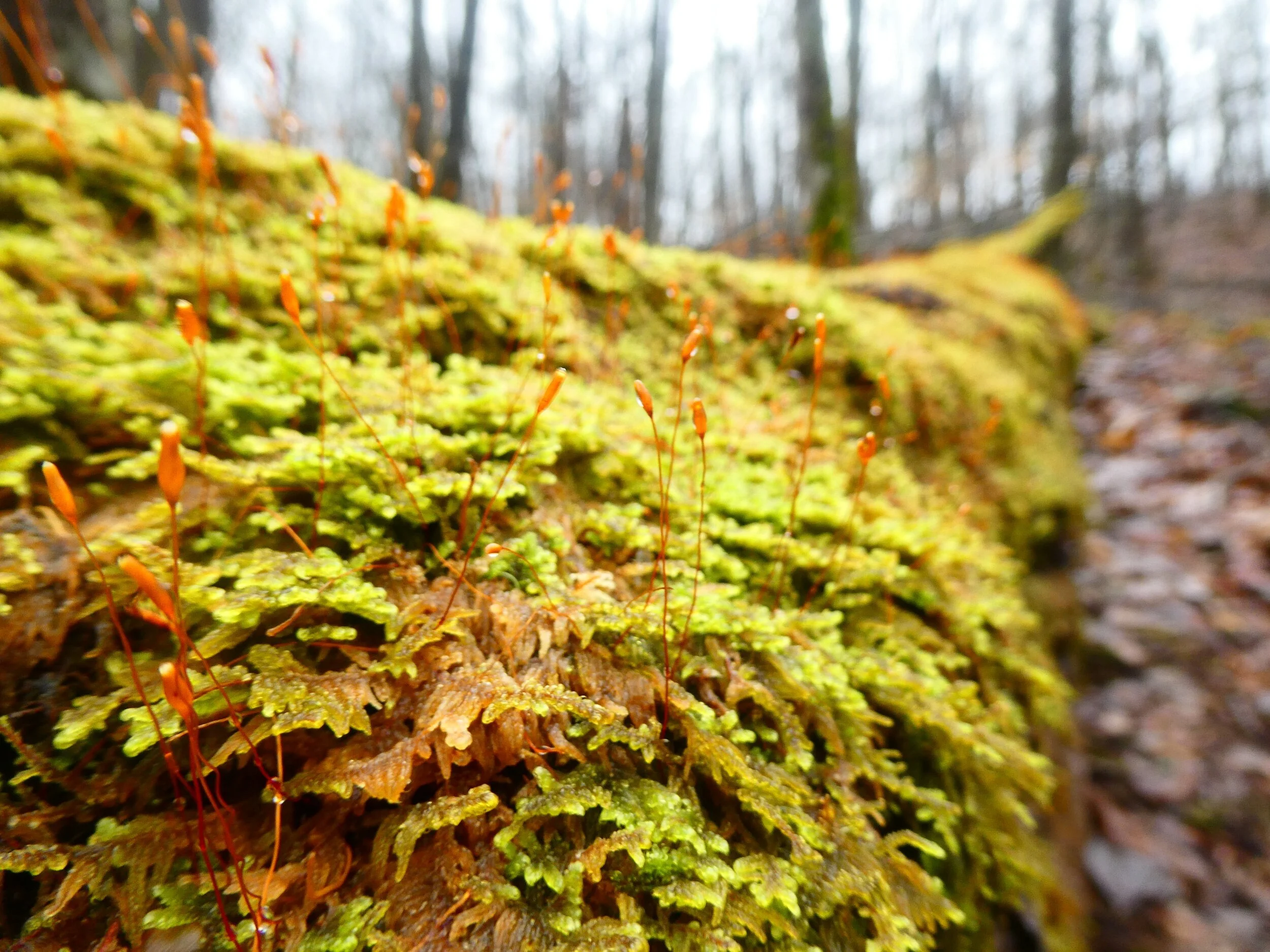
This morning I broke camp pretty early and was hiking by about 8:20am. The rain had not lasted long into the night, but the morning was cold and a light fog hung in the air. My goal for the day was to make it about 11.4 Miles to Spence Field Shelter. After climbing a ridge for about 30min, I found a good spot to eat breakfast and stretch. While I was eating, fog descended heavily on the ridge, creating a mystical atmosphere. As visibility deteriorated in the heavy fog, it quickly became apparent how the Smokies earned their name.

processed_P1040338.JPG

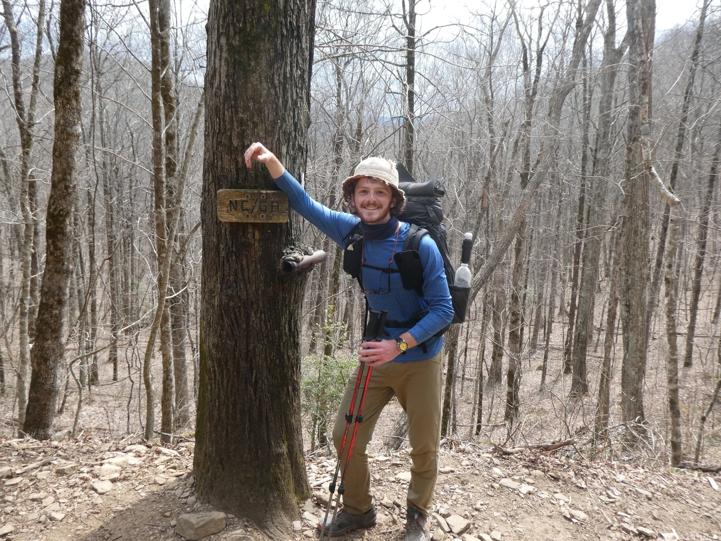
Soon the trail merged with the North Carolina/Tennessee border and I briefly amused myself my hopping from one state to another as I walked. After another 3 miles I passed Mollie's Ridge Shelter which emerged from the fog in a faintly ominous manner. This was my first time witnessing a shelter in the Smokies and I was immediately struck by its stone construction and fireplace. It was still early in the day though, and I did not linger long before hiking on.

Mollie's Ridge Shelter

Mollie's Ridge Shelter

After hiking another 3 miles, I reached Russell Field Shelter where I planned to stop for lunch. The sun emerged for the first time while I was eating. The warmth chased the fog away and quickly became a rather lovely afternoon. As I soaked in the sun, an older day hiker informed me that the weather tonight and tomorrow was forecasted to be pretty rough. It sounded like thunderstorms and wind gusts all day. Exciting😬

Russell Field Shelter

Russell Field Shelter

processed_P1040480.JPG
processed_P1040488.JPG

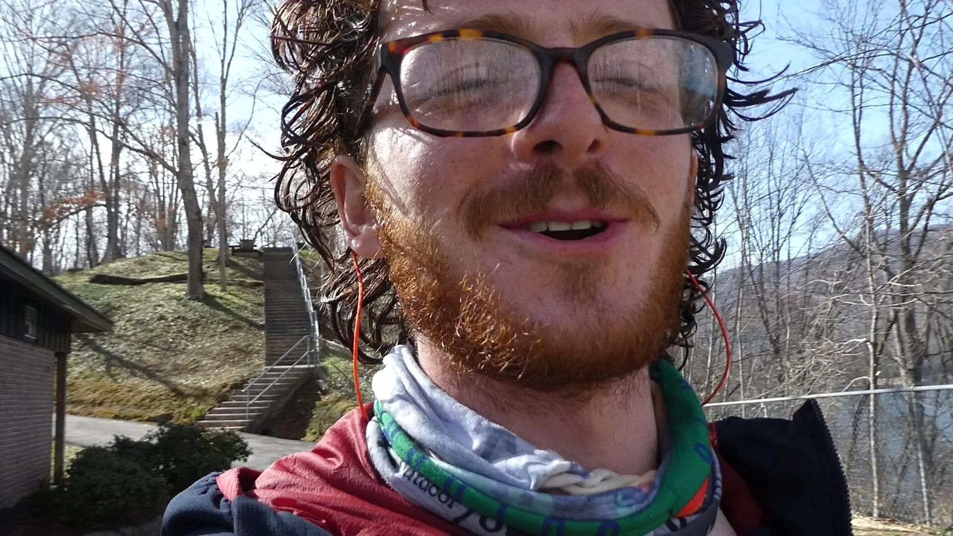
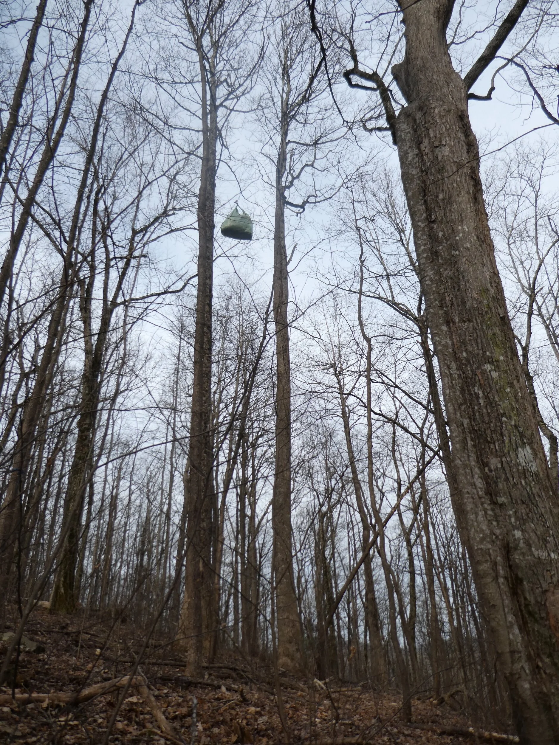
I made it to Spence Field just after 3pm. Delta, Tracy, Cloudkicker, Justin, and Tunes were already at the shelter. The weather was still lovely, but I set up my tent in a grove of Mountain Laurel in anticipation of things getting nasty. After setting up my tent, I joined the other thru-hikers around the fire pit and we chatted the afternoon away. I met a few new hikers including "Dr. Cheese" (a physical therapy Ph.D. from Atlanta), "Dirty Pasta" (who earned her trail name after spilling her dinner early in the hike), and "Calypso." Later in the afternoon Steve, who I met yesterday at the lodge, arrived with "Cranberry," a professional cellist from New Zealand.

We all ate dinner around the fire pit. At one point, almost everyone was running their backpacking stoves and the cumulative roar was approximately as loud as a jet engine. I ate my ramen and then Dirty Pasta offered me her leftover Mountain House meal, which was rather tasty. After dinner, Tunes busted out the Ukelele and we all joined in to sing "Chicken Fried" by the Zac Brown Band while steve accompanied by playing drums with cook pots and mugs.

processed_P1040495.JPG

The evening slowly wound down and I retired to my tent silently hoping that I would not be blown away in the night.

Deep in the Smokies
heavy fog rests on the ridge
enveloping all

I thought this log was super cool

I thought this log was super cool

processed_P1040422.JPG
March 24, 2021 /Jack Boyette
Comment
View from the Shuckstack

View from the Shuckstack

Hikers Log - trail date: day 16

March 23, 2021 by Jack Boyette

(Fontana Dam Shelter (mile 165.7) - Birch Spring Tentsite (mile 172.3))

I woke up at 7am this morning and spent a little over an hour trying to catch up on Hikers Logs in my tent. I ate breakfast in camp and visited the bathroom facilities one last time before calling the Fontana Shuttle at 9am.

Breakfast in camp

Breakfast in camp

The woman on the phone told me to wait in the parking lot for the 9am shuttle which would be arriving shortly. Sure enough, I was only waiting a couple minutes before a white passenger van pulled up and a cheery shuttle driver hopped out and introduced himself as "Shua, as in Jo(shua)."

Shua drove me into Fontana Village and gave me a tour of the tiny community. It quickly became apparent that the entire "village" was just a mountain lodge and resort. Shua explained that basically all the residents of Fontana Village were resort staff. It also became apparent that April 1st was opening day for most of the amenities in the village. Unfortunately, this meant I was too early to take advantage of the ice cream shop.

My goal in town was to pick up my resupply box from the post office, which opens at 11:45am, so I had a while to wait. Shua dropped me off at the main lodge and I found a comfy lobby chair in which to pass the time. After about an hour, Delta, Tracy, Cloudkicker, and Justin emerged from the lodge dining room and explained that the breakfast was outstanding. Delta said he was thinking about packing out half of his breakfast burrito and half of his burger from last night, but he did not think he could eat both. He asked if I wanted either and I happily accepted the half breakfast burrito. It was delicious.

At noon I made my way across the village to the post office, filled with anxious speculation as to whether my package had actually arrived. You see, when I shipped my resupply from Franklin, I foolishly forgot to note the tracking number for the package. This meant I had no real confirmation that the package had shipped successfully. Fortunately, the man behind the counter at the small one-room post office quickly found my package. I made my way back to the lodge and transferred the contents of my resupply box into my food bag. As I was packing, Katie and Jasmine arrived with their own resupply box and offered me several snacks that they did not want.

Packing my resupply in the Fontana Lodge lobby

Packing my resupply in the Fontana Lodge lobby

After packing, I waited for the shuttle to arrive back at the lodge. Shua arrived about a half hour later and I climbed into the van along with Katie and Jasmine who offered me a single serving shot of Fireball cinnamon whiskey. I figured why not and took it. Shua dropped Katie and Jasmine off at the Fontana Road parking lot and then dropped me off at the Hilton parking lot. After thanking Shua for his services, I took my Fireball shot - which I immediately regretted - and headed down the trail.

Me and Shua

Me and Shua

From the Hilton parking lot, the AT follows a road which leads over Fontana Dam and then up a hill to the southern boundary of Great Smokey Mountains National Park.

processed_P1040259.JPG
processed_P1040261.JPG
processed_P1040262.JPG

When I reached the southern boundary of the Smokies, I encountered a metal box labeled "AT THRU HIKERS DEPOSIT PERMITS HERE." I dropped the bottom half of my permit into the box and kept the top half to deposit when I reached the northern boundary of the park. I was now officially in the Great Smokey Mountains.

processed_P1040266.JPG

My goal was to hike about 4.5 miles into the park. Based on what I had been hearing from other hikers, the first day or two in the Smokies is a neverending climb to reach the mountain ridge. Sure enough, the trail started climbing immediately. Early in the climb, I saw two large pileated woodpeckers, but was unable to get a picture of one. The climb continued for a while, but overall the trail was well graded, and it was not too strenuous.

After a little over 3 miles, I took a short but steep side trail to the Shuckstack, an old fire tower with incredible panoramic views of the surrounding area. At the base of the tower were the ruins of a cabin which used to house the fire tour attendant.

processed_P1040299.JPG
processed_P1040287.JPG

After appreciating the views from the Shuckstack and avoiding a fall on the ridiculously steep stairs, I continued down the trail. A little over a mile later, I arrived at the campsite which seemed to be quite the popular spot. I recognized a few familiar faces including Delta, Tracy, Cloudkicker, Justin, and Tunes. After setting my tent up in one of the few remaining spots, I made my way down to the creek to soak my feet in the cool water. This is apparently really good for your feet after a long day of hiking, so it is something I should try to be more intentional about in the future. I ate dinner while soaking my feet and then retired to my tent for the evening when it started lightly sprinkling.

processed_P1040307.JPG

From my tent, I could hear Tunes singing and playing his ukelele. He played a bunch of different songs, but some standouts included "Hooked on a Feeling” by Blue Swede, "Africa" by Toto, and "Don't Stop Believing" by Journey. At some point I realized that the side of my tent was glowing red. I quickly wiggled my way out in time to catch the tail end of an incredibly dramatic sunset. The sky looked like it was ablaze as the sun crept below the mountains. It was a good way to end the day.

Fontana Hilton,
you sure have been good to me
but the Smokies call

March 23, 2021 /Jack Boyette
3 Comments
processed_P1040135.JPG

Hikers Log - trail date: days 14 & 15

March 22, 2021 by Jack Boyette

Day 14: (Nantahala Outdoor Center (mile 136.7) - Tentsite North of Stecoah Gap (mile ~150.6))

I woke up to find that I had not been swept away by river flooding in the night. After momentarily rejoicing, I packed my things, prepped my breakfast, and said my goodbyes to Hobo Island. Before setting out on the trail, I made a quick pit stop at the restroom and took time to complete my morning stretches. The N.O.C. is situated at the bottom of Nantahala Gorge, and after spending much of yesterday completing the steep and rocky descent into the gorge, I knew that the climb out would likely be tough.

My goal for the day was to hike approximately halfway to Fontana Village (my next resupply). After crunching some numbers and referencing my navigation app, I determined that Stecoah Gap was roughly the halfway point at 13.8 miles away. This would be a pretty long day with some major climbs, so I decided I would first shoot for Locus Cove Gap, a campsite 10.8 miles away. If I reached Locus Cove and still felt good, I would push the next three miles to Stecoah Gap.

processed_P1040120.JPG

I started hiking at about 8:30am and immediately began climbing out of the gorge. I passed Katie and Jasmine after a few minutes and they asked me if I liked the trail name “Frog Man,” because: “thats what everybody calls you anyways.” I told them I was not immediately opposed but I was also not sold yet. We will see if it sticks.

The climb was gradual but constant for the first 3 miles. In the morning I passed a pair of hikers who introduced themselves as Tracy and Cloudkicker. I also passed Amanda who I met last night at N.O.C. Amanda wears a glitter fanny pack and always looks like she is ready to hit the disco. After hiking about 5 miles, I made it to a rocky outcropping known as the "Jump-up." From the Jump-up I could see the Nantahala River down at the bottom of the gorge. It is always a cool feeling looking back at how far you have come.

Peering down into Nantahala Gorge from the Jump-up

Peering down into Nantahala Gorge from the Jump-up

After completing the first big climb of the day, I ate lunch at Sassafras Gap Shelter. The gap was windy but I was able to find a little relief from the cold in the shelter. Tracy and Cloudkicker also joined me in the shelter for lunch.

Sassafras Gap Shelter

Sassafras Gap Shelter

After eating, I did some quick stretches in anticipation for the short but steep climb to the top of Cheoah Bald, which is also the northern terminus of the Bartram Trail. I was excited to see Cheoah after hiking the Georgia section of the Bartram Trail back in January. The climb was indeed steep, but I powered up the bald and was rewarded with a spectacular view. On top of Cheoah Bald, I met Justin, a fellow thru-hiker and rugby player from Charlotte, NC. I chatted with Justin for a bit and then started the 2.5 mile descent to Locus Cove Gap.

The view from Cheoah Bald

The view from Cheoah Bald

I reached Locust Cove Gap and found very few available tent pads. It was mid-afternoon at this point and I was feeling pretty good, so I decided to push the next 3 miles to Stecoah Gap. On the climb out of Locus Cove Gap, I ran into Evan who explained he was now going by the trail name "Delta." This was a reference to his favorite saying: "it's all about the deltas!" which refers to the greek symbol delta, signifying change. The trail is constantly changing: terrain, weather, and scenery are never the same for long. So the trail name "Delta" is an acceptance and celebration of this change, which I think is pretty cool.

As Delta and I desceded towards Stecoah Gap, we joined up with Amanda and Madeline, who informed us that there might be trail magic waiting for us in the gap. Sure enough, as we continued our descent, we could see a large group of people gathered below in the gap picnic area. When we arrived, we encountered a group of four trail angels who offered us hotdogs, burgers, pasta salad, beer, whiskey, and an assortment of snacks. One of the women explained that they were doing trail magic in honor of her father, Eddie Noonkester, who passed away during his thru-hike attempt a few years ago. This was their second year honoring him and she proudly told me that they planned to continue the tradition as long as possible. I also learned that two friends of the family are currently attempting a thru-hike and are carrying Eddie's thru-hiker tag to Mt. Katahdin.

I ate two burgers, two helpings of pasta salad, and a beer. Since I was planning to camp at the gap, I decided to lounge around and took my shoes and socks off and elevated my legs. I also joined Madeline for a stretching session and she showed me a couple new stretches and movements to open up my hips and increase mobility. I will definitely be adding these to my usual routine because I have been feeling some soreness in my right hip over the last couple days.

The Stecoah Gap trail angels and me. The woman on the far left is Eddie Noonkester’s daughter

The Stecoah Gap trail angels and me. The woman on the far left is Eddie Noonkester’s daughter

As I continued lounging around the gap, I overheard a section hiker explain that there was an unmarked tentsite about 15 minutes up the trail. This piqued my interest because the only real place to camp at the gap was on an old gravel road. At this point in the afternoon, I was feeling rested and I also desperately needed to dig a cat hole, so I opted to continue to the tentsite. I thanked the trail angels for their generosity and hurried up the trail. The climb out of the gap was steep, but it leveled after about 10 minutes and I was able to find a suitable cat hole spot. When I finished my business, I was shocked and embarrassed to realize that in my haste to get out of the gap, I had hiked off without my socks! I realized that I left them hanging on a fence back at the gap🙃 I left my pack next to the trail and practically ran back to Stecoah Gap. To my embarrassment, I passed Excel, Amanda, and a handful of other hikers on my way back to collect my socks. Each time I passed a familiar face, I had to shamefully re-explain my foolishness - much to the amusement of the other hikers😅

I collected my socks and hiked back out of the gap without incident. After collecting my pack, I continued hiking for another five minutes or so and found the unmarked tentsite. After hanging my bear bag and setting up my tent, I retired for the evening and assessed the upcoming hike tomorrow. First thing in the morning I would be tackling "Jacob's Ladder," which involves about 800 feet of elevation gain over a half mile. After that, my goal was broadly just to get as close to Fontana Village as possible.

Don't forget your socks
they're an essential item
that you'll miss dearly

processed_P1040171.JPG

processed_20210404_221407.jpg

Day 15: (Tentsite North of Stecoah Gap (mile ~150.6) - Fontana Dam Shelter (mile 165.7))

I started hiking today a little before 9am. My plan was to hike about 15 miles and camp as close as possible to Fontana Road. This is the road to get into Fontana Village, NC where I needed to pick up the resupply box I mailed from Franklin. I mailed the box to the Fontana Village Post Office with a note stating: "hold for thru-hiker." This is something most thru-hikers do on occasion, so post offices in trail towns are accustomed to holding packages for short periods of time. The Fontana Village Post Office closes at 3:45pm, and seeing as how I was nearly 15 miles from Fontana Road, I decided it would be best to camp near the road and catch the earliest possible shuttle into town tomorrow. This would give me more time in town to call AC, get a warm meal, and maybe try to catch up on hikers logs.

The hiking was immediately angled upwards and after about a mile, I reached the incredibly tall and steep hill known as "Jacob's Ladder." During the climb, I caught up to Delta and Justin who must have passed me while I was packing up. They too were huffing and puffing up the hill and together we joined in a chorus of expletives venting our frustration with the bonds of gravity.

View from the ridge after Jacob's Ladder

View from the ridge after Jacob's Ladder

After what seemed like an eternity, we reached the top of Jacob's Ladder and began hiking along a ridge. We passed Brown Fork Gap Shelter and I stopped at the next water source to collect water and eat breakfast. My breakfast was a concoction of ramen noodles and potatoes which was originally supposed to be last night's dinner (but the trail magic at Stecoah Gap had served that purpose). After eating, I continued hiking and passed through Hogback Gap which is labeled with a sign that might have been useful 20 years ago.

processed_P1040183.JPG

Around noon, I stopped for lunch at Cable Gap Shelter around noon. I found Delta eating lunch at the shelter and he informed me that the shuttle into Fontana Village will pick up hikers from Fontana Dam Shelter which is a little over a mile past Fontana Road. The Fontana Dam Shelter is affectionately referred to by hikers as the "Fontana Hilton" because of its luxurious accommodations. Apparently, the Fontana Hilton is not only a massive 20 person shelter, it also has flushing toilets, showers, and power outlets. Needless to say, this became my destination for the evening.

Cable Gap Shelter

Cable Gap Shelter

From Cable Gap Shelter, I had roughly 6.5 miles to hike before reaching the Fontana Hilton. This included a brief climb followed by a long meandering descent towards Fontana. While making my way down, I was struck by the number and diversity of wildflowers lining the trail. I stopped frequently to take pictures and was excited to observe such clear evidence that spring was reaching southern Appalachia.

processed_P1040214.JPG
processed_P1040219.JPG

Eventually, I made it to Fontana Road where I ran into Delta, Tracy, Cloudkicker, and Justin. They explained that they were planning to get a room at the Fontana Lodge and I told them I had a reservation at the Fontana Hilton. Also waiting near the road was a thru-hiker sprawled out across his sleeping pad playing a ukelele. I thanked him for serving up pleasant tunes to suit the lovely afternoon. He laughed and explained that his trail name was "Tunes." I responded: "that makes sense," and hiked on down the trail.

The trail followed the lake shore from Fontana Road to the Fontana Hilton. This made for a scenic mile of hiking as my anticipation quickly grew for the luxurious evening awaiting me. Eventually, I rounded a corner and caught my first glimpse of the massive shelter looming above. When I arrived, I was struck by the sheer size of the shelter. I was also in awe of the solar panel phone charging station and water spigot. The only other hiker at the shelter was Amanda who explained that the toilets and showers were in a separate building up the road.

The 20-person “Fontana Hilton"

The 20-person “Fontana Hilton”

The separate shower house

The separate shower house

By the time I had set my tent up, Excel and a hiker who introduced herself as "Jollygreen" had arrived at the shelter. Amanda and Excel both explained that they were actually spending the night at the Fontana Lodge and soon they hiked up the road to catch the lodge shuttle. I then made my way to the shower building where I planned to simultaneously shower and wash my clothes. I was not expecting much from the shower house, but the water was hot and someone had left a little baggie of shampoo in the stall. I stepped into the shower with all my hiking clothes on and rinsed them to the best of my ability. After my shower, I hung all my hiking clothes to dry on a fence near my tent and silently vowed to not hike off without my socks again.

My very pleased post-shower expression

My very pleased post-shower expression

Jollygreen and I ate dinner and I learned that her trail name was a reference to her height and green puffy jacket which made her resemble the Jolly Green Giant. While we were eating, a hiker arrived who I immediately identified as "Aquaman." I had seen Aquaman's stamp in multiple shelter log books and I was excited to see that he was actually wearing an Aquaman patterned top. He explained that he is often paid to dress up as Aquaman and visit hospitals and comic book conventions. He says that DC even used his likeness as the model for Aquaman in a video game. If you want to follow Aquaman's thru-hike, he is vlogging it on his YouTube channel "Aquaman on the AT."

After eating dinner and chatting with Aquaman and Jollygreen for a bit, I retired early at about 7pm. Tomorrow my plan is to catch the 9am shuttle into Fontana Village and pick up my resupply package whenever the post office opens. After that I will cross over Fontana Dam and into Great Smokey Mountains National Park. Despite growing up in the southeast, I have never visited the Smokies, so I am super excited to hike across the entire park as a thru-hiker!

Climb in the morning
then stop to smell the flowers
in the afternoon

processed_P1040233.JPG
March 22, 2021 /Jack Boyette
8 Comments
processed_P1040032.JPG

Hikers Log - trail date: days 12 & 13

March 20, 2021 by Jack Boyette

Day 12: (Moore Creek Campsite (mile 110.4) - Burningtown Gap (mile 124))

I woke up at about 8:15am to heavy condensation in my tent from the nighttime rain. I packed my things, ate a bar for a little energy, and started hiking around 9:30am. My plan was to eat breakfast on top of Siler Bald which was a little over 3 miles away. Guthook describes Siler Bald as: "one of the most spectacular summits along the southern Appalachian Trail," so I was super stoked to check it out.

The bald itself is accessible via a 0.2 mile side trail which is graded at approximately 45 degrees the whole way up. I made it to the side trail at a little after 10:30am and dropped my pack at the bottom of the bald. I then grabbed my breakfast and camera and began the steep climb to the top of the bald. During the climb, I noticed lots of ice on the ground. It seemed like the rain last night had frozen on trees near the top of the bald. With each gust of wind, chunks of ice would fall from branches and collect on the ground. This created an illusion of hail which was a bit surreal given the relatively clear skies.

I reached the top of the bald and was greeted by Squid, Katie, and Jasmine. The views on top of Siler Bald were indeed spectacular, but the wind goblins were angry and the constant convection was cooling me down quick. I took a couple pictures but it was too cold to stick around for breakfast. I descended the bald and ate at the base of the side trail.

processed_P1030825.JPG
processed_P1030821.JPG

As I was enjoying my breakfast, two hikers came up the trail. They introduced themselves as "Michelle" and "Paperclip." I had heard of Paperclip during my first week on trail. He has been passing out self made AT thru-hiker hang tags. Hang tags are usually distributed by the Appalachian Trail Conservancy to thru-hikers at the start of their hike. However, ever since the pandemic started, they have not been distributing tags to discourage thru-hiking. I introduced myself and Paperclip asked if I had a hiker tag yet. I said that I did not and he responded: "every thru-hiker deserves a hiker tag." He then handed me a green thru-hiker tag printed on a thin durable plastic material. I was super pumped to receive my hiker tag and thanked Paperclip for making and distributing the tags.

processed_P1040319.JPG
processed_P1040321.JPG

I hiked another 2 miles beyond Siler Bald and passed a group of day hikers who informed me there was trail magic up ahead at the next gap. Sure enough, when I reached Wayah Gap I encountered a hand drawn sign announcing trail magic at the picnic area.

processed_P1030841.JPG

I made my way down a side trail and encountered an older lady who introduced herself as "Lucky Moon." She offered me a cup of hot cocoa which I gladly accepted. She also had a table strewn with brownies, carrots, and oranges. Lucky Moon explained that her granddaughter who loves participating in trail magic had drawn the sign. I lingered for a bit, enjoying my hot cocoa and chatting with Lucky Moon and other hikers. After a bit, I thanked Lucky Moon and headed down the trail.

processed_20210323_191822.jpg

After hiking another 5 miles, I reached Wayah Bald, home to a rather iconic stone observation tower. I ate lunch at the overlook near the tower and soaked in the incredible view. Far away in the distance I could see the fire tower on Albert Mountain. It was really incredible to see how far I had come in just a few days.

processed_P1040009.JPG

After lunch, I hung around the bald and called AC since I had not been able to get through to her last night. After we talked, I set off again hoping to push another 4.5 miles to Burningtown Gap which would put me half way between Franklin and the Nantahala Outdoor Center (N.O.C.). I made it to Burningtown Gap around 5pm and settled down for what was looking to be a cold and wet night.

My goal tomorrow is to hike to the N.O.C. where I am hoping to resupply, shower, and grab a beer. I think I visited the N.O.C. when I was younger during whitewater rafting trips, but I am not entirely sure. I guess we will see tomorrow✌

Lookout from Wayah -
retracing the ridges to
see how far I've come

The stone lookout tower on Wayah Bald

The stone lookout tower on Wayah Bald

The AT merged with the Bartram Trail for a few miles today

The AT merged with the Bartram Trail for a few miles today


processed_P1040098.JPG

Day 13: (Burningtown Gap (mile 124) - Nantahala Outdoor Center (mile 136.7))

The rain last night did not last long, but it was enough to coat my tent in tiny droplets of water that froze in the morning chill. This left a thin layer of ice on the outside of my tent which was enough to numb my fingers as I packed up my tent. I ate a bag of peanuts and began my hike at about 9:40am. My plan for the day was to hike about 13 miles to the Nantahala Outdoor Center (N.O.C.). After hiking about a mile, I ate breakfast at Cold Spring Shelter and rejoiced as the sun began to warm my chilled fingers.

processed_P1040044.JPG

After breakfast, I hiked another 2 miles and took a short side trail to check out a handful of tremendous views from Rocky Bald.

processed_P1040051.JPG

From Rocky Bald I began the steep descent into Tellico Gap which was followed by a steep climb to the summit of Wesser Bald. As I reached the bald, I ran into Squid who told me that she had just booked a ziplining and whitewater rafting trip tomorrow at the N.O.C. Needless to say, I was super jealous.

I took my pack off and grabbed my lunch supplies before making my way towards the lookout tower on top of the bald. As I was approaching the tower, Evan, Katie, and Jasmine descended the stairs and explained that they had just eaten lunch. I told them that was my plan too and climbed up the tower. At the top of the tower I appreciated the views for a moment and then realized I forgot my spoon at the base of the tower. I did not feel like climbing down yet, so I put lunch on hold and did my mid-day stretches while appreciating the views, sun, and gentle breeze.

processed_P1040062.JPG

From Wesser Bald, it is more or less all downhill to the N.O.C. After about 2 miles I reached an exposed rocky ridge that appeared to have sustained fire damage in recent years.

processed_P1040067.JPG

The ridge provided little protection from the sun, whose heat and UV rays were growing more oppressive by the minute. I applied some sunscreen and began the extremely dry, rocky, and steep descent towards the N.O.C.

Looking back up the steep and rocky descent from Wesser Bald

Looking back up the steep and rocky descent from Wesser Bald

After what seemed like a neverending downhill, I reached Rufus Morgan Shelter - the last landmark before the N.O.C. - and found Evan, Katie, Jasmine, and Tolkien resting and stretching near a creek. I stopped to join them for a bit and we discussed all the amazing luxuries apparantly awaiting us at the N.O.C. After a few minutes, I continued on and passed a family of day hikers who asked me how long I had been on trail. I was startled to realize that I was not exactly sure and after stuttering for a second or two, I blurted out: "about two weeks, I think." I was close, I guess 😅

I soon arrived at the N.O.C. and realized that I have definitely visited before for whitewater rafting trips with the Boy Scouts. It was cool to return as a prospective thru-hiker. I had a list of tasks I hoped to accomplish in the afternoon, including resupplying, printing my permit for Great Smokey Mountains National Park, showering, laundry, and acquiring a hot meal. But before I could accomplish any of those things, I needed to find out where I would be sleeping for the night.

processed_P1040094.JPG

The word on the trail was that there is an island stealth camping spot down river from the N.O.C. To me, that sounded pretty damn cool, so I went to the main outfitter building to ask about nearby tenting opportunities. The first staffer I approached about tent camping very quickly responded that the N.O.C. does not offer any tentsites and that the only option was to continue up the trail a mile or two. As she was explaining this to me, I noticed another N.O.C. staffer at the top of a set of stairs subtly beckoning me to come up to the second floor of the outfitter. I thanked the first lady for her time and climbed the stairs as nonchalantly as possible. When I reached the top, the second staffer explained that if I crossed the river and followed the railroad tracks for a few minutes, I would reach a fence marking the end of N.O.C. property. Beyond the fence, I would find a trail leading to "Hobo Island," a popular stealth camping spot used by hikers for many years. He also told me that the island technically belonged to the railroad company, so it was "camp at your own risk."

I left the outfitter and found Katie, Jasmine, and Evan outside. They were hanging their tents and sleeping bags to dry on lines strung between the columns fronting the outfitter. I joined them and hung my tent to dry near the entrance. Soon other hikers joined us and the front of the N.O.C. outfitter building was transformed into a giant "packsplosion" as we all emptied the wet contents of our packs to dry on the sidewalk. We joked that we were adding to the N.O.C.'s outdoorsy aesthetic.

Our “packsplosion,” conveniently located on the N.O.C.’s doorstep

Our “packsplosion,” conveniently located on the N.O.C.’s doorstep

I located an outlet and began charging my things while I reserved a thru-hiker permit for Great Smokey Mountains National Park on my phone. I emailed my permit to the N.O.C. and made my way to the General Store where I planned to resupply, print my permit, and pay for a shower. The resupply was pitiful, but I only had a two day carry to Fontana Village, so I made it work. I then printed my permit and payed for shower access. The lady at the register handed me a towel and a magnetic key card which would grant me access to the shower building.

I made my way back to the outfitter building, and as I arrived, a very flustered looking manager came out and asked us if we could move our mess across the river. We happily obliged, and I found that my tent had already dried completely. I then took some time to call AC and made my way to the shower building. The shower was nothing fancy, but it did the job. Afterwards, I threw my laundry in with Evan and decided to go set up my tent on Hobo Island before dinner.

I followed the tracks for a ways until I reached a fence. I was not sure if it was the right fence, but in the distance I could see two people with backpacks on what must have been Hobo Island. I hopped the fence and soon discovered a well worn trail leading across a floodplain to an "island" situated in a scenic bend of the Nantahala River. When I made it out onto the island, I found Detox and Squid setting up their tents. I setup my tent and asked Detox and Squid if they had eaten dinner yet. They said they had and I asked if they knew when the restaurant closes. Squid responded that the restaurant closes at 7pm. I looked at my watch, noticed it was 6:45pm, and practically sprinted back to the restaurant at the N.O.C. I arrived a few minutes before 7pm and asked if they were still seating guests. They said they stopped taking names at 7pm, so I was right in time. The wait was estimated to be 20 minutes, so I gave them my phone number and went to check on my laundry.

Outside the laundry room I found Evan eating a pizza. He said the dryer had just finished, so I changed into my warm and clean clothes. I told Evan that I had reserved a table and he agreed to join me even though he had just eaten. Soon our table was ready and we were seated on the outer patio with an excellent view of the Nantahala. I ordered a burger with fingerling potatoes and a stout from a local brewery. Everything was delicious and I left feeling supremely satisfied.

Evan and I returned to Hobo island and found that it had turned into quite the popular spot. Nine hikers - including myself - had set up for the night. We all agreed that it was the coolest campsite yet and quietly hoped the river would not suddenly flood on us. Fortunately, there was no rain forcasted, and I soon fell asleep listening to the sound of the river rushing by.

Camp at your own risk
down the river railroad tracks
on Hobo Island

The Hobo Island hiker encampment

The Hobo Island hiker encampment

March 20, 2021 /Jack Boyette
9 Comments
The sunrise from Albert Mountain

The sunrise from Albert Mountain

Hikers Log - trail date: days 10 & 11

March 18, 2021 by Jack Boyette

Day 10: (Albert Mountain Fire Tower (mile 99.7) - Rock Gap (mile 105.8) *overnight with the Crawfords*)

I woke up a little before 8am to find that nearly everything had dried out. Apparently the rain had stopped at some point during the night and the wind gusts over the mountain must have worked hard to dry my tent. I celebrated this pleasant surprise by digging my morning cat hole and retrieving my bear bag. As I was returning to my tent I noticed that the sunrise was casting a golden complexion on the mountains to the west. I could not see the sunrise from where I set up my tent, but I knew that it must be a good one so I hurried to break down my tent and boogie up to the fire tower.

processed_P1030715.JPG

When I reached the tower, I let out an involuntary "wow." Below me stretched a valley of clouds interrupted only by an occasional mountain ridge (pictured in the banner above).

processed_P1030716.JPG

I sat at the top of Albert Mountain for a while just appreciating the grandiose view. My spirits were rather high and I decided to eat breakfast and do my morning stretches at the base of the fire tower. I also found the unofficial 100 mile marker of the AT carved into the fire tower staircase. I had half-heartedly searched for the marker last night, but the rain and cold had forced me into my tent. Albert Mountain is technically at mile 99.7, but this is the spot that most thru-hikers treat as the 100 mile mark. I took several pictures and laughed as I thought to myself: "only 21 more to go!"

processed_P1030747.JPG
processed_P1030746.JPG

My plan for the day was to hike just under 10 miles and camp near Winding Stair Gap. From there I would catch a morning shuttle into Franklin, NC to resupply and maybe grab a beer at Lazy Hiker Brewing Company. I set out a little after 10am and was happy to notice that my left arch was not giving me trouble like it had been yesterday.

After hiking a little over 6 miles I reached Rock Gap, where a very excited young boy ran up to me from down trail and yelled: "are you a hiker?!?!" My first thought was: "where are your parents??," but I replied: "yes!" The young boy then explained that his family was doing trail magic. He very excitedly told me that his name was Rainier and started naming off all the items on the trail magic menu including salad, corndogs, french fries, beer, fruit, and the list just kept going. I was honestly a little overwhelmed by Rainier's energy and the apparent fact that I would soon be in a food coma.

processed_P1030771.JPG

As Rainier led me out of the woods and into the gap parking lot, I saw two canopy tents. The first sheltered several boxes of food, a massive cooler, and a propane stove being manned by a woman and two high-school-aged kids. The other canopy tent sheltered a portable fire pit and a ring of chairs. I recognized a couple of hikers sitting around the fire pit, but I also noticed a man hunched over the pit with a cauldron of frying oil and a kettle. As I approached, I was offered a plate onto which I heaped a very tasty salad. I then accepted a beer and made my way to the fire pit. The two tents were a hive of activity and I noticed a lot of kids ranging in age from preschool (Rainier) to late high school/early college. Something finally clicked in my mind and I asked: "are you guys the Crawfords?" They were.

The Crawfords are pretty famous in the thru-hiking community. In 2018 they became the largest family to complete an AT thru-hike (two parents and six kids). At the time, their daughter Filia was also the youngest female to complete the AT (she was seven). I was not super familiar with the Crawfords' story beyond their collective trail name "The Family" and that they had an encounter with Child Protective Services after getting caught in a blizzard in the Smokies. That being said, I was still really excited to meet them and I was especially curious to learn more about their lifestyle.

As soon as I sat down, Ben (the father) asked if I would like some fresh french fries. He then proceeded to dump freshly cut potatoes into the cauldron of oil. Before I could even finish my fries, Ben asked if I wanted a corndog or fried cheese stick. I accepted both offers and he dipped a hotdog and a cheese stick into batter and dropped both in the oil. My lunch quickly turned into a plate of salad, three servings of french fries, two corndogs, a fried cheese stick, and a beer. I was a happy hiker.

I told Ben that I still had about 3.5 miles to hike before reaching Winding Stair Gap where I planned to camp for the night. He responded: "well, we'll be here tonight making fettuccine alfredo for dinner and we'll be back in the morning to make blueberry pancakes for breakfast!" ...and that is approximately the moment I decided to abandon my plans and camp at Rock Gap😂

Lots of other hikers passed through Rock Gap, but most were planning to make it into Franklin for the night, so they moved on after a corndog and a beer. Everbody kept mentioning that the weather was supposed to turn really nasty at night with heavy rain and strong winds, but the promise of blueberry pancakes kept me determined to tough it out at the gap. About mid-afternoon, Lauren and Squid showed up, both of whom were planning to spend the night at Rock Gap shelter just a few hundred yards down the trail. CatchUp and Lightning also arrived in their converted school bus to join in on the trail magic festivities.

The Crawfords, CatchUp and Lightning, and me

The Crawfords, CatchUp and Lightning, and me

As I hung around the gap waiting for dinner, I talked a lot with Ben and Cami about their thru-hike and their parenting philosophy. I will avoid dwelling on it too much here, but I must say that it was really fascinating hearing from a pair of parents that have adopted such a "radical" parenting strategy. The way they have chosen to raise their family shatters a lot of societal standards of "good parenting," but it was abundantly clear to me that their kids were happy, healthy, and much more mature than their ages would suggest. If you want to learn more about the Crawford family's thru-hike, check out their book "2000 Miles Together," which Ben tells me is available on Amazon.

Throughout the afternoon Rainier and Filia challenged me and other hikers to countless games of rock, paper, scissors and paddy cake, both of which I apparently suck at😅 At about 4:30pm, Dove (the oldest of the Crawford kids) announced that dinner was ready. She explained that they had made the alfredo sauce from scratch and my mouth watered as I smelled the roasted garlic. Squid, Lauren, and I devoured our pasta and discussed our plans for the night. I explained that I would probably set up my tent under one of the Crawfords' canopy tents to get a little extra protection from the monsoon that was apparently approaching. Squid and Lauren said that they were both planning to stay at the shelter. Ben an Cami briefly spoke amongst themselves and then offered that we could join them in their cabin for the night.

We then packed everything except the canopy tents, fire pit, and chairs in the back of the Crawfords' van. Squid and I loaded into the back of the van as well and we headed down the road. After a short drive, we reached the Crawfords' "cabin," which turned out to be a very large and very nice Airbnb just outside of Franklin. After leaving my dirty shoes and pack on the porch, I made my way inside and was immediately a bit overwhelmed. I found that I did not know what to do with myself; partially because all of the Crawfords were going about their evening tasks, and partially because the space was so nice and clean. I did not want to get any of the furniture dirty, so I ended up sitting on the floor while waiting for the shower to open up. While I waited, Ben interviewed me on camera about my thru-hike experience thus far. He did not specify what he was planning to use the interview footage for, but I am guessing it might end up on the family's YouTube channel: "Fight for Together."

After showering, Lauren, Squid, and I did a load of laundry and lounged in the living room feeling spoiled. Some of the kids baked cookies and pot stickers and offered us our fill of each. Eventually, the Crawfords made their way to bed and I spent the night on a very comfy leather couch. I was a happy hiker🤗

Sunrise on Albert
afternoon with the Crawfords
unmatched trail magic

processed_P1030762.JPG

Winding Stair Gap

Winding Stair Gap

Day 11: (Rock Gap (mile 105.8) - Moore Creek Campsite (mile 110.4))

I woke up at 7:15am and gathered my laundry from the dryer. After taking a bird bath in the sink, I lounged around and waited for the Crawfords to begin waking up. The house soon turned into a chaotic hive of activity and we ended up loading into the van a little before 8am. This time, I was in the back with Lauren and we discussed our excitement for the upcoming blueberry pancake breakfast. My plan was to eat breakfast with Crawfords and then hike the next 3.5 miles with Lauren and Squid to catch an 11:30am shuttle into Franklin.

Last night, before we left Rock Gap, we lowered the canopy tents and staked them down in anticipation for stormy conditions. When we reached the gap we found both tents had been blown over and appeared in rough shape. We quickly set to work getting the tents back up and unloaded the van for breakfast. After a few minutes, one of the tents blew over again and this time we gathered rocks to pin the tent's feet to the ground.

Once the tents were secure, Dove and Memory got to work cooking blueberry pancakes and eggs on the stove while Ben cooked sausages in a skillet over the fire. I ate my fill of pancakes and sausages and enjoyed my last few moments hanging out with the Crawfords. At about 9am Lauren and I thanked the Crawfords for their incredible generosity and headed down the trail. As I was leaving, Rainier challenged me to one last round of rock, paper, scissors. No one was surprised when I lost🤣

processed_P1030784.JPG

Filia joined Lauren and me for the first mile of our hike. She turned back and we said our goodbyes at Wallace Gap. Lauren and I talked about trail names and I said that she could be "Spreadsheets" or "Excel" given her history as a corporate accountant. Thus, Lauren became "Excel."

We started hiking in the rain, but by 10am it was barely raining at all. I realized at some point that I must have left my Buff in the dryer at the Crawfords. I was a little disappointed to loose a piece of gear so early in my hike, but it was not an essential item and I did not dwell on the loss. The 3.5 mile hike to Winding Stair Gap was nice and we reached the gap by 11am. While we waited for our shuttle, I used Lauren's trekking poles to knight her as "Excel of the Appalachian Trail."🗡

Our shuttle arrived promptly at 11:30am. The shuttle driver introduced himself as "Sunsets" and explained that he was a hostel owner who has written a guide on hiking the AT.

Sunsets has a pretty cool license plate

Sunsets has a pretty cool license plate

I asked Sunsets about the next two resupply points at the Nantahala Outdoor Center and Fontana Village, NC. Sunsets advised that I should ship a resupply to Fontana Village. He then dropped me off at the town square in Franklin where I ran into Madeleine and Daphne. I asked them about public restrooms in the area and Madeline recommended the bathroom at the local outfitter Outdoor 76.

After using the restroom, I figured I should ask the hiking experts at the outfitter about my left arch issue. My foot had not been bothering me much since the night on Albert Mountain, but I wanted to ask if they thought I needed fancy insoles or something like that. Basically, they told me just to do fewer miles and add some foot mobility stretches to my routine. They then offered me a free Buff and I marveled at the coincidence that I would be offered a free Buff the same day I lost my old one. Serendipity🙌

After that, I resupplied at Ingles and called AC on my way to the post office where I was planning to ship a resupply to Fontana Village. I shipped my box priority mail and was told the package should arrive the next day. At this point, it was 4pm in the afternoon and I was feeling a little anxious to get back on trail. Yesterday, I had arranged with CatchUp and Lightning that they would pick me up in town and shuttle me back to Winding Stair Gap. I called and texted both Lightning and CatchUp and could not get through to either.

I made my way back to the town square and called one of the shuttle services. They charged a flat rate of $20 to shuttle to the gap, which would be great if I was with a group of five other hikers to split the cost, but that was more than I wanted to pay. I finally got a text from CatchUp who explained that their cat had run off in the night and they were waiting for her to return. I then made my way to Outdoor 76, which also doubles as a bar, to see if I could convince a local to give me a lift to the gap. Unfortunately, the bar was full of thru-hikers and there were not any locals in sight. I explained my dilemma to the bartender and asked where the best place would be to try and hitchhike from town. He directed me to a series of roundabouts on the way out of town and I set off down the road.

I made my way to the first roundabout with my thumb out and a smile on my face, trying to look as unintimidating as possible. I thumbed it for probably 15 minutes before an old golden Tahoe pulled up and a lady shouted: "where ya headed?" I told her I was trying to get to Winding Stair Gap and she responded: "Ok! Let me pick my kid up from school first!" She then drove about half a block to a church preschool. I met her in the parking lot and she introduced herself as "Halley, like the comet."

I asked Halley if I could send a picture of her license plate home for safety and she said: "of course!" I then loaded up with Halley and her daughter. Halley explained that her husband is always picking up hikers and doing trail magic so she was super excited to finally be picking up a hiker herself! I explained how grateful I was to be picked up and that this was my first time hitchhiking. Halley dropped me at Winding Stair Gap and I thanked her again for her kindness.

Halley and me

Halley and me

I was excited to find Dirk and Sneaky Pete waiting at the gap. They explained that a friend of Dirk's son was coming to pick them up and I stayed to chat for a bit. After a few minutes, their ride arrived and a young man jumped out with a cooler of beer and a goodie bag of food and snacks. He introduced himself as "Sam" and explained that he had thru-hiked a few years back. Sam offered me a vanilla chocolate stout, several bars, and two McDonald's cheeseburgers, all of which I accepted happily.

I stayed to chat a little longer and then said my goodbyes and headed down trail. I hiked about a mile to the first tent campsite and set up my things. I then spent a little over an hour trying to find service to call AC, but did not have much luck. I managed to send a couple texts and then settled down in my tent for the night.

Tomorrow my goal is to make it halfway to the Nantahala Outdoor Center, my next resupply point.

The trail has a way
of providing what you need
serendipity

processed_P1030794.JPG
processed_P1030795.JPG
March 18, 2021 /Jack Boyette
6 Comments
processed_20210322_074323.jpg

Hikers Log - trail date: day 9

March 16, 2021 by Jack Boyette

(Standing Indian Shelter (mile 85.9) - Albert Mountain Fire Tour (mile 99.7))

I woke up a little after 8am to the sound of heavy rain and occasional thunder outside my tent. After thanking the trail for giving me such a wonderful opportunity to test the integrity of my rain gear🙃, I began to pack my things. I packed my sleeping quilt and camp clothes within the relatively dry confines of my tent. These items all go inside a dry bag which is packed into a trash bag for extra waterproofing inside my pack. I then stored my pack under the awning of the shelter and went back to retrieve my bear bag and take down my tent.

I ate breakfast huddled under the awning of the shelter with most of the hikers who had spent the night at the campsite. After a while, it became apparent that the rain would not be easing any time soon and hikers slowly began to trickle out into the rain. After the crowd under the awning thinned out a bit, I did my morning stretches, got my lunch prepped, and set out into the rain at a little after 10am. My goal was to camp near the fire tower on Albert Mountain. My navigation app did not show a campsite there, but I figured there is always a tent pad or two near cool landmarks.

As I began hiking, I reflected on how unusual it was that I made it all the way through Georgia without any serious rainfall. This is almost unheard of, so it seemed fitting that my first full day in North Carolina would be a rainy one. Throughout the morning, I found the hiking to be rather pleasant. The colors of the forest seemed extra vivid as the moss and trees soaked up the falling rain. My rain gear also held up well, which certainly helped keep my spirits up and ward off hypothermia.

P1040102.JPG

My camera is not waterproof, so it spent most of the day hiding away in a waterproof baggie. Unfortunately, this means I did not take many pictures. All of the overlooks were completely fogged out, but I wish I could have taken more pictures of all the very happy moss.

After about 8 miles of hiking, I made it to the sign for Carter Gap Shelter where I planned to eat lunch. Katie and Jasmine, two prospective thru-hikers I met my first night at Stover Creek Shelter, arrived at just about the same time. We could not see the shelter from the sign and after spending an embarrassing amount of time following various side trails, we finally found the shelter. Captain had arrived already and was planning to spend the night. Katie and Jasmine also said they were planning to spend the night at the shelter. I still had about 6 miles left to hike so I ate my lunch, stretched, and headed back out on trail.

The afternoon was wet but the rain had lightened a bit. The fog however was here to stay, and though I climbed many ridges and passed several supposed "lookouts," I was not treated to any spectacular views. During the afternoon, I also started experiencing discomfort in the arch of my left foot. I slowed my pace and hoped that this was just some acute soreness after my bigger miles yesterday.

One of the few pictures I risked taking in the rain today. I still don't know what this sign means🤷‍♂️

One of the few pictures I risked taking in the rain today. I still don't know what this sign means🤷‍♂️

The last push of the day was the climb up Albert Mountain, which Guthook (my navigation app) describes simply as "steep." This amounts to about 400 feet of elevation gain over 0.2 miles. The climb was more technical than anything I have encountered before and I found myself concentrating intently on each step. I am probably exaggerating when I say that I was practically bouldering, but that is what it felt like as I scrambled up Albert Mountain.

Eventually, I made it to the top and was rewarded with more foggy views at the base of the fire tower. I climbed the stairs of the tower, but the trapdoor leading to the tower interior was bolted shut. I had not expected to be able to sleep in the tower, but it would have been cool, so I was a little disappointed. Sure enough, there were a handful of tent pads near the base of the tower. After scouting out one that seemed acceptably flat, I set up my tent and ate dinner. I realized that I was getting cold and irritable rather fast, so I quickly set up my bear bag and crawled into my tent. Once in my tent, I warmed up and spent a good chunk of time massaging my feet and thinking about the short day I was planning for tomorrow.

Thunder to wake me
heavy wind against my tent
and yet still, I hike

Surrounded by fog near the top of the fire tower on Albert Mountain

Surrounded by fog near the top of the fire tower on Albert Mountain

March 16, 2021 /Jack Boyette
2 Comments
processed_P1030609.JPG

Hikers Log - trail date: day 8

March 15, 2021 by Jack Boyette

(Dick's Creek Gap (mile 69.2) - Standing Indian Shelter (mile 85.9))

I woke up at 7am which gave me more than enough time to shower, pack, and stretch before the shuttle was scheduled to leave the Budget Inn at 9am. I loaded into the van along with Tyler, Caroline, and a young lady thru-hiker who introduced herself as "Squid." She explained that she got her trail name because her last name is "Calamari." We reached Dick's Creek Gap at 9:15am and I sat near the parking lot to prepare my breakfast while Tyler, Caroline, and Squid set off down the trail.

processed_P1030557.JPG

While I ate breakfast, I reflected on my previous experience with this section of trail. Last summer, I rather spontaneously decided to do an overnight backpacking trip on the AT. The section I chose was Dick's Creek Gap to the Georgia/North Carolina border, which I was hoping to knock out today before lunchtime. In the summer, it struck me as a really pretty section of trail and I was excited to hike it again.

As soon as I climbed out of the gap, the wind began its assault. As I hiked, I was constantly readjusting my adventure hat to ensure it would not be stolen off my head by vicious wind goblins. I soon started to pass many familiar faces including Squid, Daphne, Detox, Tyler, Caroline, and Painless. I also ran into a few new faces including Joe, who almost always hikes shirtless and has earned the trail name "Nipslip" - which he hates.

I soon made it to the border, where there was a traffic jam of hikers all waiting to take their picture with the sign. I waited my turn and took a few pictures to commemorate finishing my first state of the AT. At 78.1 miles, the Georgia section is not particularly long, but it was my first major milestone on trail and it felt pretty good to step into North Carolina.

processed_P1030582.JPG
processed_P1030586.JPG

Just north of the border is Bly Gap which is home to a really old twisted tree growing in the middle of the trail. I ate lunch near the tree at a small campsite just out of the wind. After lunch I did my mid-day stretches and took time to photograph the old tree.

processed_P1030590.JPG
processed_P1030598.JPG

During my previous overnight trip on this stretch of trail, I had hiked the next couple miles after the border, so I knew that the climb out of Bly Gap was going to be tough. However, I also knew that there was an excellent view at the top so I found myself repeating "we do it for the views" over and over as I climbed. The extreme wind also added excitement to the climb as each gust threatened to carry me off the mountain.

The rocky climb out of Bly Gap

The rocky climb out of Bly Gap

After burning a few calories, I made it to the view on Courthouse Bald. As I soaked in the vista, I realized that I could see Hiawassee in the distance. It was cool to think about how far I had come since 9am.

processed_P1030653.JPG

After another 2 miles of hiking, I made it to Muskrat Creek Shelter. By now it was about 2:30pm and I was starting to feel a little tired. The next shelter was in 4.9 miles so I decided to hike on and see how far I could make it. After about another hour of hiking my feet were starting to ache, so I stopped to rest, air out my feet, and elevate my legs. When I took my socks off, I was surprised to realize that I had developed my first blister! Two exciting milestones in one day: finishing my first state and earning my first blister🎉

I elevated my feet for 20 minutes and then treated my blister. After stretching again, I set off down the trail feeling better. At this point, the skies were teasing rain and I was rather determined to make it to Standing Indian Shelter. I made it at about 5:45pm and quickly set up my tent and hung a bear line as it started to lightly rain.

There were a number of familiar faces at the shelter including Evan, Madeleine, and another thru-hiker named Jack who was now going by the trail name "Captain." After eating dinner, Madeleine nonchalantly approached me and asked if I had any confidence in my bear bag hanging abilities. I laughed and explained that I had spent my last three nights on trail teaching fellow hikers to hang bear bags.

By this point in the evening the rain was starting to pick up, but fortunately Madeleine was a quick learner and soon we had her bag hung. I then quickly retired to my tent in anticipation for a stormy night. As I lay in my tent, cozily wrapped up in my sleeping quilt, I reflected on a successful day of big miles and quietly wondered if my body would make me regret it in the morning😅

Wind goblins are out!
Hold tight to your gear or they
will steal it away

processed_P1030645.JPG
I wonder if anybody's home?

I wonder if anybody's home?

processed_P1030624.JPG
March 15, 2021 /Jack Boyette
6 Comments
processed_P1030482.JPG

Hikers Log - trail date: days 6 & 7

March 14, 2021 by Jack Boyette

Day 6 (Chattahoochee Gap (mile 47.8) - Swag of the Blue Ridge (mile 61.7))

I left camp just before 9am with the intention to hike 13.9 miles to Swag of the Blue Ridge. According to my navigation app, there is a sign ingraved with the words "Swag of the Blue Ridge," and because I think that is funny, I wanted to camp there😋 It is also 7.5 miles from Dick's Creek Gap where I plan to get picked up tomorrow at 11:15am. If I hit the trail by 7am, that should give me enough time to make the shuttle into town.

You may have noticed that I have not spent any time talking about the weather. That is mostly because for the past 5 days, the weather has been outstanding. Last night was the first time it rained since I have been on the trail. Nothing crazy, just enough to create a ton of condensation in my tent and a heavy fog in the morning air. When I first started hiking, the fog had mostly receded from Chattahoochee Gap. However, as I climbed out of the gap, I reentered the fog bank, which was both eerie and enchanting. The trail routed me along mountain sides covered with boulders, moss, and ferns, which complimented the fog to evoke strong fairytale vibes.

processed_P1030445.JPG

I hiked alone for most of the first few miles. The only person I passed before I hit Blue Mountain Shelter was a ridge runner at a campsite. I walked by on the trail and we quickly exchanged greetings before I headed down the trail. Soon I caught up with Lauren and we talked more about trail budgeting strategies. She also gave me a heads up about potential trail magic up ahead at Unicoi Gap. This was exciting news, but I didn't want to get my hopes up as I started the steep and difficult decent into the gap. On the way down, I ran into Daphne and shared the "word on the trail" with her about potential trail magic ahead. It is a really fun thing to watch a hiker's face light up when they hear the words "trail magic."

Sure enough, when I reached Unicoi Gap, an older gentleman who introduced himself as "Ynot2K" asked if I was thru-hiking. When I said yes, he asked if I would like a doughnut or some fresh fruit. I accepted both offers. I stayed for a bit to talk with Ynot2K and he explained that he is from southern Georgia and spends a lot of time traveling and living out of his converted van. I asked him if he had thru-hiked, and my jaw proceeded to hit the ground when he said that he has thru-hiked the AT three times! I dropped my trash with Ynot2K and thanked him for his generosity.

processed_P1030462.JPG

The climb out of Unicoi Gap was brutal, with over 1,000 feet of elevation change in less than a mile. Fortunately, residual happiness from the recent trail magic experience fueled my climb and soon I was appreciating the views from Rocky Mountain. I then began the climb down into Indian Grave Gap before starting the ascent of Tray Mountain, the last mountain over 4,000 feet on the AT before I reach North Carolina.

processed_P1030477.JPG

On my climb out of the gap I stopped at a campsite which was once the site of a 19th-century dairy farm. There are no longer any remnants of the farm, but the campsite is now known as the "Cheese Factory Site." While I was stopped, I ate a snack a snack and stretched in anticipation of the climb up Tray Mountain. On my way up the mountain, I ran into a group of day hikers who informed me that while the views at the top of Tray Mountain are decent, there is an unmarked side trail from the summit campsite which leads to a little known knob with gorgeous panoramas. I tucked this little tidbit in the back of my mind as I climbed to the summit.

The views from the top were good, but I did not hang around long because I was excited to investigate the "unmarked side trail." I started following a trail leading from the campsite at the top of Tray Mountain and soon I was hunched over - practically crawling - through the densest mountain laurel I have ever seen. After what seemed like forever, the mountain laurel parted and I found myself on a secluded ledge overlooking everything. The view was indeed spectacular and I decided this was the perfect place to stop and eat lunch.

View from the secret overlook on Tray Mountain

View from the secret overlook on Tray Mountain

processed_P1030499.JPG

After lunch, I did my mid-day stretches and began the decent from Tray Mountain. I still had 3.8 miles to hike before reaching Swag of the Blue Ridge and the clouds were teasing rain. At this point in my hike, I was surprised to observe that my shoulders were probably the most sore part of my body. Other places - especially the bottoms of my feet - were also starting to feel the hiking, but relying heavily on my trekking poles to ease the climbs and decents has been turning into a real arm workout.

After hiking 2 miles from the top of Tray Mountain I reached Steeltrap Gap, my last chance for water before reaching camp. After consulting my navigation app, I noticed that the spring was down a 0.1 mile side trail from the gap. Because Swag of the Blue Ridge has no water sources nearby, I knew I had to collect two full liters of water to ensure I would have enough for dinner, cleaning, and general hydration. I foolishly decided to carry my pack down the side trail, which turned out to be ridiculously steep. Climbing back to the gap from the spring with an additional 4 pounds of water was rather unpleasant. In the future, I'll make sure to ditch my pack at the the top of side trails and just carry my bottles to springs far off the trail.

After Steeltrap Gap, I only had about 2 miles left to reach my campsite. As I was climbing out of the gap, the sky started sprinkling, and I decided that I should finally break out my headphones. I downloaded a ridiculous amount of music on my phone in anticipation of this thru-hike attempt, but until this point, I hadn't really even thought about listening to any. I picked the album "Perils from the Sea" by Mark Kozelek and Jimmy Lavalle; a really great album featuring Mark Kozelek's vivid storytelling over restrained and minimalistic production from Jimmy Lavalle. The album was an excellent choice, and I found myself moved by both the music and the mountains.

The remaining miles passed quickly and the sprinkling subsided as I made it to Swag of the Blue Ridge. The sign was everything I expected - given that all I expected was a sign engraved with "Swag of the Blue Ridge" - but I noticed that this sign looked freshly made. I checked the comments on my navigation app and it turns out that the original sign was stolen last year and has just recently been replaced.

processed_P1030512.JPG

I quickly set up my tent and started soaking my dinner while I went on the search for a good bear bag tree. I did not search long because a perfect branch was located right across the trail from my campsite. I got my rope over on the fourth toss and went back to the campsite to check if dinner was ready. As I waited, an older gentleman came down the trail and introduced himself as "Dirk, d-i-r-k... not a trail name." He told me that his buddy named "Sneaky Pete" was just behind him and they were both pretty tired. Just then, Sneaky Pete came hiking down the trail and exclaimed how exhausted he was. There were plenty of tent pads around and it was getting pretty late, so I let them know that they were more than welcome to set up camp.

I ate my dinner and did my evening stretches as Dirk and Sneaky Pete set up their tents. We chatted for a while and I learned that they are old buddies from high school. At this point in life, Dirk is a retired social worker and Sneaky Pete is a retired nurse. I also learned that a few years ago, Sneaky Pete did a cross country bike ride from coast to coast.

processed_P1030514.JPG

After hanging my bear bag, Dirk asked if I could show them how to hang their bear bag. Apparently they had tried to hang one last night to no avail. I said I was happy to as I laughed to myself and quietly wondered if showing people how to hang bear bags would turn into my nightly ritual. Fortunately, the tree was in a more convenient location for teaching than last night's tree. Dirk struggled a bit with rope management but we soon got a line over the branch. After the bag was hung, I retired to my tent and set my alarm for 6am.

Tomorrow my goal is to make it 7.5 miles to Dick's Creek Gap by 11am. I'll try to hit the trail by 7am which should give me plenty of time. Tomorrow night I'll be showered, my clothes will be washed, and I'll be sleepin in a bed. Sounds nice😁

The smell of damp earth
clings to the foggy morning
in moss filled gullies

processed_P1030455.JPG
processed_P1030457.JPG
The view from the top of Tray Mountain

The view from the top of Tray Mountain

Another view from Tray Mountain

Another view from Tray Mountain


processed_20210315_080704.jpg

Day 7 (Swag of the Blue Ridge (mile 61.7) - Dick's Creek Gap (mile 69.2) *overnight in Hiawassee, GA*)

I woke up at 5:45am, 15 minutes before my alarm was set to go off. I started packing my things in complete darkness and quietly wondered when the sun would start peaking over the horizon. I packed as quietly as possible because Dirk and Sneaky Pete were sleeping nearby in their tents. After my tent was down, I crossed the trail to recover my bear bag. When I returned, Sneaky Pete and Dirk were stirring in their tents. I started my morning stretches and Sneaky Pete poked his head out of his tent to wish me a good morning. As I was packing my things, Sneaky Pete came over to thank me for helping last night. We shook hands and he offered to buy me dinner tonight in Hiawassee. After getting his phone number and agreeing to meet up in town, I headed down the trail.

It was nearly 7am, and it was still totally dark out. I spent the first 20 minutes of the hike relying on my headlamp to guide each step. This was my first experience "night hiking," and it was not nearly as treacherous as I expected. In fact, it was rather enjoyable. I reached Sassafras Gap and dropped my pack at the top of the water trail. After collecting a liter of water, I ate breakfast sitting next to the water trail.

Despite my timeline, I stopped for lots of pictures of moss and ferns

Despite my timeline, I stopped for lots of pictures of moss and ferns

processed_P1030526.JPG

I spent most of the morning playing tag with Caroline, Tyler, and Drew. Caroline and Tyler were also trying to make the 11:15 shuttle into town and they passed me while I stopped to enjoy a small vista on Powell Mountian. I made it to Dick's Creek Gap at about 10:45am and waited around with a large group of thru-hikers while we stretched and exchanged stories from the trail.

processed_P1030538.JPG

The shuttle for the Budget Inn arrived promptly at 11:15 and our shuttle driver introduced himself as Bob. Bob was a stout older gentleman with a thick moustache and a large puffy jacket. He wasted no time to chat and opened the back doors of an old beat up passenger van for us to place our packs and dirty trekking poles. I noticed that Bob was wearing a hat that said "Grumpy Old Man Club." I asked him what I had to do to become a member and he quickly responded "buy a hat."

The shuttle van had clearly seen better days but we made it to Hiawassee without incident and Bob dropped us off at the Budget Inn. I checked into the motel and quickly spread my gear across the floor of my room to dry and air out. The accommodations were everything I expected from a hiker-oriented budget motel in rural Georgia. My room had a bed, shower, and toilet. The man who checked me in also directed me to a separate building across the parking lot which housed coin laundry machines. I was satisfied.

Checking comments on my Hikers Log

Checking comments on my Hikers Log

My first priority was to find some food. I walked about half a block to a Taco Bell and ordered four burritos. I sat in the outdoor seating area and actually struggled to finish the fourth burrito. I returned to the Budgett Inn and hung my tent to dry. One of the other shuttle drivers - who introduced himself as "Stone Legs" - asked if I needed quarters for the laundry room. I told him that I did and we chatted for a bit while he turned my five dollar bill into quarters. Stone Legs had a strong Australian accent and I learned that he was from Perth. He told me that he has hiked over 8,000 miles on the AT including three thru-hikes. He recently moved to the States full time and bought a plot of land in North Carolina intending to grow hemp. Unfortunately, the pandemic hit and he lost everything. Now he is a volunteer shuttle driver for the Budget Inn and they give him a place to stay.

In the laundry room I found a hiker box that was pretty picked over in terms of food. However, I did manage to scavenge some useful items for my night in town including some q tips, hand creme, a disposable razor, and a tube of Bengay. I put my laundry in the washing machine and took a shower. When I was all nice and clean, I asked Stone Legs about the best places to resupply in town. He told me to check Walgreens for good deals on $1 bags of nuts and trail mix, otherwise he said Ingles was likely my best bet. I grabbed a bunch of nuts and trail mix from Walgreens and then called my parents while I was walking to Ingles.

On my walk to Ingles, I passed the Hiawassee town square which included a big sign saying “Welcome Hikers”

On my walk to Ingles, I passed the Hiawassee town square which included a big sign saying “Welcome Hikers”

When I got back from Ingles, I did stretches on the patch of grass between the Budget Inn and an abandoned gas station. I then texted Sneaky Pete to let him know I was still available for dinner and called AC. We talked for a while as she gave me exciting updates about developing internship opportunities and I updated her on trail life.

I arranged to meet Dirk and Sneaky Pete at the Sundance Cafe at 7pm. The cafe was about a 25 minute walk from the Budget Inn, but it was certainly worth a free meal with new friends. Sneaky Pete said there would be another couple joining us and when I arrived I met "5 pounds" and "Mule," a retired couple from Minnesota. I ordered a Guinness and the fettuccine eggplant parmesan. While we ate and drank, we discussed thru-hiking, canoing in Minnesota, frog fungal disease. Altogether, it was an excellent meal with good company and conversation.

From left to right: Dirk, 5 Pounds, Mule, and Sneaky Pete

From left to right: Dirk, 5 Pounds, Mule, and Sneaky Pete

We left Sundance Cafe with our bellies full around 8pm. After saying my thanks and goodbyes to Sneaky Pete, Dirk, 5 Pounds, and Mule, I walked back to the Budget Inn feeling very happy. When I got back to my motel room I zoomed with AC and applied some Bengay before falling into a very deep sleep😴

Early morning hike
headlamp beam to guide my steps
Dick's Creek, here I come

More ferns and moss

More ferns and moss

March 14, 2021 /Jack Boyette
3 Comments
processed_P1030411.JPG

Hikers Log - trail date: day 5

March 12, 2021 by Jack Boyette

(Rock Top Spring (mile 34.2) - Chattahoochee Gap (mile 47.8))

I woke up this morning just before 7am. After digging my morning cat hole, I took down the bear bag and quickly broke camp. I backtracked down the trail a few yards to collect water from Rock Top Spring. After collecting a liter of water, I decided to do my morning stretches next to the spring. Hitting the trail at a little after 8am, I figured I would eat breakfast at Wolf Laurel Top, a scenic overlook and campsite about 0.8 miles down the trail. I also knew I needed to contact the Budget Inn in Hiawassee to check their availability for Sunday or Monday night. As I mentioned in my previous hikers log, the Budget Inn offers free shuttles from Dick's Creek Gap, which is at mile 69.2. That's about 35 miles from where I camped last night meaning I could make it there in three days (Sunday) averaging less than 12 miles a day. The only problem is I was unsure of when the shuttles run to Dick's Creek Gap. If they only run once in the early morning, I would really have to bust my butt to make it to Dick's Creek Gap by Sunday morning. In that case, I would likely be better off reserving a room for Monday night.

I made it to Wolf Laurel Top at about 8:45am and had just enough cell reception to call the Budget Inn, but unfortunately I did not get an answer. I figured it was before business hours and I would go ahead and eat breakfast before calling again. Breakfast was an amalgamation of granola and walnuts leftover from when I started, mixed with things I scavenged from the hiker box including hulled sunflower seeds and a very calorie dense instant hot cereal mix. As I was eating breakfast, two other prospective thru-hikers - Kyle and Evan, both of whom I met yesterday - joined me at the overlook. We chatted briefly about our respective plans for getting into Hiawassee. Evan is staying at Hostel Around the Bend, which is within walking distance from Dick's Creek Gap. Kyle is staying at the Budget Inn, but was also unsure about the shuttle situation.

After they left, I called the Budget Inn again and this time I got through. I asked them about their availability Sunday and Monday night as well as the shuttle schedule. Fortunately, they had availability both nights and the shuttle runs at 9am and 11:15am every day. They told me they can also do scheduled pickups if necessary. I reserved a room for Sunday night and told them I would try my best to make the 11:15am shuttle. This means that today and tomorrow I should probably increase my milage to ensure I have plenty of time to make it to Dick's Creek Gap on Sunday morning.

I started hiking again and soon ran into Evan at a water source. We started hiking together and he explained that he is an industrial engineering student taking a gap year from MIT. After a half mile or so, we stopped to chat with two day hikers and appreciate the view from an overlook on Cowrock Mountain.

The overlook from Cowrock Mountain

The overlook from Cowrock Mountain

We then continued hiking and discussed the different types of engineering, Evan's summer job at one of the National Physics Laboratories, and the future of electric vehicles. Soon we made our way down into Tesnatee Gap where we were thrilled to experience a double dose of "trail magic." First, an older gentleman named Roy offered us fresh fruit, including bananas, oranges, and apples as well as fresh water. I took a banana and asked Roy if he had thru-hiked in the past. He explained that he had never thru-hiked, but he was born and raised in the area and spent much of his younger days hiking on the AT. He has now fully embraced the role of "trail angel," spreading trail magic when he can.

Roy and me

Roy and me

Also in the gap was a yellow short bus that I recognized from yesterday at Neel's Gap. The bus belonged to two past thru hikers "Catch up" and "Lightning," a married couple who I met yesterday coming off Blood Mountain. Sure enough, Catch up was neeling outside the bus grilling hotdogs on a tiny Webber grill, surrounded by a pair of folding chairs, a case of beer, and bags of chips. I gladly accepted a hotdog and a beer while Catch up offered to take any trash we were carrying. Evan and I hung around and chatted with Catch up for a bit and learned that he hiked the AT with his son a few years back. His wife Lightning is also an AT thru-hiker, and I believe he said they met on the trail. Now he and Lightning live out of their converted school bus, fitted with an Ikea futon and kitchenette. They travel around the counrtry, performing trail magic and doing thru-hikes when they can. I told Catch up that I was applying to PhD programs, including one at the University of Central Florida, and he told me that he and Lightning had just finished thru-hiking the Florida Trail. He explained that even though Florida is without mountains, the biodiversity of flora and fauna makes the hiking fantastic!

Catch up and me

Catch up and me

After Evan and I finished our beers, we thanked Catch up and Roy for their generosity and began the steep climb out of Tesnatee Gap. At the top of the climb, we were rewarded with another great overlook and stopped for pictures. I was planning to do a longer day, so after a couple minutes I decided to hike on while Evan stayed to enjoy the view for a bit.

processed_P1030392.JPG

After a little over 4 miles, I stopped for lunch on Sheep Rock Mountain. I hung around to do my mid-day stretches and update the hikers log. Evan caught up to me and stopped briefly for a snack. He explained that he planned to hike another mile to Low Gap Shelter and I told him I planned to do another 6 miles to Chattahoochee Gap. He then headed off down the trail and I finished my stretches.

I continued hiking and shortly passed Low Gap Shelter. On the climb out of Low Gap, I passed Detox, a retired Navy officer I met my first night at Stover Creek Shelter. After just a few minutes, I stopped to collect water and take pictures at a gorgeous little stream cascading down the mountain (pictured in the banner).

The trail continued for several miles along the ridge and I arrived at Chattahoochee gap at about 4:15pm. I briefly considered pushing another 2.3 miles to Blue Mountain Shelter but decided against it. I was feeling good about my mileage this early on the trail and did not want to over exert myself. At Chattahoochee gap, I met "Painless" a recently retired dentist from central Wisconsin who despite his trail name, was feeling quite sore after his 17 mile day. We set up our tents on an old Forest Service road and talked for a while about canoeing in the Quetico and Boundary Waters. About an hour later, Daphne - an older lady I had passed earlier in the day - rolled into camp. Painless offered to collect water for us if I would show him how to hang a bear bag. It was a fair exchange of services because the water source was at the bottom of a VERY steep ravine.

processed_20210312_200628.jpg

Another hiker named "K bar" arrived while Painless was collecting water. When he returned from the ravine, Daphne and K bar both joined us for the bear bag hanging lesson. I found what I considered to be a perfect branch, but Daphne quickly exclaimed that it was too high and that she would use a different branch on a nearby tree. I told her that the branch she chose was definitely not high or strong enough, but her mind was set, and I did not feel like arguing with her. I got my bear line over on my third or fourth throw and hung my first purebred PCT hang of the trail. After that painless and K bar both tried for my branch a couple times, but their lines kept getting tangled. I could tell they were both tired and were quickly growing irritated. After a few frustrating minutes they both decided to hang from Daphne's branch. I helped painless hang his bag, which ended up being more of a bear pinata than a proper bear bag, but I could tell he was satisfied to be done. I hadn't eaten dinner yet and light was fading fast, so I asked Painless if he felt comfortable helping K bar get her bag up. I then returned to camp to eat dinner. About 20 minutes later, painless and K bar returned and declared that they had given up. K bar said she was opting to sleep with her food.

After I finished my dinner, I added my cold soak container, spoon, and trash to my bear bag. I then helped Daphne hang her bag in a modified PCT style, but the finished product left much to be desired in terms of height. At this point, the sun had completed it's decent over the mountains, and I retired to my tent for the night.

Tomorrow I hope to do another 15 miles or so. That should put me about 7 or 8 miles from Dick's Creek Gap, which if I leave camp early enough on Sunday, should be doable before 11:15am🤞

My first trail magic:
free hotdogs and Natti Light -
the trail does provide

processed_20210312_200437.jpg
March 12, 2021 /Jack Boyette
13 Comments
The view from Blood Mountain

The view from Blood Mountain

Hikers Log - trail date: day 4

March 11, 2021 by Jack Boyette

(Jarrard Gap (mile 26.2) - Rock Top Spring (mile 34.2))

I went to bed last night with the wind howling against my tent. In anticipation of a cold night, I bundled up in my base layer, insulated hoodie, rain jacket, fleece beanie, and fleece gloves. I fell asleep rather cozy and woke a few hours later to discover that the wind had died and I was actually too hot. I quickly removed a couple layers and settled back down for a restful night of sleep. I woke at about 7am desperately needing to dig a cat hole, so I grabbed all the necessary equipment and made my way towards my bear bag.

The goal was to kill three birds with one stone; I would dig my cat hole, appreciate the rising sun, and take down my bear bag. I only accomplished the first two goals because I realized I had not yet taken a picture of my bear bag hang. Maybe this seems silly, but I was rather proud of that hang and I wanted to document it because it was such a pain in the ass to get right. I mentioned in my last hikers log that it took me a long time to find a suitable branch. What I neglected to mention is that I never really found a suitable branch, at least not one suitable for my usual bear bag hanging technique. I use a technique called the PCT method (if you want any context for the rest of this paragraph, I recommend looking it up on YouTube😅). This strategy only requires a single tree as opposed to a more traditional two tree hang, and is apparently more bear-proof. The branch I ended up using was a little too close to the trunk so when I finished my single tree hang, the bag was at the proper height relative to the branch and ground, but it was only two or three feet from the trunk of the tree. This was easily remedied by pulling the slack end of the rope away from the trunk and tying it off to a tree about 15 feet away. This modified two tree/PCT method did the trick and my food was not disturbed in the night.

Isn't she gorgeous?

Isn't she gorgeous?

I took my time to stretch and collect water before leaving camp. The climb to the top of Blood Mountain would begin more or less right away, and I wanted to be loose and hydrated on my way up. I left camp at about 9:15am and quickly passed Tom, an older gentleman who also spent the night at Jarrard Gap. I briefly stopped to chat and we ended up discussing strategies for getting out of camp quickly in the morning. I told him that if I'm really trying to break camp fast, I will deflate my sleeping pad right after I wake up so I'm not tempted to lounge around too long on the hard ground. I then hiked on for another 20 minutes and found a nice log for breakfast. Apparently I was not the only person who thought it looked like a good snack spot because I noticed three large pieces of jerky that someone had dropped on the ground. As a prospective thru-hiker, I am not especially ashamed to admit that after subjecting the jerky to a visual and olfactory examination, I deemed it safe to eat and devoured it all. Calories are valuable during extended endurance exercise and food waste is bad. Also, it was delicious😈

The climb up Blood Mountain is heavy with switchbacks, making the 1.2 mile 900 foot climb manageable. It also helped that I had eaten just about all my food and my pack was feeling extra light. As the trail wound up the side of the mountain, I was routed through dense tunnels of Mountain Laurel. The climb brought back many fond memories of my first time climbing Blood Mountain. I reached the top sooner than I expected and ran into Kyle and Alyssa, two other prospective thru-hikers I've been running into a lot over the past couple days. The view from the top was spectacular. Blood Mountain is the highest peak on the AT in Georgia and the panoramas from the top are awe inspiring. Also at the top is Blood Mountain Shelter, a very impressive stone building that could potentially sleep a lot of hikers.

processed_P1030295.JPG

After appreciating the views, I began making my way down the mountain towards Neel's Gap. On the way down I realized I had cell service, so I stopped at a large boulder to call AC. After talking on the phone for a little over an hour, I countinued hiking and arrived at Neel's Gap around 1:00pm. This is the location of Mountain Crossings, a fully stocked outfitter providing the first convenient resupply option for north-bound thru-hikers.

Mountain Crossings at Neel's Gap

Mountain Crossings at Neel's Gap

My first priority was to resupply food. I also planned to charge my phone and power bank. I met a bunch of familiar faces at Mountain Crossings, including Lauren (the ex-corporate accountant) who is quickly becoming my personal finance coach for this hike. I inventoried my food and modified my four day food resupply list to ensure that I would not be purchasing anything I still had enough of. I proudly told Lauren that I had prepared my shopping list and was now ready to resupply without making frivolous, hunger-fueled purchases. She then reminded me to check the hiker boxes before shopping to see if anything I needed was available for free. Hiker boxes are bins outside of outfitters, hostiles, post offices and other places that hikers frequent. These bins are a place where hikers put things they don't want to carry anymore. This often takes the form of unneeded gear, but just as often, hiker boxes are full of food that people bought too much of or are sick of eating. Fortunately for me, my visit to the hiker box eliminated a few food items from the shopping list.

The food options were about what I expected, including all the thru-hiker staples: ramen, Knorr Pasta Sides, and instant oatmeal. The prices were not cheap, but I figured the convenience was worth it. Paying for a shuttle into town to resupply wouldn't be any cheaper. Mountain Crossings also has a famous pizza freezer full of Red Baron pizzas that they will cook on site for hungry hikers. I still had a lunch to eat so I passed on buying my own pizza, but was lucky enough to be offered a slice from a day hiker.

I hung out at Mountain Crossings for a while to charge my phone and power bank. As I waited, I talked with many other thu-hikers about their plans for the night. There seemed to be a 50/50 split between those planning to continue hiking and those getting a hotel for the night. I began hiking again at 3:45pm with the goal of hiking until I found a decent campsite near a water source. I passed Tom and Evan camping at Swaim Gap, but it was only another mile or so until the next campsite, so I decided to hike on.

I ended up hiking another 3 miles until I reached a tiny but scenic one tent pad camping site just past Rock Top Spring. I had no trouble hanging a bear bag and settled down for a dinner of curry couscous that I had foraged from the hiker box. Altogether, it was a pretty short day but I felt good about all that I had accomplished👍

Rock Top Spring

Rock Top Spring

Couscous curry dinner: brought to you by the Mountain Crossings hiker boxes

Couscous curry dinner: brought to you by the Mountain Crossings hiker boxes

Tomorrow I need to organize my first overnight in town. I think I'll spend the night in Hiawassee probably at the Budget Inn which had a $40 hiker deal with free shuttles twice a day to and from the trail at Dick's Creek Gap. I'll keep y'all posted on my overnight plans whenever they come to fruition✌

Up mountain switchbacks
through the emerald tunnels
of Mountain Laurel

processed_P1030350.JPG
March 11, 2021 /Jack Boyette
8 Comments
  • Newer
  • Older

© 2023 John Boyette